
weather

Heat advisory in effect until 7 p.m.

By Howard B. Owens

The heat index today could reach as high as 100 degrees according to the National Weather Service has issued a heat advisory for the region.

The index will at least hit 95 degrees.

High heat and humidity may cause heat-related illness.

The NWS advises: 

Drink plenty of fluids, stay in an air-conditioned room, stay out of the sun, and check up on relatives and neighbors. Young children and pets should never be left unattended in vehicles under any circumstances. 

Take extra precautions if you work or spend time outside. When possible reschedule strenuous activities to early morning or evening. Know the signs and symptoms of heat exhaustion and heatstroke. Wear lightweight and loose-fitting clothing when possible. To reduce risk during outdoor work, the Occupational Safety and Health Administration recommends scheduling frequent rest breaks in shaded or air-conditioned environments. Anyone overcome by heat should be moved to a cool and shaded location. Heatstroke is an emergency! Call 9 1 1.

Thunderstorms, torrential downpours and lots of lighting expected now

By Press Release

From the National Weather Service:

At 8:32 p.m. a Special Weather Statement of Hazardous Weather Conditions was issued by the National Weather Service Office in Buffalo.

A line of scattered thurnderstorms will affect Genesee County and other localities. Radar indicated thunderstorms were located along a line extending from near Point Breeze to near Varysburg.

Movement was south at 20 mph. Winds in excess of 30 mph are possible with these storms, along with brief torrential downpours and frequent lightning.

Locations impacted include Batavia, Attica and Byron. This includes Interstate 90 between exits 48 and 47.

Torrential rainfall is also occurring with these storms, and may cause localized flooding. Do not drive your vehicle through flooded roadways.

Frequent cloud-to-ground lightning is occurring with these storms. Lightning can strike 10 miles away from a thunderstorm. Seek a safe shelter inside a building or vehicle.

Severe thunderstorm warning in effect till 5:15 p.m., roadway to be closed at Route 98 and Lockport

By Press Release

From the National Weather Service office in Buffalo:

A severe thunderstorm warning remains in effect until 5:15 p.m. EDT for Southeastern Orleans and Central Genesee counties.

At 4:30 p.m. EDT, a severe thunderstorm was located over Oakfield, or near Batavia, moving east at 35 mph.

Up to 70 mph wind gusts pose a hazard, according to radar. Expect considerable tree damage. Damage is likely to mobile homes, roofs, and outbuildings. Locations impacted also includes Darien Lakes State Park, Attica, Corfu, Elba, Alexander, East Bethany, and Interstate 90 near exit 48.

For your protection move to an interior room on the lowest floor of a building. Torrential rainfall is occurring with this storm, and may lead to flash flooding. Do not drive your vehicle through flooded roadways.

UPDATE 4:54 p.m.: A low-hanging cable wire and possibly a tree are reported down in the roadway in Elba in the area of 4119 Lockport Road. A first responder says the roadway is partially blocked. The roadway will be shut down at Route 98 and Lockport Road. Spectrum is notified; no ETA.

UPDATE 5 p.m.: The Elba chief says the cable line has been cleared; now removing other debris before reopening roadway.

NWS office in Buffalo issues Hazardous Weather Outlook: heat, humidity, then storms and gusty winds

By Billie Owens

From the National Weather Service office in Buffalo:

1151 a.m. EDT Monday July 5: Niagara-Orleans-Monroe-Wayne-Northern Cayuga-Oswego-Jefferson-Lewis-Northern Erie-Genesee-Wyoming-Livingston-Ontario-Chautauqua- Cattaraugus-Allegany-Southern Erie.

This Hazardous Weather Outlook is for western and north central New York this afternoon and tonight. The combination of heat and increasing humidity levels today may lead to heat index values near advisory levels of 95F inland across the Genesee Valley and Finger Lakes region.

Tonight, a cold front will approach and then move into the Lower Lakes with increasing chances for storms. The best chance to see a storm will be just south and east of Lake Ontario.

A Marginal Risk for severe thunderstorms has been issued with the main threat damaging wind gusts.

Tuesday through Sunday -- a stronger system approaches the Lower Lakes Wednesday with another round of storms. A Marginal Risk for severe thunderstorms has been issued for Wednesday afternoon and evening with the main threat damaging wind gusts.

Flash Flood Warning in effect now until 1:30 a.m. for Central Genesee County

By Press Release

From the National Weather Service office in Buffalo:

At 10:28 p.m. the National Weather Service in Buffalo issued a Flash Flood Warning for Central Genesee County in Western New York until 1:30 a.m. July 2.

Doppler radar indicated thunderstorms producing heavy rain across the warned area. Radar estimated that 2 to 3 inches of rain has already fallen over the warned area and an additional half to one inch of rain will be possible.

Flash flooding is ongoing or expected to begin shortly.

HAZARD...Flash flooding caused by thunderstorms. SOURCE...Radar. IMPACT...Flash flooding of small creeks and streams, urban areas, highways, streets and underpasses as well as other poor drainage and low-lying areas.

Some locations that will experience flash flooding include Batavia, Oakfield and East Pembroke.

PRECAUTIONARY/PREPAREDNESS ACTIONS -- "Turn around, don`t drown" when encountering flooded roads. Most flood deaths occur in vehicles.

Hazardous Weather Outlook issued

By Billie Owens

A Hazardous Weather Outlook was issued for today by the National Weather Service office in Buffalo.

It is for Western and North Central New York.

Today and tonight, a few storms will be possible along lake breeze boundaries. There is a marginal risk that these storms will become severe with the primary threat being damaging winds and hail.

Wednesday through Monday, a cold front will near and then cross the Eastern Great Lakes on Wednesday. There is a slight risk of severe storms with the primary threat damaging wind gusts and hail.

Snow expected to hit region tonight and into the morning

By Howard B. Owens

A winter weather advisory has been issued for midnight tonight until 2 p.m. on Wednesday with from 3 to 6 inches of snow predicted from a storm passing through the area.

Travelers should plan on slippery road conditions.

"This will be a heavy, wet snow, and may result in isolated power outages and downed tree limbs," according to the National Weather Service.

Gale-force winds knock out power for at least 3,000 National Grid customers in Genesee County

By Howard B. Owens

More than 3,000 National Grid customers spread out over more than 15 locations in Genesee County had power outages following heavy winds that swept through the region late this morning and afternoon.

The outages include:

  • Le Roy and Bergen (centered in the Village of Le Roy), two outages affecting 2,435 customers. A crew has been assigned and it is accessing conditions.
  • Bethany, one outage along Bethany Center Road just south of Ellicott Street Road, 20 customers. A crew has been assigned.
  • Alexander, two outages, both just north of the village, affecting 75 and 81 customers. A crew assigned to the southern of the two outages but not yet to the other outage. A third outage, affecting fewer than five customers is reported near Attica.
  • A small outage is reported just south of Darien Center. No crew assigned.
  • Basom, two outages on the reservation along the county line with one crossing the county line. One outage, 774 customs, a crew assigned. Another, 731 customers, a crew is assigned. Another, more to the eastern side of the reservation, 105 customers. There are also two smaller outages with crews assigned.
  • Alabama, one outage along Lewiston Road, 21 customers, no crew assigned.
  • Village of Oakfield, multiple outages affecting 821 customers, a crew is assigned.
  • Elba, just east of the village, north of Route 262, 22 customers, no crew assigned.
  • Batavia, there were two outages but both appear to have been cleared.

Scanner traffic was heavy for awhile late this morning and early afternoon. As for what fire crews responded to, here's what we know:

  • Downed lines at 73 W. Main St. in Le Roy prompted the closure on Main at Gilbert and East Bethany - Le Roy roads. National Grid responded to the scene
  • Also in Le Roy, a tree and/or wires were down in the roadway blocking traffic on south Route 19 near Washington Street.
  • Wires in the roadway at Dodgeson and Hickox roads in Alexander.
  • A tree, wires, and power lines were reported down in the 6800 block of Norton Road in Elba.

National Grid girding for gale force winds tomorrow

By Press Release

Press release:

In anticipation of gale-force winds that could exceed 60 mph beginning Friday morning in Western New York, National Grid is increasing staffing to include 1,300 line, service, tree, damage assessment and public safety workers.

The bolstered field force includes external resources and will be deployed across the region as necessary if the anticipated wind event disrupts electricity service to customers. The company will continue to closely monitor the weather forecast and has activated its comprehensive emergency response plan, which includes:

  • Securing extra resources and mobilizing field and tree crews.

  • Pre-staging crews and materials in areas anticipated to be most severely impacted.

  • Proactively reaching out to elected, municipal and emergency management officials to keep them updated on our preparations and provide safety information.

  • Reaching out directly to customers through traditional and social media, email and texts, and on our website to provide safety information and to urge them to be prepared.

  • Conducting outbound calls to life support and critical facility customers to ensure that they are prepared.

In anticipation of the adverse weather, National Grid also provides customers with the following safety reminders:

Electricity & Generator Safety

  • If a power outage occurs, customers can notify National Grid online to expedite restoration.

  • Never touch downed power lines; always assume they are carrying live electricity. Downed lines should immediately be reported to National Grid at 1-800-867-5222 or by calling 9-1-1.

  • Generators used to supply power during an outage must be operated outdoors to prevent the buildup of deadly carbon monoxideBefore operating a generator, be sure todisconnect from National Grid’s system by shutting off the main breaker, located in theelectric service panel. Failure to do this could endanger our crews and your neighbors.

  • Customers who depend on electrically powered life support equipment, such as a respirator, should register as a life support customer by calling National Grid at 1 -800-642-4272. (In a medical emergency, always dial 9-1-1.)

  • Keep working flashlights and an extra supply of batteries in your home and be sure to charge all electronic devices before the storm.

  • Please use caution when driving near emergency responders and crews restoring power.

  • Be sure to check on elderly family members, neighbors and others who may need assistance during an outage.

Stay Informed and Connected

  • Customers with active electricity accounts who text "REG" to 64743 can receive personalized alerts via text, email or phone call when we detect an outage on their premises. Customers also can text "OUT" to 64743 to report an outage.

  • For real-time power outage information, online outage reporting, and in-depth storm safety information, visit National Grid’s Outage Central website. Customers who create an online profile also can sign up for email alerts.

  • Visit our website: http://www.nationalgridus.com

USDA ready to assist farmers, ranchers and communities affected by winter storms

By Press Release

Press release:

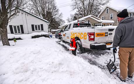
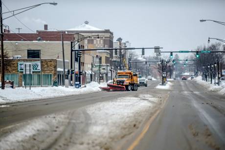
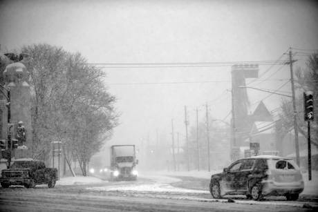
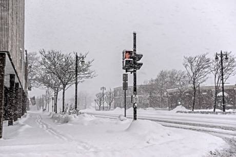
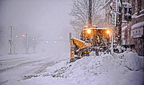
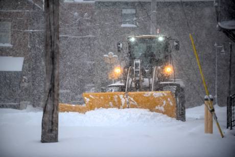
The U.S. Department of Agriculture (USDA) reminds rural communities, farmers and ranchers, families and small businesses affected by the recent winter storms that USDA has programs that provide assistance.

USDA staff in the regional, state and county offices are prepared with a variety of program flexibilities and other assistance to residents, agricultural producers and impacted communities.

"USDA is committed to getting help to producers and rural Americans impacted by the severe weather in many parts of the country," said Kevin Shea, acting Secretary of Agriculture.

"As severe weather and natural disasters continue to threaten the livelihoods of thousands of our farming families, we want you and your communities to know that USDA stands with you."

Visit farmers.gov or your local USDA Service Center to inquire about assistance.

Risk Management and Disaster Assistance for Agricultural Operations

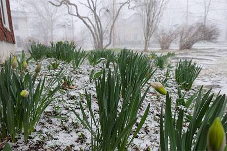
USDA offers several risk management and disaster assistance options to help producers recover after they are impacted by severe weather, including those impacted by winter storms and extreme cold.

Even before disasters strike, USDA provides tools for producers to manage their risk through the Federal Crop Insurance Program, a public-private partnership between USDA’s Risk Management Agency and private companies and agents.

For crops that do not have crop insurance available, the Noninsured Crop Disaster Assistance Program (NAP) is available through the local Farm Service Agency. This risk protection includes crop production loss and tree loss for certain crop insurance products. It is recommended that producers reach out to their crop insurance agent or local FSA office for more information.

Producers that signed up for Federal Crop Insurance or NAP who suffer losses are asked to report crop damage to their crop insurance agent or local FSA office, respectively, within 72 hours of damage discovery and follow up in writing within 15 days.

Livestock and perennial crop producers often have more limited risk management options available, so there are several disaster programs for them. Key programs include:

  • The Livestock Indemnity Program and the Emergency Assistance for Livestock, Honeybee and Farm-raised Fish Program reimburses producers for a portion of the value of livestock, poultry and other animals that were killed or severely injured by a natural disaster or loss of feed.
  • The Tree Assistance Program provides cost share assistance to rehabilitate or replant and clean-up damage to orchards and vineyards that kill or damage the tree, vines or shrubs. NAP or Federal Crop Insurance often only covers the crop and not the plant.

USDA reminds producers that it’s critical to keep accurate records to document the losses and illnesses following this devastating cold weather event. Livestock producers are advised to document beginning livestock numbers by taking photos or videos of any losses.

Other common documentation options include:

  • Purchase records
  • Production records
  • Vaccination records
  • Bank or other loan documents
  • Third-party certification

Additionally, USDA can provide financial resources through its Environmental Quality Incentives Program to help with immediate needs and long-term support to help recover from natural disasters and conserve water resources. Assistance may also be available for emergency animal mortality disposal from natural disasters and other causes.

The Farm Service Agency (FSA) also has a variety of loans available including emergency loans that are triggered by disaster declarations and operating loans that can assist producers with credit needs.

Photos: Around Batavia after overnight snowstorm

By Howard B. Owens

snowfeb162021.jpg

Three-year-old Matthew helps his father, Tom Cunningham, shovel snow on Kibbe Avenue.

snowfeb162021-2.jpg

Kathy Ferrara clears the sidewalk outside her business on East Main, Batavia's Original Pizzeria.

snowfeb162021-3.jpg

Dave Graney shoveling snow on Ellicott Avenue.

snowfeb162021-4.jpg

Elmwood Cemetery

snowfeb162021-5.jpg

Kibbe Park

snowfeb162021-6.jpg

Ellicott Street at Liberty Street

snowfeb162021-7.jpg

East Main Street

snowfeb162021-8.jpg

Snowman on Ganson Avenue

Winter storm warning in effect for tonight

By Howard B. Owens

A winter storm warning has been issued by the National Weather Service for Genesee County starting at 7 p.m. and going to 1 p.m. tomorrow.

Heavy snow is expected with from seven to 14 inches of accumulation is possible.

The storm is expected to sweep through all of Western New York with some areas receiving heavier snowfall.

Travel could be difficult to impossible. There will be areas of blowing snow and hazardous conditions will impact commute traffic sometime Tuesday morning.

Heavy snow and dangerous travel conditions forecast from 7 tonight through Tuesday at 1 p.m.

By Billie Owens

From the National Weather Service office in Buffalo:

A Winter Storm Warning with heavy snow  -- 7 to 14 inches -- takes effect this evening at 7 o'clock for Genesee County and the City of Batavia, in fact for all of Western and Central New York.

It will be in place until 1 p.m. tomorrow.

Travel could be very difficult to impossible. Areas of blowing snow along the south shores of Lake Ontario and Lake Erie. The hazardous conditions will impact the Tuesday morning commute.

PRECAUTIONARY/PREPAREDNESS ACTIONS -- Widespread accumulating snow will create dangerous travel conditions.

'Treacherous' heavy snow, high winds, low visibility expected: 'Stay home if you can'

By Press Release

From Tim Hens, superintendent, Genesee County Highway Department:

There is an increasing likelihood that Genesee County will be the target of a significant lake effect snow band from early Friday evening until late Saturday night.

The worst conditions are anticipated in the western half of the county, but all areas are likely to receive significant snow coupled with strong winds.

Understandably this is “Just winter in WNY” but driving conditions are expected to be treacherous in this lake effect event primarily due to high winds and low visibility. There is a solid base of snow already on the ground, so significant drifting into roadways will also be a problem.

Plan ahead and stay home if you can.

If you must go out, please check for conditions, drive slowly and do not crowd the plows.

Please be responsible and do not wait for “Travel Advisories” or “No Unnecessary Travel Advisories” to be issued as these are often done reactively after first responders are already swamped with cars off the roads.

Winter storm watch issues for Friday night and Saturday

By Howard B. Owens

A winter storm watch has been issued for Western New York starting Friday, with Genesee County included in the area that could see as much as nine inches of lake effect snow.

The watch is in effect from Friday afternoon through late Saturday night, with the heaviest lake effect snow expected Friday night into Saturday.

Wind gusts could reach 45 mph, which could mean considerable blowing and driving snow making travel difficult.

Visibility could also be reduced.

Hazardous Weather Outlook forecast this week

By Billie Owens

This afternoon a Hazardous Weather Outlook was forecast for Genesee County and elsewhere in portions of Western and North Central New York by the National Weather Service Office in Buffalo.

Beginning tomorrow night, Feb. 1, a strong low-pressure system will move very slowly northward along the East Coast through Wednesday.

"Snow will spread back to the north and west and into portions of the regions later Monday night through Tuesday before slowly tapering off from west to east Wednesday."

There remains a great deal of uncertainty about how far west accumulating snow will spread, and the amount of snow to be expected. Moderate snow accumulations are possible from the Genesee Valley to the eastern Lake Ontario region during this time period.

Authentically Local