
weather

Reader storm photos for Saturday

By Howard B. Owens

corfustormelliott8.jpg

As of 7 a.m., Ken Lauer says Route 33 is pretty much blocked by some tractor-trailers.  Route 77 seems OK "but you gotta be nuts to be driving," he says. "Too much blowing to estimate snowfall, but drifts are two to four feet.  Crosby on the corner is open.  I’m at the bakery if someone needs warmth and a hot beverage.  Looks like Santa Amazon is in need of Rudolph and some large tow trucks."

Email weather-related photos to howard@thebatavian.com or text to (585) 260-6970

corfustormelliott6.jpg

corfustormelliott.jpg

corfustormelliott_1.jpg

img-4223.jpg

Jason Smith's dogs in Batavia are a bit unsure about going outside.

img-4221.jpg

20221223_093859.jpg

Photo submitted by Leah Buckel. "This tree narrowly missed our house! Unfortunately, part of it did hit my husband's car."

Coverage of Winter Storm Elliott: Friday and Saturday

By Howard B. Owens

img_caed1216776c-1.jpg

We're starting our Day #2 coverage of Winter Storm Elliott in Genesee County.  This post will be anchored at the top of the home page until further notice.  For Friday's coverage, click here.

See also these stories we published Friday night:

Throughout the day, a persistent, large band of lake-effect snow stretching from Lake Erie to Alabama and Oakfield has hovered in place. As the satellite photo above shows, it's been pretty stationary and so far shows no signs of abating. The band is 15 miles wide.

The National Weather Service predicts that blizzard conditions will continue throughout the Niagara Frontier overnight. 

Dispatchers continue to report multiple motorists stranded in the northwest quadrant in the county with some occupants reporting hypothermia.  There have been several motorists rescued already, most taken to various warming shelters, a couple to UMMC for treatment.  

There are about 2,000 National Grid customers without power, and for most, no ETA on power restoration. 

There is a travel ban in effect for Genesee County and for the Thruway.

This post will be continuously updated, except for a break for sleep, until either the storm ends or we start a new post. While it is being actively updated, it will be anchored at the top of the home page.

UPDATE 12:37 a.m.: There is a convoy of emergency responders on Route 77 heading toward Route 33 retrieving people, and then they will proceed on Route 33.

UPDATE 12:41 a.m.: An emergency responder reports being stuck on Route 63, and another responder advises they can't get to him and advises they go to the Alabama Station #1.  "We're stuck well before that."

UPDATE 1:09 a.m.: An MRAP from Orleans County is now assisting with rescues.

UPDATE 1:50 a.m.: Tim Hens says that it's slow going trying to clear roads.  Judge Road is impassible, also Lewiston Road. The crews are trying Townline Road now.  The whiteout conditions are making the work impossible.

UPDATE 2:35 a.m.: Taking a break, or trying, to get some sleep.

UPDATE 9:04 a.m.: A convoy of rescue teams just completed going through Route 77 at Judge and is heading north.  There is also a rescue convoy operating around Sumner Road in Darien.

321491187_3380243075574954_6715297893042894735_n.jpg

UPDATE 9:07 a.m.: The "Dollar" in Family Dollar in Eastown Plaza blew off overnight. (Reader submitted photo). Submit photos to howard@thebatavian.com or (585) 260-6970.

Also, Bethany's UTV is en route to Alabama to assist with rescue efforts.

UPDATE 9:12 a.m.: A rescue convoy has reached a group of cars in Alabama and are checking for occupants. A dispatcher asks for car descriptions "so we can clear some of these calls" and is told, "Some of the cars are buried in four or five feet or snow. We'll do our best.  Most people are telling us are in the Alabama Hotel, patrons are telling us."

UPDATE 9:19 a.m.: A fire police commander in Oakfield reports he's about two minutes from the Hall, and another chief is "taking over command and relieving me."

UPDATE 9:20 a.m.: A crew commander reports that there are about 100 people at the Alabama Hotel, and they all report they're doing well.  The convoy will try to head east and make it back to the Oakfield Fire Hall.

UPDATE 9:26 a.m.: A crew is heading east on Lewiston. The State Police from Orleans County is coming to the area with tracked vehicles. They will check north and west. There is also a crew heading to Macomber and Knowesville.

UPDATE 9:30 a.m.: East Pembroke chief says he has enough four-wheel vehicles to send to Alabama but doesn't have the manpower available to operate them. He's checking to see if there is enough manpower to deploy them.  The Indian Falls chief reports that the State Police have four tracked ATVs at his hall, ready to be deployed.

UPDATE 9:34 a.m.: For more reader-submitted photos, click here.

UPDATE 9:37 a.m.: A Darien crew is heading to Alabama to assist.

UPDATE 10:40 a.m.: All of the people are out of their vehicles from the Niagara County line to Alabama Center, a responder reports.  There's also a semi-trailer blocking Route 5.  A firefighter is checking an unknown odor at a residence on Lewiston Road.

UPDATE 10:51 a.m.: The travel ban for Genesee County will be partially lifted at noon.  Click here for more information.

UPDATE 11:07 a.m.: A crew is heading out toward Townline Road after leaving the fire hall. That crew is going out of service for while once it reaches its hall.

See also: Genesee Snopackers assisting with search and rescue efforts during storm

UPDATE 11:12 a.m.: "We're trying to stop cars at Route 77 and Ledge north because they keep trying to get through, and there is no place to put them."

UPDATE 11:16 a.m.: That odor at a residence on Lewiston Road; they had an issue with their furnace. The furnace has been shutdown. "They are good with electric heat."

UPDATE 11:25 a.m.: Multiple times last night and tonight, fire chiefs have been informed that Mercy EMS ambulances were not available. A dispatcher just informed a chief in Indian Falls that Mercy is not responding to calls outside of Batavia. Darien's ambulance is fully staffed and standing by for calls.

UPDATE 11:27 a.m.: Byron's ambulance is dispatched to Le Roy for a medical call.

UPDATE 11:38 a.m.: An Elba chief reports Route 98 at Townline and Edgerton is closed and impassible with five vehicles "stretched across the roadway."  Also, a crew is going to be sent to Indian Falls to stop traffic from coming north.

UPDATE 11:43 a.m.: There are no operators with the vehicles on Route 98.  A rep from Torrey Farms believes the operators are at the school.

UPDATE 12:53 p.m.: The last vehicle on Judge Road has been unstuck, and the driver is being sent to Indian Falls.  Resources are getting redeployed to Batavia. Route 77 north of Route 5 "is turning into a parking lot in some ways."

UPDATE 1:04 p.m.: See also, County leaders counting blessings in midst of 'wicked storm'

UPDATE 1:12 p.m.: State of Emergency declared for the City of Batavia.

UPDATE 1:20 p.m.: Alabama Fire paged for a replacement crew to respond to Station #1.

UPDATE 1:31 p.m.: See also, Weather-related closures and cancellations

UPDATE 1:42 p.m.: A crew is heading to the TA to pick up gas for a man currently at the Indian Falls Fire Hall.

UPDATE 2:48 p.m.:  Supplies are being taken to Indian Falls for Alabama and Pembroke. 

UPDATE 3:19 p.m.: Bethany Center Road is now open.

UPDATE 5:02 p.m.: National Grid reports 757 customers without power, down from more than 1,700 earlier today.

UPDATE 5:28 p.m.: Alabama Fire had a call but couldn't get to it because "Route 63 is unpassable for us."  So Oakfield is trying to try and respond from their side of 63.

UPDATE 5:30 p.m.: Akron Road is also unpassable.

UPDATE 5:41 p.m.: See also, Winter Storm Elliott: update from Hochul

UPDATE 6:15 p.m.: Le Roy's UTV assignment to Oakfield is back in service.

UPDATE 6:24 p.m.: A crew has picked up "plenty of supplies" at City Fire and is heading back to that affected zone.  "Good. We'll have another mission when you get here," the assistant chief is told.

UPDATE 6:58 p.m.: Fire commanders are trying to keep as few emergency vehicles on the road as possible for call responses.  Route 77 is unpassiable. Mercy EMS has started responding to calls outside of Batavia but staging outside the snow-impacted area while firefighters respond to incidents.

UPDATE 7:19 p.m.: An emergency responder reports, "conditions are deteriorating out here again."

UPDATE 7:27 p.m.: An Alabama crew is on a medical call on Route 77 and needs assistance getting the patient out of the house.  It's been difficult to get additional help there.  An MRAP is responding to assist.

UPDATE 7:30 p.m.: Dispatchers are receiving calls that Route 77 at Route 5 is impassable because of all the tractor-trailers along the roadway. A Mercy medic in the area reports, there is one lane available for thru traffic, "but I wouldn't recommend it for future calls."

UPDATE 7:59 p.m.: A volunteer in Alabama has received a call from a Newstead firefighter stating that Erie County received a call from a woman with a child that has been trapped in a car at Tesnow and Wright roads since yesterday afternoon. Forest rangers in the area are going to offload their snowmobiles and head to that location, and bring the occupants back to the Indian Falls Fire Hall.

UPDATE 8:56 p.m.: There is a truck stuck on Clinton Street Road with two adults and a child.

UPDATE 10:04 p.m.  I'm not saying this is the last update to this post but it may very well be.  We're unsticking it from the top of the home page.  We will continue to provide coverage as news developes.

A community of emergency response assists those in need during storm

By Joanne Beck

Friday was one of those days for emergency responders when it seemed as though rescues and accidents made for a nonstop blur of duty.

Oakfield firefighter Bill Sturgeon’s day began around 11 a.m., and he was still on duty late into the night. And in between, there was a family from Lockport that went off the road, a Connecticut couple stuck in another spot and a boyfriend-girlfriend duo attempting a drive back to her home in Toronto.

Yet many others were out and about for unknown or frivolous reasons — one pair was going to the Rez — which perplexed the veteran firefighter.

“I thought, ‘where’s everybody going?’ The chief and third assistant pulled up to one car and asked them ‘where are you going?’ They said Canada and the chief said no, you’re not,” Sturgeon said. “We’re calling around trying to find hotel rooms. The Holiday Inn Express said they were all full, and (Chief) Sean Downing called them. They said they had two more rooms that had been shut down and needed to be cleaned. They literally opened rooms because the fire department asked them.”

Throughout the extreme weather event — an understatement, maybe — Sturgeon was awed by the cooperation of that hotel staff; Dollar General, which remained open while the stranded visitors could buy up supplies, snacks and even dog food; and the (GOOSE) Community Center’s willingness to open its doors to temporarily house people.

Plus, no doubt, the ample numbers of rescue workers from city, village, town and county law enforcement, emergency management, rescue and public works departments.

“We’re doing our best to get out there. There was a welfare check on an elderly couple; everything was fine. You have to pick and choose who you can help, and also be safe,” he said. “We’re going to take it and adjust as we see fit, and the weather sees fit. I imagine the ambulance will be here all night.”

He came upon Michael Santaferrara, who was driving from New York City to Lewiston, at the intersection of Lewiston Road and Main Street. The lost driver had been rerouted a few times and asked where he could settle in for a while. Firefighters directed the lost driver to the fire hall; however, accidents and road detours made for a more difficult journey than Santaferrara expected, he said. (See related story.)

Oakfield crews brought food into the fire hall, cooked up grilled cheese sandwiches, and served other items, including towels and blankets, to people as they ended up stranded in their travels.

A Genesee County travel ban was issued by early afternoon after multiple accidents and vehicles sliding off the road wreaked havoc with emergency response. At least one ambulance and a rescue truck got stuck as well, Sturgeon said.

Amidst all of the commotion, one brilliant occurrence was evident, he said.

“The amazement of all the firefighters here, and across the county, the Sheriff’s (personnel), everybody working together, in the interest of the public, to do what they can,” he said. “It’s huge. To see people pull together. It takes a community to come together for something like this. I saw that today.”

Motorists rescued, fed, kept warm during travel on Friday

By Joanne Beck

oakfieldrescue2.jpg

Michael Santaferrara got up early Friday morning to drive from Cazenovia to see his sisters in the western part of the state. He thought all was well while after driving about 140 miles on the Thruway.

“Then they closed it because of all the crashes,” the New York City visitor told The Batavian Friday night. “Once I left the Thruway, my whole world changed. Within seconds, I felt like I was in the Arctic. It was a complete whiteout. I was driving five miles an hour looking for what I was hoping was a road.”

By the volume of 911 calls and observations of emergency responders out there, Santaferrara was not alone.

He was, though, perhaps one of the luckier ones. After pulling off the Thruway and onto rural side roads — he described as “just like going from one white canvas to the next” — he arrived at the intersection near Pembroke Central School. Oakfield firefighters were on scene directing and assisting traffic.

Santaferrara was asked where he was headed to, and he replied, “Lewiston,” which prompted a tepid response to attempt it at his own risk. There had been many accidents and vehicles off the road by that point, and emergency responders weren’t encouraging anyone to be driving if possible.

He asked where he could go to just get off the road for a while, and they directed him to the Oakfield fire hall. That wasn’t as easy as it sounded. En route, Santaferrara encountered a few different detours caused by accidents, and coupled with whiteout conditions, he was just hoping to find his destination.

“I just looked down the road and saw all white. It was a pure whiteout,” he said, after driving a bit farther down the road and pulling into a driveway. “I was tempted to knock on the door. I went back to the intersection, and they were all gone.”

He put Oakfield Fire Station into his phone and finally arrived to safety. Well, sort of. He was in the general area but could not even see the building. He tried opening and knocking on doors along parts of the facility before finding the right entryway. And there they were, others who were rescued and a group of firefighters taking care of them.

“They had already saved a family with a baby and a dog,” Santaferrara said. “They fed us all and gave us towels to dry ourselves, and we just hung out there, kept warm, and then they drove us to a hotel they recommended.”

There was also a couple traveling from Connecticut and yet another pair trying to drive to Canada. Although he had grown up in Syracuse, Santaferrara has lived in NYC for nearly four decades, he said.

“This is winter amplified,” he said, adding that his sisters offered to come and get him. "I said, ‘no way I am letting you come to get me.’ I was in it; I could see what I was going through. The 100 percent opacity … It’s the worst I’ve ever experienced in my life.”

Despite the dicey trip, Santaferrara was thankful for towels to dry off his snow-covered face, body and hands; for the comforting nourishment of grilled cheese sandwiches and beverages; and for the genuine kindness from the firefighters themselves.

“They were really hospitable, warm, and really welcoming,” he said. “I literally thought I would be stranded in it … in the middle of nowhere. I never had my fingers and face freeze that fast.”

Oakfield Fire Hall served as a warming station for the storm, firefighter Bill Sturgeon said. He agreed that it's been one of the worst storms ever -- and that's during his 32-year career as a firefighter. He transported folks to a hotel in Batavia when needed.

"It has to be among the top one to two storms I've ever been through ... visibility-wise. There had to be 15 to 20 cars off the road between Fisher Road and the village line. I felt bad, but I couldn't stop," Sturgeon said later Friday night. "We have more people that were brought into the fire hall. The captain was driving home and saw a couple and picked them up; one had asthma. But an ambulance crew was here to help." 

(See a personal account about driving in the storm.)

There were several helpers, including those from unexpected places. When Santaferrara walked into the fire hall, there was a goosebump moment: the contact page of his late mom and dad popped up on his phone.

“That made you feel like they were looking after you,” he said.

His luck continued when he got the last available room at a city hotel, he said. With his trail mix snack running low, he was ready to stay put nonetheless until it was deemed safe to travel. His vehicle remains at the fire hall, and firefighters have offered to pick him up and bring him back to the station when that moment comes.

“I feel incredibly grateful,” he said.

img_5989oakfieldrescue_1.jpg

Top Photo: Members of Oakfield Fire Rescue during a brief lull from rescuing motorists stranded in the wintry conditions Friday in Genesee County; the truck ready for action, above. Photos submitted by Michael Santaferrara, who was taken to a Batavia hotel after getting stuck in white-outs while enroute to Lewiston.

County Highway crews heading to Route 77 in Alabama to try and rescue stranded drivers in whiteout conditions

By Howard B. Owens

img_2045.jpg

With a high degree of concern for people trapped in their cars in the area of Route 77 and Judge Road, County Highway Superintendent Tim Hens, along with three county highway personnel driving three heavy loaders/plow trucks, are leaving Batavia in an attempt to rescue them.

No other emergency personnel in fire trucks, rescue trucks, or patrol cars have been able to reach them.

"I've got three highway guys putting their lives at risk, my life at risk, to try and save them, but I would feel bad if we didn't try," Hens said.

Hens was just leaving the City of Batavia, driving behind the highway trucks and said visibility was already down to nearly zero. He passed a semi-truck stuck in the snow in front of Tops.  There was about a foot of snow in that location.

Deputies have reported drifts of snow as high as five feet surrounding the cars that are stuck in Alabama.

"We have a pretty high level of concern," Hens said. "Some people have been out there nine, 10 hours. I know there are people who are hypothermic at this point.  I'm not sure we will be able to reach them.  It's just such bad visibility. I'm not even sure we will be able to get there, to be honest."

There has been a heavy, large lake-effect snow band stretching from Lake Erie into Alabama and Oakfield all day.  The National Weather Service reports it is likely to be in place until at least midnight.

"It might be there until midnight tomorrow," Hens said. "This storm is going to revival '77 in its intensity.  It's maybe not as wide or as broad but for people under the snow band, it will be."

Photo: File photo of Tim Hens from 2018 at Genesee County Legislature meeting.

UPDATE: here's a four-second video from Tim Hens showing conditions on the road to Alabama.

Reader Photos: Winter Storm Elliott hitting Genesee County

By Howard B. Owens

park_road_before_alexs_rest.jpg

Park Road by Alex's. Photo by Nick Volpe.

To submit your weather photos, email them to howard@thebatavian.com or text them to (585) 2160-6970

lewiston_rd_in_by_old_kmart.jpg

Lewiston Road. Photo by Nick Volpe.

home_depot_batavia.jpg

Veterans Memorial Drive. Photo by Nick Volpe.

img_20221223_184013346.jpg

A residence on Townline Road. Alabama.  Photo by Dave Bencic.

img_1733weather.jpg

Whiteout conditions on Batavia Oakfield Townline Road. PHoto by Dan Carmichael.

img_7008weahter.jpg

Photo by Dan Carmichael.

1223222148c.jpg

State Street, Batavia. By David Austin

Elliott continues visit throughout Genesee County: more than 2K customers with power outages

By Joanne Beck

dec_2022_storm.jpg

If you've dared to go outside for even a few minutes, it's quite apparent that the biting wind and snow have remained relentless this evening. According to the National Grid outage map, the number of outages is going up by the minute, as it was 1,879 Genesee County customers affected at 6:38 p.m., and that ticked up to 2,033 by 6:40 p.m. 

National Grid is "assessing the situation," according to the outage site. That means there is no estimated time of power restoration yet. To check on outages in your area, and estimated timelines of repair, go HERE.

The Natonal Weather Service reported a temperature of just 2-degrees shortly before 6 p.m., with winds up to 40 mph.

Photo: Streetlights glow through the haze of wintry elements and a dark gray sky Friday evening on a Batavia city street. 

Photo by Joanne Beck.


City and County closes Friday but essential services remain open

By Joanne Beck

winterfeb132019.jpeg

Even though city and county offices closed Friday, all essential offices, including City of Batavia police, fire, public works, management and non-union personnel, will continue to operate through the duration of the storm, City Manager Rachael Tabelski says.

Tabelski and Genesee County Manager Matt Landers made a decision Thursday to close their respective offices and buildings Friday; however, staff has been in place, including the Sheriff’s Office road patrol, dispatch center, the jail and highway department snowplow crews, Landers said.

This is the first for the county in several years to close down ahead of time due to anticipated weather.

“After multiple discussions with County Emergency Management, the County Sheriff’s Office, the County Highway Department, various other County departments, along with the City of Batavia Manager, it was clear that for the safety of the County workforce, we should close County offices on the 23,” Landers said.  “We originally discussed closing early, but after discussions with the National Weather Service out of Buffalo, it was looking like the serious weather would be coming into Genesee County in the morning, and I didn’t want to subject the workforce to driving home in treacherous conditions.”

Having county offices closed on Friday would also free up some manpower that previously would have had to clear county-staffed parking lots, he said.

On the city side, after reviewing the predictions of flash freezing and gale force winds, combined with lake effect snow, "County Manager Matt Landers and I jointly decided to close City and County offices,” Tabelski said. 

“The less traffic on the roads and City streets tomorrow, the easier clean-up efforts will be,” she said Thursday night.

Management has continued to monitor county Emergency Management Director Tim Yaeger’s weather and storm reports.

“We are also in touch with National Grid to support their storm response,” Tabelski said. “National Grid is predicting multiple, and potentially long duration, outages within their territory.  They have over 1,000 line men/women and guards that will be dispatched throughout the region as needed for power outages and down wires."

As of 5 p.m. Friday, 1,700 Genesee County customers remained without power.

Tabelski reminds folks to “Never touch a down wire, and call 911 immediately!” 

City staff is monitoring Doppler radar and reports from the state DOT, Thruway Authority, NYS State Police, and Department of Homeland Security, “who are all involved with storm preparedness and storm response,” she said.

“We advise all residents and visitors to the City of Batavia to be cautious and careful as driving conditions change over the next 24 hours,” she said regarding Friday and Friday night.  “We hope that everyone has a very Happy Holiday and Merry Christmas!”

The storm has been estimated to run its course through 7 a.m. Sunday, according to the National Weather Service. Citizens have been urged to remain at home and off the streets per a Genesee County Sheriff's Office travel ban and a State of Emergency declared by Gov. Kathy Hochul.

Throughout the day Friday, there have been multiple automobile accidents, along with some downed trees and utility wires. For more details about the day's events, go HERE.

And don't forget those beloved four-leggeds. American Veterinary Medical Association advises pet owners to:

Know the limits: Just like people, pets' cold tolerance can vary from pet to pet based on their coat, body fat stores, activity level, and health. Be aware of your pet's tolerance for cold weather, and adjust accordingly. You will probably need to shorten your dog's walks in very cold weather to protect you both from weather-associated health risks.

Short-haired pets feel the cold faster because they have less protection, and short-legged pets may become cold faster because their bellies and bodies are more likely to come into contact with snow-covered ground. Pets with diabetes, heart disease, kidney disease, or hormonal imbalances (such as Cushing's disease) may have a harder time regulating their body temperature and may be more susceptible to problems from temperature extremes. The same goes for very young and very old pets.

Provide choices: Just like you, pets prefer comfortable sleeping places and may change their location based on their need for more or less warmth. Give them some safe options to allow them to vary their sleeping place to adjust to their needs.

Stay inside. Cats and dogs should be kept inside during cold weather. It's a common belief that dogs and cats are more resistant than people to cold weather because of their fur, but it's untrue. Like people, cats and dogs are susceptible to frostbite and hypothermia and should be kept inside. Longer-haired and thick-coated dog breeds, such as huskies and other dogs bred for colder climates, are more tolerant of cold weather; but no pet should be left outside for long periods in below-freezing weather.

For more information about storm preparedness, the City of Batavia Fire Department has advice available HERE

File Photo of a previous winter storm in Batavia, by Howard Owens.

Thruway Authority institutes travel ban from Henrietta to Pennsylvannia

By Howard B. Owens

Press release:

TRAVEL ALERT - ALL VEHICLE BAN IN EFFECT UNTIL FURTHER NOTICE: Due the high wind, winter storm, and blizzard warnings in Western New York, a BAN ON ALL VEHICLES is in effect on I-90 from exit 46 (Henrietta) to the PA line and I-190 from I-90 to exit 22 (Route 62) until further notice. See real-time traffic cameras at thruway.ny.gov/travelers.

Genesee County declares State of Emergency, institutes travel ban

By Press Release

Press release:

Genesee County Manager L. Matthew Landers has declared a local state of emergency for Genesee County due to blizzard-like conditions.  Effective immediately, Genesee County Sheriff upgrades previously issued travel advisory to a travel ban for all of Genesee County until further notice.  A travel ban means no travel for anyone but emergency vehicles which includes police, fire, ambulance, snow plows, etc. 

Currently, the western half of Genesee County is experiencing blizzard conditions with blowing and drifting snow causing zero visibility. Weather forecasts indicate similar conditions are expected for all of Genesee County later today and through Saturday.  Numerous accidents and stranded vehicles are blocking roadways and causing unsafe driving conditions for motorists and first responders.

Sheriff Sheron encourages residents, “For your safety and the safety of first responders and highway snow removal personnel this holiday weekend, please stay off the roads until conditions improve.”

UMMC closing clinics, offices due to storm

By Press Release

Press release:

Due to the winter storm and icy roads that are expected in much of the area we serve, we will close some care offices early.  Please note the United Memorial Medical Center Hospital and Emergency Department are and will remain open for all emergencies.  Given regional travel advisories and for the safety of patients and staff, some outpatient offices will be closing at noon and calling their patients directly to reschedule appointments.

  • United Memorial Medical Center Hospital- OPEN
  • United Memorial Medical Center Emergency Department-OPEN
  • Primary Care Offices- CLOSE AT NOON, some morning visits are virtual and appointments are being rescheduled, phone lines remain open
  • Specialty Care Offices (Cardiology, Surgery, Women’s Care, Pain Center, Wound Center, Lipson Cancer Institute and Orthopedics)- CLOSE AT NOON, some morning visits are virtual and appointments are being rescheduled, phone lines remain open
  • UMMC Imaging at Jerome Center- CLOSES AT NOON
  • Physical Therapy- CLOSES AT NOON
  • UMMC Lab at Jerome Center- CLOSES AT NOON, CLOSED SATURDAY
  • Outpatient Pharmacy- CLOSES AT NOON
  • Healthy Living Center- CLOSES AT NOON

All essential staff members are required to report to work.

Patients and families with any questions should first reach out to their Primary Care or Specialty Care offices; for other questions, call 585-343-6030 for more information.

UPDATED: Strong Winds bringing trees down, knocking out power throughout Genesee County

By Howard B. Owens

This post has been superseded by a new weather update post. Click here to view that post.

1weatherdec232022.jpg

Photo: Tree into a house at 22 Elmwood Ave., Batavia.  Photo by Steve Ognibene.

There are more than two dozen small power outages reported throughout Genesee County, most of them only affecting a handful of customers each.

There is an outage affecting 35 customers along Galloway Road in Batavia and Pembroke, one affecting 184 customers in East Bethany, just northeast of the hamlet, one affecting 53 customers along Bernd Road in Le Roy, 13 customers on Maple Road and Conley Road in Bergen, 15 customers along Oatka Trail in Le Roy, 28 customers on the Tonawanda Indian Reservation, and 13 along Dry Bridge Road in Alexander.

There have been multiple calls, starting at about 7 a.m., throughout the county for wires and trees down in the roadway, including but not limited to, Wilkenson Road, Route 20 in Alexander, Lockport Road in Oakfield, Weatherwax Road, Elba, Clipnock Road in Stafford, Keeney Road in Le Roy, and Route 19 near Vallance Road in Le Roy.

UPDATE 10:35 a.m.: Pole and wires down on Sanders Road. Stafford. Wyoming Road, Pavilion.

UPDATE 10:56 s.m.: Tree and wires down, Hartshorn Road, East Pembroke

UPDATE 11:01 a.m.: There's a tree down on Upton Road, blocking.  National Grid is already on scene on Hartshorn Road, and there is a power outage in Byron, Bergen, Stafford, and Le Roy, affecting 819 customers. There is an outage affecting 59 customers along Route 20 in Darien and Alexander, 23 Customers along Bridge Road, Elba.

UPDATE 11:24 a.m.: Wires down on Sackett Road, Bergen.

UPDATE 11:57 a.m. Whiteout conditions reported in parts of Genesee County. A Mercy ambulance was involved in an accident on Edgerton Road, Elba.

UPDATE 12:06 p.m.: Multiple poles down, tree down across the roadway, on Angling Road, East Pembroke.

UPDATE 12:11 p.m.: Complete whiteout conditions reported at Wortendyke and Route 5.

UPDATE 12:16 p.m.: Tree into a house on Donahue Road, Batavia. No injuries.  There is a two-car, minor injury accident at Lewiston and Fisher Road.

UPDATE 12:22 p.m.: A minor injury rollover accident is reported on the Thruway.

UPDATE 12:25 p.m.: A tree into a house is reported at 22 Elmwood Avenue. The house is believed to be unoccupied.

UPDATE 12:59 p.m.: Wire down across the road on Pearl Street Road near Donahue Road.

UPDATE 1:04 p.m.: Trees and power lines down on Townline Road, Darien.

UPDATE 1:22 p.m.: Tree across the road on Attica Road, Alexander.

UPDATE 1:52 p.m.: Tractor-trailer blocking the roadway on Route 33 at Boyce Road.

UPDATE 2:10 p.m.: Wires down in the roadway on Bethany Center Road.

UPDATE 2:18 p.m.: Rebel Liners in Alexander has a weather station set up with a feed on Wunderground.com that is reporting a top wind gust of 46 mph so far.

UPDATE 2:21 p.m.: The Offhause Farms in Batavia weather station reports winds of 26 mph with gusts of 41 mph.

UPDATE 2:26 p.m.: "The Alabama Hotel has been turned into a warming shelter (as long as we have power). If you are stranded nearby, come in… I’ll start the coffee and make sure you don’t go hungry!"

UPDATE 2:35 p.m.: Trees and wires down, completely blocking, on Linden Road, Bethany.

UPDATE 3:15 p.m.: A Sheriff's patrol reportedly involved in an accident. We don't have a location.  There may be a Mercy ambulance involved as well, or a separate accident.  There's no report of injuries.

UPDATE 3:18 p.m.: The accident involving a Mercy ambulance and Sheriff's patrol is on Route 63 in Alabama.  No injuries reported.

UPDATE 3:21 p.m.: There are 1,719 National Grid customers without power in Genesee County.

UPDATE 3:25 p.m.: A firefighter reports at least 10 vehicles stopped on Judge Road.  He said he's trying to get them to the Fire Hall.  The dispatcher informs him Alabama Hotel is also available.

UPDATE 3:29 p.m.: Multiple vehicles off the road on Route 77 at Judge, and also, Akron Road.

UPDATE 3:59 p.m.: A Mercy EMS ambulance responding to a call is stuck in the snow (didn't catch location).

UPDATE 4:07 p.m.: Route 63 north is being shut down at Veterans Memorial Drive.

UPDATE 4:18 p.m.: Somebody called into dispatch that he came across a Dodge Dart stuck in a ditch off Lewiston Road and the dispatcher informed him, "we have about 50 vehicles stuck on Lewiston Road."

UPDATE 4:25 p.m. Darien Fire asked if Corfu PD could close Route 77 to southbound traffic. There are no Corfu PD officers working today and all deputies are tied up. Corfu Fire is closing Route 77.

UPDATE 5:03 p.m.: Darien's Fire Hall is being opened as a warming center.

UPDATE 5:05 p.m.: A first responder is asking dispatchers to prioritize people stuck in vehicles -- people without gas, without vehicles running, "there is no way we can get to everybody."  A dispatcher responds that she has been trying to that but is going through the list again to see if there is anybody who can be prioritized.

UPDATE 5:46 p.m.: Elba's UTV is being dispatched to a location on Lewiston Road between Church and Knowlesville for a woman in a vehicle with disrupted breathing. No other emergency vehicle has been able to get down the road to her location.

UPDATE 5:52 p.m.: For the Lewiston Road call, paramedics are staging at the Oakfield Fire Hall.

UPDATE 6:08 p.m.: A Mercy EMS ambulance is being dispatched for a woman in a vehicle with trouble breathing on Lewiston Road just north of the Thruway.

UPDATE 6:14 p.m.: A first responder on Lewiston Road is going to try and take the occupants of the vehicle to a warming station at Oakfield Fire Hall.  Mercy EMS can go back in service.

UPDATE 6:19 p.m.: A tractor-trailer on Oak Street in Batavia has jack-knifed and had traffic blocked and has been able to get moving again.  No property hit. Also, the first responder on Lewiston Road has helped the vehicle get unstuck and it is now following him to the Oakfield Fire Hall.

UPDATE 6:31 p.m. Pembroke Highway Department personnel are in the Pembroke garage now to facilitate refueling for any Genesee County patrol in need of gas.

UPDATE 6:43 p.m.: The Lewiston Road couple made it to the Oakfield Fire Hall.  A volunteer at the hall notes that there are about 15 people there and they're running out of blankets. They could use about 20 more blankets.

UPDATE 7:17 p.m.: We're hearing more calls of people being rescued from vehicles and being taken to either warming centers or local hotels, and that the hotels are filling up.

UPDATE 7:39 p.m.: A road in Alabama is unpassable for a medical call in the district. Two responding units said they can't make it. Also, Corfu is open as a warming shelter.

UPDATE 7:43 p.m.: A car is reported off the road on Colby Road in Darien with children. Also, a first-responder with multiple people in his vehicle is stuck on Malby Road, Oakfield. He said there are three our four feet of snow in the area.  A chief said that SnoPackers (the local snowmobile club) is coming in and will they will be on their way to help get them out.

UPDATE 8:28 p.m.: A fire chief came across a semi-truck off the road on Sumner Road.  "He said he was headed to Amazon. I don't know if he's fully loaded or not."  A heavy wrecker is in route.

UPDATE 9:08 p.m. A firefighter is transporting a middle-aged man to a Fire Hall (Oakfield?) who is in and out of consciousness after being rescued from a vehicle.

UPDATE 9:34 p.m.: Elba Central School is OPEN as a warming center/shelter for anyone who may need it. Please come to the North door (the archway) and you can gain access through the doors. The cafeteria is open with tables and chairs. We have some blankets and coats if needed. If you need a ride or any help, please call 585-813-2796.

UPDATE 9:37 p.m.: From Alabama Hotel:

We want to take a minute to send a huge Thank You to our friends across the street at the Alabama Holley Farms! They have gone back and forth a few times for us to help with food and supplies. Our dining room is set up to accommodate about 70 people. We are currently caring for approximately 100 people and many children. These are not our locals - They are from Canada, Maryland, Niagara Falls, Los Angeles, Ohio, etc. How amazing to have "strangers" come together to help. These are people who were stranded hours ago that are now doing dishes, clearing off tables, and doing everything they can to help one another. Truly a humbling experience.

Neighbors of the Hotel dropping off blankets and supplies... you guys are the REAL MVP's!

A huge shout out to Craig Alexander and Brian Kotarski for being here to help tonight! Could not have done this without you!

Lastly, Bonnie Woodward - Owner of The Alabama Hotel. Thank YOU for suggesting that we open our doors tonight and take care of everyone. I wish you were able to meet all of these amazing people - They are sending their love and much appreciation your way!

UPDATE 9:38 p.m.: There are still multiple motorists stranded in the Alabama and Oakfield area.  Volunteer firefighters and highway workers are working to reach them where possible.  Some roads are covered in three or four feet of snow.

UPDATE 9:40 p.m.: There's a group of motorists stranded on Route 5 near Cleveland Road.

UPDATE 9:47 p.m.: A first responder is dropping off a family he rescued at a warming shelter at Grace Baptist Church.

UPDATE 10:13 p.m.: The band of heavy snow that has been hovering over Oakfield and Alabama is expected to remain in place until at least midnight, according to the National Weather Service.

UPDATE 10:16 p.m.: County Highway Superintendent Tim Hens is reportedly out with a plow crew in the Alabama/Pembroke area.

UPDATE 10:24 p.m.: Alabama Station #2 has been shut down. "It's not safe out there."

UPDATE 10:47 p.m.: Click here for story about County Highway personnel heading out to try and rescue people trapped in cars on Route 77.  Also, didn't catch the location, but there is a group of cars that are stuck on a roadway and one person "wandered off," and nobody knows where he is.

UPDATE 10:51 p.m.: East Pembroke's chief is out with an SUV with six people. They have plenty of gas and are all set to wait until morning if necessary but they believe a friend was trying to rescue them on foot.  His last known location was Simons Road and Bennett Road.  But there is also chatter with dispatchers to indicate he may have been located.

UPDATE 10:54 p.m.: An Elba volunteer has located two hypothermic people on Judge Road. The patients are being loaded in Oakfield's rescue.

UPDATE 11:05 p.m.: Two patients who are hypothermic but awake are being transported to UMMC by Mercy EMS.  ETA in 20 or 30 minutes.

UPDATE 11:29 p.m.: A volunteer has picked up a group of travelers in a Range Rover with New Jersey license plates in Oakfield.

UPDATE 11:37 p.m.: See A community of emergency response assists those in need during storm

UPDATE 11:38 p.m.: See Motorists rescued, fed, kept warm during travel on Friday

UPDATE 11:53 p.m.: A volunteer has picked up five people along Drake, watching for more stranded motorists as he heads to the village. A chief recommends dropping them off at The Goose, which is a warming center.  A dispatcher informs the Oakfield chief that they have received multiple calls of stranded motorists reporting hypothermia, but there is no way to get rescue crews to them at this time.

UPDATE Dec. 24, 12:32 a.m.: We've started a new update post.

3weatherdec232022.jpg

Photo by Steve Ognibene

2weatherdec232022.jpg

Photo by Steve Ognibene

State of Emergency declared due to anticipated winter storm: Gov. Hochul urges restricted travel

By Joanne Beck

Storm Elliott has prompted Gov. Kathy Hochul to declare a statewide State of Emergency in anticipation of a winter storm to hit Genesee and other Western New York counties by early Friday morning.

The State of Emergency is to be in effect through Monday. 

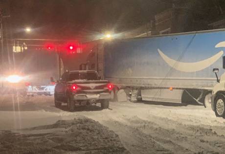
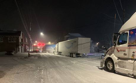
Beginning at 6 a.m. Friday, there will be a full Commercial Vehicle Ban on NYS Thruway (I-90) between Exit 46 (Rochester, I-390) and the Pennsylvania Border, and soft closures on Interstates and State Highways in Western New York, Hochul said in a press release issued Thursday night.

Press Release:

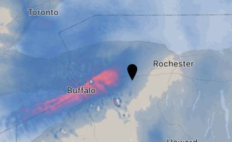
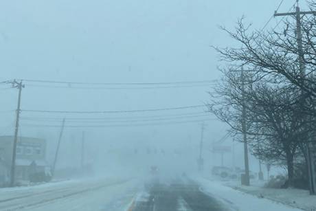
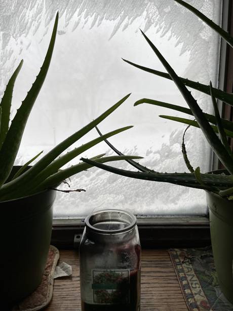
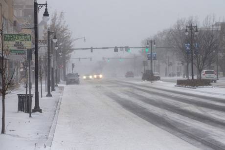
Gov. Hochul has declared a State of Emergency for the entire State of New York in advance of a significant winter weather system forecast to bring a mixed bag of hazards across the state beginning Thursday evening and continuing through Monday. Heavy rain and snow, strong winds, coastal and lakeshore flooding and flash freezing are all possible in various regions across the state throughout the holiday weekend. In addition, lake effect snow is expected to impact areas along Lakes Erie and Ontario beginning Friday night and continuing into Monday with total snow accumulations forecast to reach up to three feet.

"With Mother Nature throwing everything she has at us this weekend, I encourage New Yorkers who are considering travelling for the holidays to do so before Friday or after Sunday to stay safe," Governor Hochul said. "Our agencies are well prepared, coordinated and ready to deploy assets and equipment if needed to respond to the storm. We want all New Yorkers to get where they need to go safely to celebrate the holidays with loved ones."

Thursday into Friday, rain, snow showers and strong winds are forecast for most of the state with rainfall amounts of up to three inches possible in some places. Moderate to major coastal flooding (1-2 feet) is possible Friday morning due to rain and strong winds, and lakeshore flooding up to three feet above flood stage is possible off Lake Erie and Lake Ontario due to rain, snowmelt and strong winds.

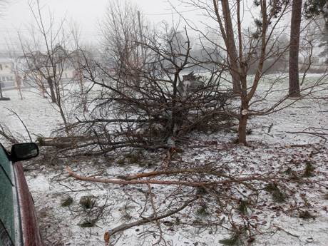
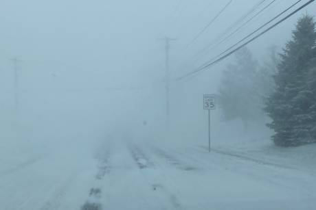
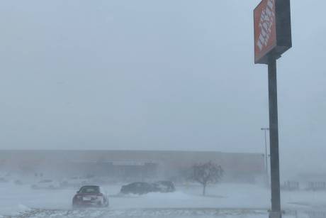
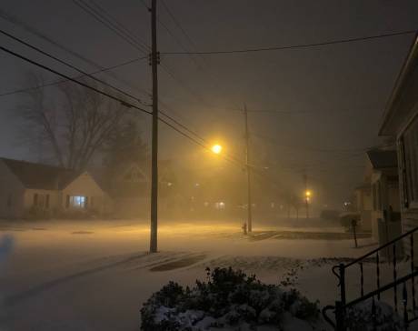
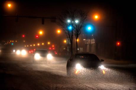
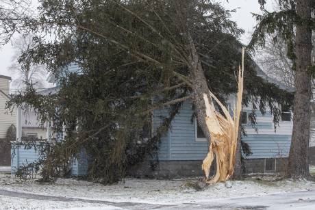
Starting Friday and continuing into Saturday morning, much of the state is expected to see strong winds up to 60 miles per hour or more as temperatures will drop quickly and significantly, by more than 35 degrees in some regions, causing flash freezing, below zero wind chills and icy road conditions. This will impact the Friday morning commute in Western New York and the evening commute for the rest of the state. Winds on Friday and Saturday will be strong enough to cause downed trees and power lines.

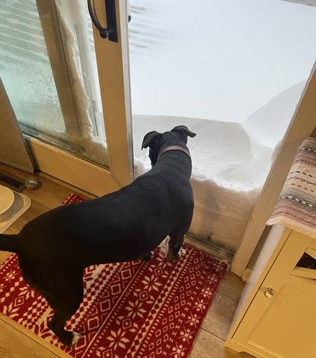
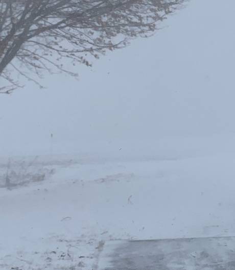
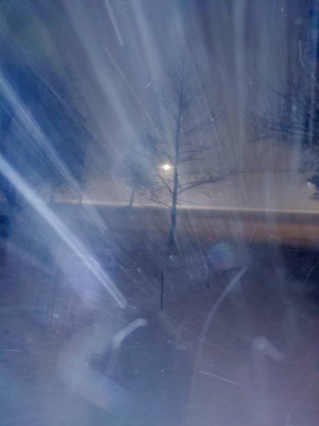
Friday night and continuing through Monday, lake effect snow will impact areas off Lake Erie and Lake Ontario, and strong winds are expected to cause blowing and drifting snow with near zero visibility and localized blizzard conditions. The Buffalo and Watertown areas could see up to three feet of snow through Sunday night. Below normal, freezing temperatures with low wind chills are expected to persist through Monday for upstate regions.

Hochul urged New Yorkers to take all necessary precautions, if traveling this week, and plan ahead for significant weather impacts.      

Blizzard Warnings, Coastal Flood Warnings, Lakeshore Flood Warnings, High Wind Warnings, Wind Chill Warnings, and Winter Storm Warnings are all in effect this weekend throughout various counties across the state. For a complete list of weather watches, warnings, and advisories across New York, visit the National Weather Service website.

New York State Division of Homeland Security and Emergency Services Commissioner Jackie Bray said, "The timeline for this storm has moved up. If you are planning to travel this weekend, do everything you can to travel tonight instead or wait until Sunday morning. Please, avoid travel on Friday and Saturday given the conditions most of the state will face. In addition to hazardous roads, strong winds will likely cause power outages. Be prepared for the possibility of losing power."

Division of Homeland Security and Emergency Services

The New York State Division of Homeland Security and Emergency Services began coordinating State Agency response operations and contacted local governments earlier this week ahead of weather impacts to ensure preparedness. The State's Emergency Operations Center will be opening Friday morning.

The Office of Emergency Management is working with Erie County to pre-stage chainsaws and generators, and deploying sandbags to the US Coast Guard in Buffalo to protect against potential lakeshore flooding. The Office of Fire Prevention and Control has equipment and personnel available to assist with mutual aid requests.    

Across the State's Ten Stockpiles, DHSES has the following deployable items to support storm-related needs:

1,487 generators
985 pumps
528 chainsaws
250 light towers
Cots, pillows, blankets, water, and MREs

Department of Public Service

In preparation for this week's statewide winter weather event the New York utilities have approximately 7,700 workers available statewide to engage in damage assessment, wire guarding, response, repair, and restoration efforts. 

This includes an additional 800 external line and tree workers secured by National Grid, 330 external line and tree workers secured by NYSEG and RG&E, 95 external line and tree workers secured by Central Hudson, 150 external line and tree workers secured by Orange & Rockland and 800 external line and tree workers secured by Con Edison. DPS staff will track utilities' response, repair and restoration work throughout the event and ensure utilities shift appropriate resources to regions that experience the greatest impact.

Department of Transportation

The State Department of Transportation is monitoring weather conditions and is prepared to respond with 3,450 supervisors and operators. Additionally, 75 ICS personnel are available to support the response to this event. All affected residency locations will be staffed for 24/7 operation throughout the duration of the event. Staff can be configured into any type of response crew that is needed such as snow and ice, flood, chipper, load and haul, cut and toss, traffic signal, etc. All available equipment is ready to deploy.

The State Department of Transportation is preparing to close the following roads in Erie County to all traffic starting at 6 a.m. Friday until conditions improve:

State Route 400
State Route 219
I-290
I-190
State Route 5 (Big Tree Road to I-190)

A restriction for trucks "Trucks Use Right Lane" on Interstate 81 from Exit 32 (Central Square) to Exit 51 (Alex Bay) starting at noon Friday.

Regional crews are currently engaged in all-hazards preparations. Drainage structures are being checked and cleared of debris.  To support response activities in critical areas, a total of 65 staff, including 59 plow truck operators, 4 supervisors, 1 assistant manager, 1 ICS support specialist, 10 plow trucks, 2 snow blowers, and 1 grader are being deployed to Western New York. They are distributed as follows:

3 plow trucks from Central New York
2 plow trucks, 2 snow blowers, and 1 grader from the Finger Lakes
4 operators and 2 plow trucks the Western Southern Tier
26 operators, 2 supervisors, and 1 assistant manager from the Mid-Hudson Region
10 operators, 1 supervisor, and 3 plow trucks from the Southern Tier
19 operators and 1 supervisor from Long Island
1 ICS specialist from the Capital District

The need for additional resources (Operators, Trucks, Mechanics, EOI's) will be re-evaluated as conditions warrant throughout the event. Generator stockpiles are being readied for deployment to support dark signal response. Fleet mechanics in affected areas will be staffing all main residency locations 24/7 to perform repairs and keep trucks on the road.  Statewide equipment numbers are as follows:

1740 large and medium duty plow trucks
52 tow plows
37 snow blowers
338 loaders
13 tree crew bucket trucks
78 chippers
32 traffic signal trucks
20 graders
73 excavators

For up-to-date travel information, call 511, visit 511NY.org or download the free 511NY mobile app.

Thruway Authority 

Thruway Authority personnel are staffed around the clock and ready to respond to the storm with 678 operators and supervisors statewide. Thruway has shifted and deployed additional staff and equipment from its New York and Albany Divisions to support snow and ice operations in the potentially hardest hit areas in Western New York. Deployed resources include operators and supervisors, and large plow trucks.

Beginning at 6 a.m. Friday, ALL COMMERCIAL VEHICLES will be banned on the New York State Thruway (I-90) from exit 46 (Rochester I-390) to the Pennsylvania border, and the Niagara Thruway from I-90 to exit 22 (Route 62).

Thruway statewide equipment numbers and resources are listed below: 

352 large and medium duty plow trucks
10 tow plows
66 loaders
More than 119,000 tons of salt on hand

Variable Message Signs and social media are utilized to alert motorists of winter weather conditions on the Thruway. 

The Thruway Authority encourages motorists to download its mobile app which is available for free on iPhone and Android devices. The app provides motorists direct access to real-time traffic information, live traffic cameras, and navigation assistance while on the go. Motorists can also sign up for TRANSalert e-mails which provide the latest traffic conditions along the Thruway.

New York State Police

The State Police will assign extra patrols to areas that are significantly impacted by the storm. All four-wheel drive and specialty vehicles are in service, including utility task vehicles and snowmobiles.

Department of Environmental Conservation

DEC Environmental Conservation Police Officers, Forest Rangers, Emergency Management staff and regional staff are on alert and monitoring the developing situation and actively patrolling areas and infrastructure impacted by severe weather. DEC is coordinating resource deployment with agency partners and all available assets are positioned to assist with any emergency response.

DEC is advising backcountry users to be aware of and prepared for winter conditions. Winter hiking and skiing safety and preparedness are extremely important no matter your physical ability or destination. Properly preparing for winter conditions is essential for a more enjoyable and safer experience. During and immediately following periods of heavy snowfall, avoid open, exposed areas like bare summits and use extreme caution when traveling on or near open slopes. 

DEC reminds those responsible for the large-scale removal and disposal of snow to follow best management practices to help prevent flooding and reduce the potential for pollutants like salt, sand, oils, trash and other debris in snow from affecting water quality. Disposal of snow in local creeks and streams can create ice dams which may cause flooding in nearby areas. Public and private snow removal operators should be aware of these safety issues during and after the storm. Additional information is available here.

Office of Parks, Recreation and Historic Preservation

New York State Park Police and park personnel are on alert and closely monitoring weather conditions and impacts. Seven sawyer crews are on standby to assist with clearing downed trees and branches from roadways. Park visitors should check parks.ny.gov or call their local park office for the latest updates regarding park hours, openings, and closings.

New York Power Authority / Canal Corporation

The New York Power Authority and the Canal Corporation staff are performing preparations to ensure all facilities, assets and equipment are secured and ready. The Power Authority is prepared to support power restoration activities if needed.

Port Authority of New York and New Jersey

The Port Authority is monitoring weather conditions. Speed restrictions may be in effect at the bridges, as well as along roadways to and from the crossings. Passengers through the Port Authority's facilities are encouraged to reach out to carriers and airlines directly for the latest information on delays and cancelations. For the latest information about Port Authority facilities, please check social media, sign up for PA alerts or download one of the PA mobile apps, including RidePATH which provides real-time updates and alerts for PATH service.

Metropolitan Transportation Authority

Metropolitan Transportation Authority is closely monitoring weather conditions to ensure safe, reliable service. MTA employees will be poised to respond to any weather-related issues and remove any downed trees that may fall across tracks.

MTA Bridges and Tunnels will ban empty tractor-trailers and tandem trucks beginning at 8:00 p.m. Thursday through 8:00 p.m. Friday. Pedestrian walkways at the Cross Bay Bridge and Marine Parkway Bridge will be closed during this same time period; pedestrian walkways at the RFK Bridge and Henry Hudson Bridge may close depending on weather conditions.

Customers are encouraged to check new.mta.info for the latest service updates, and to use caution while navigating the system. Customers should also sign up for real-time service alerts via text or email. These alerts are also available via the MTA's apps: MYmta and TrainTime.

Safety Tips

Winter Travel Safety

The leading cause of death and injuries during winter storms is transportation accidents. Before getting behind the wheel, review these safety tips:

  • When winter storms strike, do not drive unless necessary.
  • Make sure that your vehicle is clear of ice and snow; good vision is key to good driving.
  • Always match your speed to the road and weather conditions. Plan your stops and keep more distance between cars.
  • Be extra alert and remember that snowdrifts can hide smaller children.
  • Make sure your car is stocked with survival gear like blankets, a shovel, flashlight and extra batteries, extra warm clothing, set of tire chains, battery booster cables, quick energy foods and brightly colored cloth to use as a distress flag.
  • If you have a cell phone or other communications device such as a two-way radio available for your use, keep the battery charged and keep it with you whenever traveling.

Cold Weather Safety

  • Be aware of wind chill - wind in combination with the actual temperature - that can cause an increase of heat loss to the human body.
  • Dress appropriately and avoid staying in the cold too long.
  • Wear a hat and gloves when appropriate with layers of clothing. Avoid unnecessary exposure of any part of the body to the cold.
  • Drink plenty of warm fluids or warm water but avoid caffeine and alcohol. Stay active to maintain body heat.
  • Take frequent breaks from the cold.
  • If signals of hypothermia or frostbite appear, get out of the cold, slowly warm the individual and seek medical assistance:
  • Frostbite: Symptoms include loss of feeling, a white or pale appearance in fingers, toes, ears, and nose.
  • Hypothermia: Symptoms include uncontrollable shivering, slow speech, memory lapses, frequent stumbling, and drowsiness.

Heavy Exertion

Heavy exertion, such as shoveling snow, clearing debris or pushing a car, increase the risk of a heart attack. Follow these tips to stay safe after the storm:

  • Stay warm, dress warm and SLOW DOWN when working outdoors.
  • Take frequent rests to avoid over-exertion
  • If you feel chest pain, shortness of breath, or pain in your jaw radiating down your arm — STOP and seek help immediately.

Power Outages

Winter storms can cause power outages. Review these safety tips before the lights go out so you know what to do in an emergency:

  • Call your utility provider to notify them of the outage.
  • Avoid all downed power lines and report them to your utility provider for repair; assume all downed lines have live electricity.
  • Use only flashlights for emergency lighting - candles pose the risk of fire.
  • Keep your refrigerator and freezer doors shut to keep food from spoiling.  When in doubt, throw it out!
  • Do not use a charcoal grill or generator indoors and do not use a gas stove for heat-they could give off harmful levels of carbon monoxide.
  • Turn off major appliances to prevent damage from a possible surge when the power comes back on-keep one light turned on so you know when power returns.

Home Heating

Heating equipment is one of the leading causes of home fire deaths. Keep loved ones safe by following these important steps:

  • Keep all combustibles at least three feet away from heating equipment.
  • Always plug appliances including space heaters directly into a receptacle. Never plug appliances into a power strip or extension cord.
  • Make sure there is a working smoke alarm in each bedroom, outside sleeping areas and on every level of your home.

For all non-emergency service needs before, during or after a storm, call 211 or visit 211nys.org.

For more safety tips, visit the New York State Division of Homeland Security and Emergency Services Safety Tips web page.

Winter Storm Elliott could bring blizzard conditions to WNY

By Howard B. Owens

The winter storm bearing down on Western New York has a name: it's Elliott, and news reports say it is gaining strength.

The National Weather Service has issued a blizzard warning for much of WNY, including Genesee County.

If the forecast holds up, total snow accumulations could be from 2 to 3 feet between Friday and Sunday, with wind gusts up to 70 mph.

A blizzard warning has been issued for 7 a.m. Friday through 7 a.m. on Sunday.

An actual blizzard isn't expected to hit until Friday afternoon at the earliest but a rapid temperature drop from the teens to single digits will result in a flash freeze on Friday morning, the National Weather Service predicts.

Wind chills could drop to 10 to 20 degrees below zero.

The weather service states, "Travel will be extremely difficult to impossible at times. Widespread blowing snow will significantly reduce visibility. Very strong winds could cause extensive tree damage and numerous power outages. The bitter wind chills as low as 10 to 20 below zero could cause frostbite on exposed skin in as little as 30 minutes."

UPDATED: Closures due to winter storm Christmas weekend

By Joanne Beck

This post will be anchored at the top of the home page for the next day or two.  Scroll down for additional news items.

Please send closures and cancellations to news@thebatavian.com

The following places have made closure announcements due to the impending storm:

  • Batavia City School District will be closed Friday due to the forecasted weather conditions, Superintendent Jason Smith said.  Schools will resume on Tuesday, Jan. 3, 2023. 
  • City of Batavia and Genesee County offices and buildings will be closed on Friday. They will reopen on Tuesday, Dec. 27.
  • Tonawanda Valley Federal Credit Union in Batavia will be closed Friday.
  • Cornell Cooperative Extension and Genesee and Leadership Genesee offices will be closed Friday, December 23, 2022, due to the severe weather forecast.  The offices will reopen at 8:30 a.m. on Tuesday, December 27, 2022.
  • Due to the projected inclement weather, Pavilion Central School will be closed tomorrow December 23rd and through the weekend. All afternoon and evening activities for today are still scheduled.
  • The Town of Batavia Offices will be closed Friday, Dec. 23, 2022, due to the severe weather forecast. The Department of Public Works and Essential personnel will be available. The Town Office will re-open Tuesday, Dec. 27, 2022, at 8:30 a.m.
  • County Court and City Court will operate on an "emergency operations" basis on Friday.  Click here for details and court contact information.
  • Hollwedel Memorial Library will be closed on Friday.
  • Morganville United Church of Christ in Stafford has canceled services for Saturday and Sunday.
  • Community Action of Orleans and Genesee will be closed on Friday due to the anticipated storm and on Monday in observance of the Christmas holiday. 
  • UMMC is closing non-emergency, non-essential services. For details, click here.
  • Elba Central is closed due to the winter storm on Friday, Dec 23rd, including all extracurricular and athletic events. We look forward to seeing our Lancer family on January 3, 2023! 
  • Mental Health Association of Genesee & Orleans Counties is closing both our Batavia and Albion offices Friday and will reopen Tuesday.
  • Batavia Downs Gaming & Hotel has announced they will be closed on Friday beginning at 11:30 a.m. The hotel will remain open for those that are already staying or who have reservations tonight.  We urge everyone to please be safe and obey all travel advisories. A decision on whether Batavia Downs will reopen on Saturday will be posted on our social media pages and website in the morning.
  • UR is closing its building in Batavia, which includes: Primary Care, Urology, Hematology and Oncology, ENT, Neurosurgery
  • Batavia First Presbyterian has canceled tonight's Eve of Christmas Eve service.
  • The LeRoy and Batavia offices of Village Physical Therapy will be closing at 1 p.m. today. Village Fitness in LeRoy will also be closing at 1 p.m. today, will remain closed Saturday & Sunday, and will reopen at 8 a.m. on Monday.
  • All VA Outpatient Patient Clinics in Buffalo and Batavia
  • North Darien Bible Church is canceling our Christmas Eve Service, but we will have our Christmas Day service at 10 a.m.
  • Le Roy Federal Credit is closing today at 2 p.m.
  • Tops is closed until Monday morning.
  • A travel ban has been issued for Genesee, Erie, Niagara and Orleans Counties. All Masses at Ascension Parish are canceled for Saturday and  Sunday. There will be no livestream of Mass.
  • Perry Veterinary Clinic is closed Saturday.
  • Everpresent Church Christmas service is rescheduled for 7 p.m. on Sunday evening. 
  • Walmart is closed until Monday morning.

This list will be updated as new information is received. To submit your closure announcement, send to news@thebatavian.com

Sheriff issues storm-related travel advisory starting at 6 a.m. until further notice

By Press Release

Press release:

In anticipation of the forecasted severe blizzard-like conditions, the Genesee County Sheriff’s Office, in conjunction with the Genesee County Highway Department, Emergency Management Services, and the County Manager is issuing a travel advisory for all of Genesee County effective 6 a.m. Friday, Dec. 23, 2022, until further notice. 

Motorists are encouraged to avoid all unnecessary travel due to the expected flash freeze, strong winds, heavy snow and sub-zero wind chill temperatures.  These conditions will undoubtedly create white-out conditions and extremely dangerous travel for all motorists. 

During a travel advisory roads are not closed, however, no unnecessary travel is advised.  A trip which could wait until the advisory is lifted should not be made.  The Genesee County Sheriff's Office does not determine the necessity for any individual to report to work.

Sheriff Sheron encourages residents, “For your safety and the safety of first responders and highway snow removal personnel this holiday weekend, please stay off the roads until conditions improve.”

National Grid prepares for potential holiday storm, offers safety advice

By Joanne Beck

Press Release:

National Grid has increased its upstate New York field force to more than 2,800 line, service, tree, damage assessment and public safety workers in preparation for a major storm forecasted to begin Thursday afternoon and continue into the holiday weekend.

Forecasts for Genesee, Erie, Niagara and Orleans counties include a blizzad warning from 7 a.m. Friday to 7 a.m. Sunday. Estimates call for total snow accumulations of one to three feet, and winds gusting as high as 70 mph Friday and Friday night.

A rapid switch from rain to snow with sharply falling temperatures into the teens and single digits will result in a flash freeze on Friday, according to the National Weather Service. Blizzard conditions will develop Friday afternoon lasting into Saturday night.

The storm is expected to bring a wintry mix of rain, sleet and snow, along with plummeting temperatures, ice buildup and extremely damaging winds, a National Grid press release states.

In addition to ensuring all National Grid field- and office-based employees are available for this storm, the company has secured external resources, including hundreds of contractor crews, some coming from as far away as Kentucky, Tennessee, Texas and Canada. The company also has activated its comprehensive emergency response plan, which includes:

• Securing external resources and pre-staging crews and materials in areas anticipated to be
most severely impacted.
• Initiating patrols to monitor our gas system for any impact from potential flooding.
• Proactively reaching out to elected, municipal and emergency management officials to keep them updated on our preparations and provide safety information.
• Reaching out directly to customers through traditional and social media, email and texts and on our website to provide safety information and to encourage them to be prepared.
• Conducting outbound calls to life support and critical facility customers to ensure they are prepared.

“Heading into the holiday weekend, our line workers, field teams, support staff and contractor crews have made the commitment to be away from their families if they’re needed to restore service to our customers,” said Brian Gemmell, National Grid’s Chief Operating Officer for New York Electric. “We know that there is never a convenient time to endure a storm, especially during the holidays, and our crews are at the ready if the weather impacts our energy delivery system.”

Gemmell said the company will continue to closely monitor weather forecasts and he encourages customers to keep safety a priority with the following reminders:

Electricity & Generator Safety
• If a power outage occurs, customers can notify National Grid online to expedite restoration.
• Generators used to supply power during an outage must be operated outdoors to prevent the buildup of deadly carbon monoxide. Before operating a generator, be sure to disconnect from National Grid’s system by shutting off the main breaker, located in the electric service panel. Failure to do this could endanger our crews and your neighbors.
• Customers who depend on electrically powered life support equipment, such as a
respirator, should register as a life support customer by calling National Grid at 1-800-642-4272. In a medical emergency, always dial 911.
• Keep working flashlights and an extra supply of batteries in your home and be sure to
charge all electronic devices before the storm.
• Please use caution when driving near emergency responders and crews restoring power.
• Be sure to check on elderly family members, neighbors and others who may need assistance during an outage.

Safety Near Downed Power Lines
• Stay away from downed power lines and wires; use caution if one is nearby, and always assume that they are carrying live electricity.
• Never touch a person or an object that is in contact with a downed line, as electricity can pass through to you.
• Take caution when approaching fallen trees, which could have power lines caught in them.
• Remember that water can conduct electricity. If you see a line down in a puddle or flooded
area, avoid contact with the water to prevent risk of shock.

Learn more about downed power line safety at our website.

Stay Informed and Connected
• Customers with active electricity accounts who text ‘REG’ to 64743 can have
personalized alerts sent to them via text, email or phone call when we detect an outage on their properties.
• Customers also can text ‘OUT’ to 64743 to report an outage.
• For real-time power outage information, online outage reporting, and in-depth storm safety information, visit National Grid’s Outage Central website. Customers who create an online profile also can sign up for email alerts.
• Customers can read the latest company news, check outage status and report an outage by using the National Grid app.
• Visit our website, follow us on Twitter and friend us on Facebook.
• Click here for details on the company’s storm preparation and restoration process.

Winter storm watch issued for holiday weekend

By Howard B. Owens

A winter storm watch is to begin on Friday morning and will remain in effect through Monday morning.

The National Weather Service predicts a rapid switch from rain to snow with sharply falling temperatures into the teens that will result in a flash freeze on Friday.

From Friday afternoon through most of the weekend, forecasters predict strong winds, and heavy lake-effect snow, resulting in significant blowing and drifting snow.

Wind gusts could reach 65 mph, with localized blizzard conditions possible.

Travel for the holiday weekend will be difficult to impossible at times, according to the weather service. 

Areas of blowing snow could significantly reduce visibility, with whiteouts possible. 

The most persistent and worst conditions will be where lake effect snow is most
widespread, which is still uncertain at this time.

Strong winds could cause tree damage and power outages.

Wind chills could drop to 10 to 20 degrees below zero, which can cause frostbite on exposed skin in as little as 30 minutes.

Snow, ice, winds expected this afternoon through Sunday

By Howard B. Owens

A winter weather storm is heading our way, according to the National Weather Service.

A winter weather advisory is in place to start at 4 p.m. today.

A winter weather watch has been announced for Friday evening through Sunday morning.

Initially, expected mixed precipitation with snow accumulations of up to two inches and ice accumulations of around one-tenth of an inch with wind gusts up to 40 mph.

Starting Friday evening, heavy lake-effect snow is expected, with accumulations of nine inches or more in the most persistent lake-effect snow bands.


Travelers should plan for slippery road conditions with increased difficulty of travel where lake-effect snow is falling.

Authentically Local