
weather

Up to five inches of snow expected overnight

By Howard B. Owens

weatherfeb122020.jpg

A winter weather advisory is in effect for 12 hours, from 10 p.m. until 10 a.m. with three to five inches of snow expected in Genesee County, according to the National Weather Service

Residents can also expect very cold air to hit the region Thursday night through Friday night with wind chills dropping below zero.

Graphic: Accuweather

Winter weather expected to pass through area tonight through Friday

By Howard B. Owens

wedfristormfeb2020.jpg

A winter weather advisory is in effect from 7 o'clock tonight until 1 p.m. Thursday, with a winter storm watch in effect from Thursday evening through late Friday night.

The advisory calls for mixed precipitation with snow accumulation of two to four inches and ice accumulation of a few hundredths of an inch.

For the winter storm watch, heavy snow is possible with as much as six inches falling on parts of Genesee County.

Travel could be difficult and perhaps hazardous at times.

Graphic: Accuweather.

Heavy, wet snow leads to minor accident on Ganson Avenue

By Howard B. Owens

img_1058gansonaccident.jpg

A light amount of heavy, wet snow is falling in Batavia and the roads are getting slick.

At about 8:35 p.m., a vehicle failed to negotiate a curve in Ganson Avenue and slid into a tree. City fire and Mercy EMS were called to the scene to evaluate a pregnant woman who was riding in the backseat.

Officer Mark Lawrence said City DPW has been notified of road conditions and are expected to start treating roadways.

Here at The Batavian, we go out at night to find out what's going on so you don't have to. Help us do more to inform you about what's going on in your community by becoming a supporter.

Wind blew building onto its roof in Corfu

By Howard B. Owens

20200112_150558.jpg

An outbuilding rests on its roof in Corfu (Town of Darien) off of Route 33 just east of the County line following Saturday night's windstorm.

Photo submitted by a  Arielle McVay​.

Overnight wind knocks down trees, knocks out power in spots throughout the county

By Howard B. Owens

dsc_5246.jpg

There are more than two dozen power outages reported in Genesee County following a night of strong winds that brought down trees and power lines and kept local fire crews responding to sparking and arcing lines throughout the night.

The largest outage is in the South Byron, Byron, and a bit into the Bergen area of the county with more than 800 National Grid customers without power. A work crew has just been assigned to that outage and power restoration is expected by 6 p.m.

There are six outages in the City of Batavia. The larges stretches along Ellicott Street from Jackson Street to Cedar Street and as far south as Jackson Primary School and north to about Florence Avenue. There are 547 customers without power in that outage. A crew has been assigned and power restoration is expected by 6 p.m.

There's an outage affecting 108 customers in the Naramore Drive area. A crew has not yet been assigned but power restoration expected by 6 p.m.

There are three other outages in the city affecting five customers are less.

There is an outage in the Town of Pembroke, west of Indian Falls, with 59 customers without power. No crew has been assigned. Power restoration is expected before 6 p.m.

There are two outages in Alabama. One affecting 16 customers the other 20. A crew has not been assigned. Power should be restored by 6 p.m.

On either side of Route 20 in Alexander and Bethany, along West Bethany Road and Molasses Hill Road, 58 customers are without power. No crew has been assigned and power restoration is expected by 6 p.m.

Residents in the area of Godfrey's pond, 42 customers, are without power. No crew assigned. Restoration by 6 p.m.

There's an area with 114 customers just west of Route 237 and mostly north of North Byron Road that is without power. No crew assigned. Restoration expected by 6 p.m.

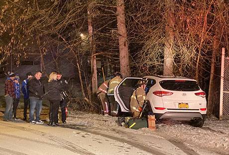
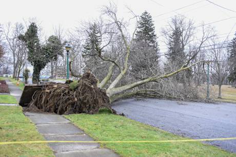
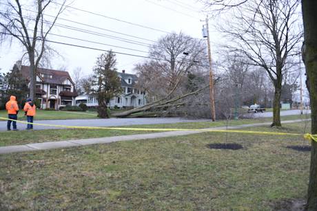
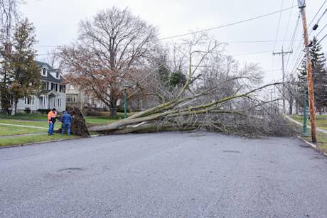
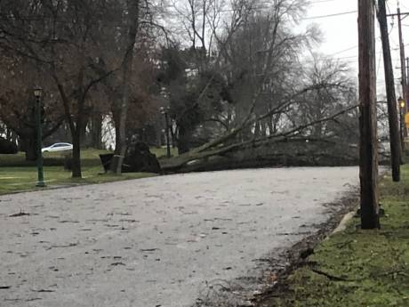
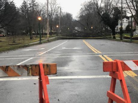
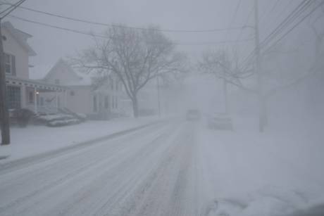
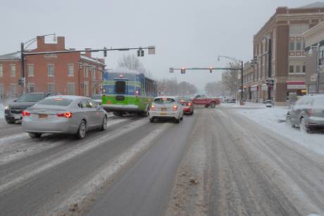
Photos: Top three photos by Philip Casper of a tree down on Ellicott Avenue.

dsc_5248.jpg

dsc_5243.jpg

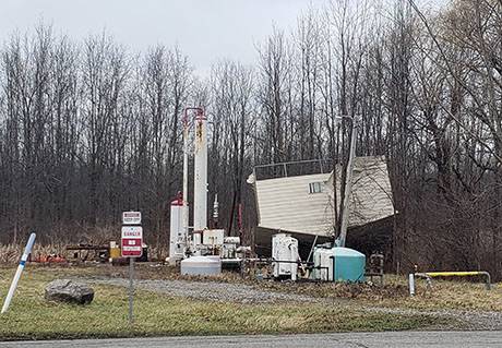
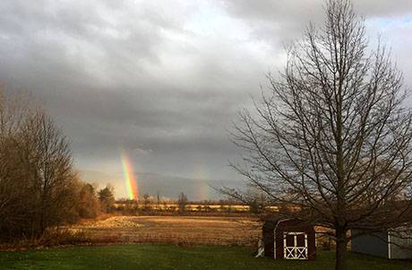
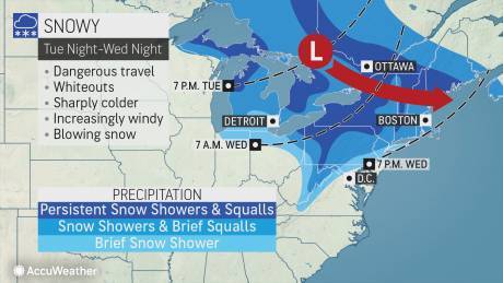
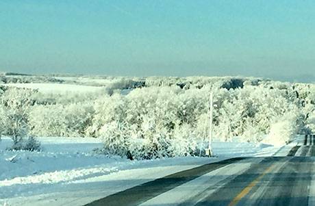
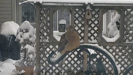
Below, reader-submitted photos. If you have weather-related photos to submit, email them to howard@thebatavian.com or text (585) 260-6970.

img_6609.jpeg

img_6605.jpeg

Strong winds topple telephone pole onto house in Byron, trapping residents

By Billie Owens

A telephone pole fell onto a house at 6281 Walker Corners Road in Byron. No word on injuries. Byron and South Byron fire departments are responding. "Residents are trapped," says a dispatcher. A Sheriff's deputy is heading there to check on residents.

Multiple power, phone and cable lines and signs and trees are down countywide and multiple alarms for fire and burglary have been called in due to strong winds during the early morning hours. Emergency responders have been very busy.

According to the National Weather Service, a powerful winter storm with snow, ice, heavy rain, severe thunderstorms and flash flooding hit much of the eastern United States Saturday and is expected to wind down today. Gusty winds are anticipated behind the storm which is why wind advisories are issued across a large portion of the eastern United States, including Genesee County.

UPDATE 6:47: "Sounds like (Byron and South Byron) fire's all set. Where do you want me to go next?" the deputy asks.

Photo: A boy's first snowman, dressed for today's big game

By Howard B. Owens

img_9578briggs.jpg

Jackson Briggs, son of Batavia Blue Devils football Coach Brennan Briggs, made his first snowman today, finishing it this morning in advance of the Buffalo Bills' playoff game today in Houston.

Photo submitted by Brennan Briggs.

Potentially dangerous snow squall moving through the area

By Howard B. Owens

A potentially dangerous snow squall is moving through the region and is expected to hit Genesee County by 12:45 p.m., according to the the National Weather Service.

A weather warning has been issued.

The Weather Service warns of poor visibility, heavy and blowing snow, with wind gusts of 30 mph.

The warning is based on radar images. 

The Weather Service warns of "dangerous life-threatening travel" during the squall.

Cold and snow expected over next 24 hours

By Howard B. Owens

weatherdec172019.jpg

A low-pressure zone will pass over Genesee County tonight and into tomorrow bringing persistent snow and temperatures between zero and 10 degrees, according to Accuweather.

During snowfall and squalls, whiteout conditions could persist. Travel could be treacherous.

The National Weather Service forecast:

Tonight: Scattered snow showers before 1a.m., then a chance of snow showers after 3 a.m. Mostly cloudy, with a low around 22. West wind 7 to 14 mph. Chance of precipitation is 40 percent. New snow accumulation of less than one inch possible.

Wednesday: Snow showers likely before 5 p.m., then snow after 5 p.m. Temperature falling to around 15 by 5 p.m. Breezy, with a west wind 17 to 21 mph, with gusts as high as 36 mph. Chance of precipitation is 80 percent. New snow accumulation of around an inch possible.

Heavy lake effect snow expected to bring poor travel conditions to Genesee County today

By Billie Owens

A band of heavy lake effect snow will affect northwestern Genesee County today, according to the National Weather Service.

At 9:22 this morning, a band of lake effect snow producing snowfall rates of 1 to 2 inches per hour was located across Niagara and Orleans counties, centered near a Niagara Falls to Lockport to Medina line.

The band will remain nearly stationary through 11:30 a.m. and then will begin to move southward early this afternoon.

Expect poor travel conditions within this band with visibility a quarter mile or less.

Winds will also pick up late this morning, resulting in areas of blowing and drifting snow.

UPDATE 11:52 a.m.: A winter weather advisory is in effect until 5 p.m. with heavy lake effect snow, with total snow accumulations of three to five inches expected and wind gusts up to 40 mph. This is expected to create very difficult travel conditions and significantly reduce visibility. The hazardous conditions could impact the afternoon commute.

Severe weather alert for lake affect snow and blowing snow on Wednesday

By Billie Owens

Earlier this morning the National Weather Service in Buffalo issued a severe weather alert for lake effect snow and blowing snow from 5 a.m. through 7 p.m. Wednesday (Dec. 11).

Total snow accumulations of 3 to 5 inches are expected in the most persistent lake snows across Northern Erie and Western Genesee counties. Winds gusting as high as 40 mph will produce blowing snow and very poor visibility at times.

Lake effect snow will move north across the area Wednesday morning, then intensify and move back south Wednesday afternoon.

Travel could be very difficult for brief periods of time. Areas of blowing snow could significantly reduce visibility. The hazardous conditions could impact the morning and afternoon commute.

Lake effect snow will fall in relatively narrow bands. If traveling, be prepared for rapidly changing road conditions and
visibilities.

Photos: Cold, white and blue in Batavia

By Howard B. Owens

wintermorningdec32019.jpg

It was a beautiful morning in Genesee County, with temperatures in the teens so trees stayed flocked even though the sun was out and the sky was blue.

Top photo, from Court Street, looking toward the Old Courthouse.

wintermorningdec32019-2.jpg

The snow-covered eagle atop the Upton Monument taken through the window on the third floor of the Old Courthouse.

wintermorningdec32019-3.jpg

The Rowell Mansion.

wintermorningdec32019-4.jpg

Centennial Park (in black and white).

wintermorningdec32019-5.jpg

Centennial Park (in black and white).

wintermorningdec320192.jpg

The Barber Conable Post Office Building in Batavia.

wintermorningdec32019-6.jpg

The flag pole outside the Old Courthouse.

Photo: A dove on a winter morning

By Howard B. Owens

screenshot_2019-12-02_at_9.35.27_am.jpg

Jason Smith shared with us this picture of a dove in the morning snow.

If you have a snow picture you would like to share, send it to howard@thebatavian.com.

Untreated roads and sidewalks slippery, more snow expected

By Howard B. Owens

accuweatherdec12019.jpg

As predicted, travel conditions today are treacherous. There have been multiple minor accidents reported around the county this morning.

Batavia PD is advising local residents to avoid travel:

Wowzers! This icy stuff is really making city streets and sidewalks slippery! We encourage everyone to avoid unnecessary travel as there’s numerous accidents throughout the area. So here’s a short list of things you could do rather than go outside...
1. Put up your tree (it’s December now, so it’s allowed).
2. Watch all the NEW Hallmark movies (all new until 8 p.m.!).
3. Nap with the cat or dog on the couch.
4. Play board games with the kids.
5. Make a list of gifts you need to get from your local city businesses.

In all seriousness, it’s pretty nasty out. Let’s give our friends over at the DPW the room they need to make the streets safe.

Have a safe day everyone!

Freezing rain and rain are expected to continue through 3 p.m.

Accuweather is reporting that more snow is on the way tonight with possible snowfall continuing until tomorrow afternoon.

Graphic: Courtesy Accuweather.

test

By Howard B. Owens

test

Authentically Local