pembroke

Grand Jury Report: Motorcyclist charged with manslaughter in death of teenager

By Howard B. Owens

Christopher R. Scinta is indicted on counts of manslaughter in the second degree, a Class C felony, leaving the scene of a property damage accident, a Class C felony, reckless driving, a Class A misdemeanor, criminal mischief in the fourth degree, a Class A misdemeanor, two counts of obstructing governmental administration, a Class A misdemeanor, obstructing emergency medical personal, a Class misdemeanor, and speeding, a violation. Scinta is accused of causing the death of Jasmyne Rubel at the roundabout in the City of Batavia on Nov. 4. He is accused of leaving the scene of a personal injury accident without notifying police of the accident. He is accused of driving a 2006 Kawasaki in a reckless manner. He's accused of intentionally damaging window blinds in interview room #2 at the Batavia Police Department. He is accused of attempting to interfere with a government official's lawful duty. He is accused of interfering with the medical treatment of Jasmyne Rubel by a qualified first responder. 

Cindy L. Bush is indicted on a felony count of DWI and of aggravated unlicensed operation. Bush is accused of driving drunk on April 24 in the City of Batavia on Ross Street in a 2004 Chevrolet. The indictment alleges a prior conviction within the past 10 years for DWI in February 2015 in the City of Batavia.

David J. Leroy is indicted on a count of criminal possession of a weapon 3rd, a Class D felony. Leroy is accused of knowingly possessing a switchblade knife in the Town of Pembroke on July 25.

Geovanny Lopez is indicated a felony count of DWI, aggravated unlicensed operation in the first degree, a Class E felony, and circumventing an interlock device, a Class A misdemeanor. Lopez is accused of driving a 2009 Ford on the I-490 on Aug. 4 in the Town of Le Roy. The indictment alleges that Lopez was convicted of DWI with the past 10 years, on Dec. 12, 2016, in Yonkers.

Shannon L. Marvin is indicted on a count of grand larceny in the fourth degree, a Class E felony. Marvin is accused of stealing a Discover card belonging to another person in the Town of Bergen during the month of October in 2021.

LEGAL NOTICE: Town of Pembroke schedules public hearing for Water District #5

By Legal Notices

PUBLIC NOTICE:

At a Special Meeting of the Town Board of the Town of Pembroke, held at the Town Hall in said Town of Pembroke, County of Genesee, State of New York on the 18th day of January, 2023.

PRESENT:

Thomas Schneider, Supervisor
Kathleen Manne, Councilperson
Edward Arnold, Jr., Councilman

In the Matter of ORDER CALLING PUBLIC HEARING

The Establishment of Water District #5 (Pratt Rd) in the Town of Pembroke, Genesee County, New York under Town Law Article 12-A.

Click the headline for more ... 

WHEREAS, A map, plan and report have been prepared in a manner and detail as determined by the Town Board of the Town of Pembroke, regarding the establishment of a proposed   Water District No. 5 in the Town of Pembroke.

The map, plan and report have been filed in the Town Clerk’s Office in the Town on the 2nd day of June 2021.

The map, plan and report were prepared by Jeremy DeLyser, P.E., of Clark Patterson Lee, a competent engineer, licensed by the State of New York, showing the boundaries of the proposed district, a general plan of the distribution system and a report of the proposed methods of operation and the estimated maximum cost of said proposed district. The map depicts the boundaries of the proposed district.

The boundaries are as follows;

Beginning at the intersection of the easterly municipal boundary line of the Town of Pembroke/Town of Batavia, and the center line of Slusser Road (49.5 feet wide right-of-way); thence,

  1. Southerly, along the easterly municipal boundary line of the Town of Pembroke/Town of Batavia, a distance of 507 feet, more or less, to the southerly property line of tax account number 17.-2-10.1; thence,
  2. Westerly, along the southerly line of tax account number 17.-2-10.1, a distance of 330 feet, more or less, to a point 500 feet southerly of and parallel to the center line of Slusser Road; thence,
  3. Northwesterly, through the lands of tax account numbers 17.-2-10.1, 17.-2-10.2, and 17.-2-31.21, along a line 500 feet southerly of and parallel to the center line of Slusser Road, a distance of 1,868 feet, more or less, to a point on a southerly line of tax account number 17.-2-31.21; thence,
  4. Northwesterly, along the southerly lines of the tax account numbers 17.-2-31.21, 17.-2-31.12, 17.-1-48.11, 17.-1-48.12, 17.-1-49, 17.-1-50.1, 17.-1-50.2, and 17.-1-75, to the easterly extension of a line of tax account number 17.-1-75; thence,
  5. Westerly, across Tonawanda Creek, along the easterly extension of a southerly line of tax account number 17.-1-75, and a southerly line of tax account number 17.-1-75, a distance of 325 feet, more or less, to the westerly line of tax account number 17.-1-75; thence,
  6. Northwesterly, along the westerly line of tax account number 17.-1-75, and the northerly extension of the westerly line of tax account number 17.-1-75 a distance of 337 feet, more or less, to the center line of Pratt Road; thence,
  7. Westerly, along the center line of Pratt Road, a distance of 148 feet, more or less, to the southerly extension of a westerly line of tax account number 17.-1-11; thence,
  8. Northwesterly, along the southerly extension of a westerly line of tax account number 17.-1-11, and a westerly line of tax account number 17.-1-11, a distance of 448 feet, more or less, to a northerly line of tax account number 17.-1-11; thence,
  9. Easterly, along a northerly line of tax account number 17.-1-11, a distance of 165 feet, more or less, to a westerly line of 17.-1-11; thence,
  10. Northwesterly, along a westerly line of tax account number 17.-1-11, a distance of 290 feet, more or less, to a westerly line of tax account number 17.-1-11; thence,
  11. Easterly, along a northerly line of tax account number 17.-1-11, the easterly extension of the northerly line of tax account number 17.-1-11, and the existing Town of Pembroke Water District No. 1, a distance of 762 feet, more or less, to a southerly line of tax account number 17.-1-18; thence,
  12. Northwesterly, along the southerly line of tax account number 17.-1-18, a distance of 541 feet, more or less, to a point 500 feet westerly of and parallel to the center line of Pratt Road (49.5 feet wide right-of-way; thence,
  13. Northerly, through the lands of tax account numbers 17.-1-18, 17.-1-19.12, 17.-1-19.11, and 17.-1-21.111, along a line 500 feet westerly of and parallel to the center line of Pratt Road, a distance of 1,528 feet, more or less, to a northerly line of tax account number 17.-1-21.111; thence,
  14. Northeasterly, along a northerly line of tax account number 17.-1-21.111, a distance of 323 feet, more or less, to a westerly line of tax account number 17.-1-21.111; thence,
  15. Northwesterly, along a westerly line of tax account number 17.-1-21.111, a distance of 116 feet, more or less to a northerly line of tax account number 17.-1-21.111; thence,
  16. Northeasterly, along a northerly line of tax account number 17.-1-21.111, and the westerly lines of tax account numbers 17.-1-35 and 17.-1-36, a distance of 684 feet, more or less, to the northwesterly corner of tax account number 17.-1-36; thence,
  17. Southeasterly, along the northerly line of tax account number 17.-1-36, a distance of 68 feet, more or less, to an angle point; thence,
  18. Easterly, along the northerly lines of tax account numbers 17.-1-36, 17.-1-37, 17.-2-2.212, 17.-2-2.211, and 17.-2-2.1, a distance of 1,863 feet, more or less, to the northeasterly corner of tax account number 17.-2-2.1; thence,
  19. Southerly, along the easterly line of tax account number 17.-2-2.1, and the southerly extension of the easterly line of tax account number 17.-2-2.1, a distance of 330 feet, more or less, to the center line of Pratt Road; thence,
  20. Easterly, along the center line of Pratt Road, a distance of 70 feet, more or less, to the southwesterly extension of the westerly line of tax account number 17.-2-3; thence,
  21. Northeasterly, along the southwesterly extension of the westerly line of tax account number 17.-2-3, and the westerly line of tax account number 17.-2-3, a distance of 336 feet, more or less, to the northerly line of tax account number 17.-2-3; thence,
  22. Easterly, along the northerly lines of tax account numbers 17.-2-3, 17.-2-5, 17.-2-4, 17.-2-38, 17.-2-39, 17.-2-40, 17.-2-41, 17.-2-42, 17.-2-43, 17.-2-44, and 17.-2-45, a distance of 1,179 feet, more or less, to the easterly line of tax account number 17.-2-45; thence,
  23. Southerly, along the easterly municipal boundary line of the Town of Pembroke/Town of Batavia, a distance of 803 feet, more or less, to the southerly line of tax account number 17.-2-6.2; thence,
  24. Westerly, along the southerly lines of tax account numbers 17.-2-6.2 and 17.-2-6.12, a distance of 408 feet, more or less, to the westerly line of tax account number 17.-2-6.12; thence,
  25. Northerly, along the westerly line of tax account number 17.-2-6.12, a distance of 124 feet more or less, to the southerly line of tax account number 17.-2-46; thence,
  26. Westerly, along the southerly lines of tax account numbers 17.-2-46, 17.-2-47, 17.-2-49.1, 17.-2-55.2, and 17.-2-6.112, a distance of 662 feet, more or less, to the easterly line of tax account number 17.-2-51; thence,
  27. Southwesterly, along an easterly lines of tax account numbers 17.-2-51 and 17.-2-53.1, a distance of 143 feet, more or less, to a northerly line of tax account number 17.-2-53.1; thence,
  28. Easterly, along a northerly line of tax account number 17.-2-53.1, a distance of 206 feet, more or less, to an easterly line of tax account number 17.-2-53.1; thence,
  29. Southeasterly, along an easterly line of tax account number 17.-2-53.1, a distance of 96 feet, more or less, to a southerly line of tax account number 17.-2-53.1; thence,
  30. Westerly, along a southerly line of a tax account number 17.-2-53.1, a distance of 40 feet, more or less, to a point 500 feet easterly of and parallel to the center line of Slusser Road; thence,
  31. Southwesterly, through the lands of tax account numbers 17.-2-6.111 and 17.-2-7, along a line 500 feet easterly of and parallel to the center line of Slusser Road, a distance of 667 feet, more or less, to the southerly line of tax account number 17.-2-7; thence,
  32. Westerly, along a southerly line of tax account number 17.-2-7, a distance of 199 feet, more or less, to an easterly line of tax account number 17.-2-7; thence,
  33. Southerly, along the westerly line of tax account number 17.-2-8, a distance of 1,952 feet, more or less, to a point 500 feet northerly of and parallel to the center line of Slusser Road; thence,
  34. Southeasterly, through the lands of tax account numbers 17.-2-8, along a line 500 feet easterly of and parallel to the center line of Slusser Road, a distance of 1,390 feet, more or less, to the easterly municipal boundary line of the Town of Pembroke/Town of Batavia; thence,
  35. Southerly, along the easterly municipal boundary line of the Town of Pembroke/Town of Batavia, a distance of 530 feet, more or less, to the Point of Beginning.

Pratt Road/Water District #5, as described above, contains approximately 309 acres of land.

All as shown on a map prepared by CPL, entitled “Pratt Road Water District – Water District Map”, dated May 20, 2020.

WHEREAS, the improvements proposed consist of construction and maintenance of a water system, to serve the said district, including water mains, and distribution pipes to be installed at the sole expense of the residents of the district and no public funds will be expended therefore; and

WHEREAS, the maximum amount proposed to be expended for the improvements (or, the maximum amount proposed to be expended for the performance or supplying of services) as stated in the said Map. Plan and Report is the sum of Two Million Fifty five Thousand and no/100 Dollars ($2,055,000.00) of which Nine Hundred Four Thousand Dollars and no/100 ($904,000.00) will be provided by USDA Rural Development in the form of a grant and One Million One Hundred Fifty-one Thousand Dollars and no/100 ($1,151,000.00) will be provided by a loan from USDA Rural Development at a rate of 1.75% over a period of 38 years; and

WHEREAS, the total estimated cost after the first year of service for equivalent dwelling units is $1,048.00, of which $552.00 will be paid toward debt service and $496.00 will be paid toward annual water costs (including operation and maintenance costs) Total one time estimated costs per equivalent dwelling unit for installation are estimated to be $1,140.00.

NOW THEREFORE IT IS HEREBY:

ORDERED, that a public hearing before the Town Board of the Town of Pembroke, shall be held at the Pembroke Town Hall, 1145 Main Road Corfu, New York on the 9th day of February, 2023 at 6:30 p.m. to hear the residents and landowners in the proposed district  interested in the subject thereof, concerning the same, and for such other action on the part of said Town Board as may be required by law or proper in the premises.

Dated:  January 18th, 2023

Motion made by: Supervisor Schneider
Seconded by: Councilman Arnold
Ayes: Manne, Arnold, Schneider
Nays: None

APPROVED by: Unanimous vote (3-0)

State of New York) County of Genesee)    ss:

I, Nicole Begin, Town Clerk of the Town of Pembroke, Genesee County, New York, do hereby certify that I have compared the preceding Order with the original thereof filed in my office in Pembroke, New York on the 18th of January, 2023, and that the same is a true and correct copy of said original and of the whole thereof.

In Testimony whereof, I have hereunto set my hand and affixed the seal of said Town, this 18th day of January, 2023.

Nicole Begin

Town Clerk of the Town of Pembroke

Genesee County, New York


LEGAL NOTICE: Town of Pembroke schedules public hearing for Water District #4

By Legal Notices

PUBLIC NOTICE:

At a Special Meeting of the Town Board of the Town of Pembroke, held at the Town Hall in said Town of Pembroke, County of Genesee, State of New York on the 18th day of January, 2023.

PRESENT:

Thomas Schneider, Supervisor
Kathleen Manne, Councilperson
Edward Arnold, Jr., Councilman

In the Matter of ORDER CALLING PUBLIC HEARING
The Establishment of Water District #4  in the Town of Pembroke, Genesee County, New York under Town Law Article 12-A.

Click the headline for more ...

WHEREAS, A map, plan and report have been prepared in a manner and detail as determined by the Town Board of the Town of Pembroke, regarding the establishment of a proposed   Water District No. 4 in the Town of Pembroke.

The map, plan and report have been filed in the Town Clerk’s Office in the Town on the 2nd      day of June 2021.

The map, plan and report were prepared by Jeremy DeLyser, P.E., of Clark Patterson Lee, a competent engineer, licensed by the State of New York, showing the boundaries of the proposed district, a general plan of the distribution system and a report of the proposed methods of operation and the estimated maximum cost of said proposed district. The map depicts the boundaries of the proposed district.

The boundaries are as follows;

Beginning at a point, being the northwesterly corner of the Existing Extension No. 1 to the Existing Town of Pembroke Water District No. 1 and the intersection of the centerline of Gabbey Road (C.R. 4) (66 feet wide right-of-way) and a westerly extension of a southerly line of tax account number 10.-1-31.111; thence,

  1. Northerly, along the centerline of Gabbey Road and an easterly line of the Existing Town of Pembroke Water District No. 1, a distance of 174 feet, more or less, to a northeasterly corner of the Existing Town of Pembroke Water District No. 1; thence,
  2. Southwesterly, along a northerly line of the Town of Pembroke Water District No. 1, through the lands of tax account number 10.-1-38.115, a distance of 862 feet, more or less, to a point on the southwesterly line of tax account number 10.-1-38.115, 500 feet northeasterly of and parallel to the centerline of Gabbey Road; thence,
  3. Northwesterly, along the southwesterly line of tax account number 10.-1-38.115, a distance of 307 feet, more or less, to a southwesterly corner of tax account number 10.-1-38.115; thence,
  4. Northerly, along the westerly line of tax account number 10.-1-38.115, a distance of 400 feet, more or less, to the northwesterly corner of tax account number 10.-1-38.115; thence,
  5. Easterly, along the northerly line of tax account number 10.-1-38.115, a distance of 514 feet, more or less, a point 500 feet westerly of and parallel to the centerline of Gabbey Road; thence,
  6. Northerly, along a line 500 feet westerly of and parallel to the centerline of Gabbey Road, through the lands of tax account numbers 10.-1-52, 10.-1-51, 10.-1-50, 10.-1-1.112, 10.-1-2.123, 10.-1-49, 10.-1-48, and 10.-1-46.1, a distance of 2,006 feet, more or less, to the northerly line of tax account number 10.-1-46.1; thence,
  7. Easterly, along the northerly line of tax account number 10.-1-46.1, a distance of 70 feet, more or less, to the southwesterly corner of tax account number 10.-1-2.21; thence,
  8. Northerly, along the westerly line of tax account number 10.-1-2.21, a distance of 125 feet, more or less, to the southerly line of tax account number 9.-1-64; thence,
  9. Westerly, along the southerly line of tax account number 9.-1-64, a distance of 519 feet, more or less, to the southwesterly corner of tax account number 9.-1-64; thence,
  10. Northerly, along the westerly line of tax account number 9.-1-64, a distance of 422 feet, more or less, to a point 500 feet southerly of and parallel to the centerline of Akron Road (99 feet wide right-of-way); thence,
  11. Westerly, along a line 500 feet southerly of and parallel to the centerline of Akron Road, through the lands of tax account numbers 9.-1-65.11, 9.-1-66, 8.-1-13.11, and 8.-1-13.12, a distance of 2,598 feet, more or less, to the westerly line of tax account number 8.-1-13.12; thence,
  12. Northerly, along the westerly line of tax account number 8.-1-13.12, a distance of 269 feet, more or less, to the southeasterly corner of tax account number 8.-1-12; thence,
  13. Westerly, along the southerly line of tax account number 8.-1-12, a distance of 250 feet, more or less, to the easterly line of tax account number 8.-1-16.21; thence,
  14. Southerly, along the easterly line of tax account number 8.-1-16.21, a distance of 51 feet, more or less, to the southeasterly corner of tax account number 8.-1-16.21; thence,
  15. Westerly, along the southerly line of tax account number 8.-1-16.21, a distance of 577 feet, more or less, to a point 500 feet easterly of and parallel to the centerline of Marble Road (49.5 feet wide right-of-way); thence,
  16. Southerly, along a line 500 feet easterly of and parallel to the centerline of Marble Road, through the lands of tax account numbers 8.-1-16.121, and 8.-1-16.112, a distance of 2,054 feet, more or less, to the easterly line of tax account number 8.-1-17.2; thence,
  17. Southeasterly, along the easterly lines of tax account numbers 8.-1-17.2, 14.-2-66, and 14.-2-1.112, a distance of 1,009 feet, more or less, to the southeasterly corner of tax account number 14.-2-1.112; thence,
  18. Westerly, along the southerly line of tax account number 14.-2-1.112, a distance of 163 feet, more or less, to the northwesterly corner of tax account number 14.-2-1.111; thence,
  19. Southerly, along the easterly line of tax account number 14.-2-1.111, a distance of 400 feet, more or less, to the southwesterly corner of tax account number 14.-2-1.111 and a northeasterly corner of the Existing Extension No. 1 to the Existing Town of Pembroke Water District No. 1; thence,
  20. Westerly, along the southerly line of tax account number 14.-2-1.111, across Marble Road, along the southerly line of tax account number 14.-1-18.2, and along a northerly line of the Existing Extension No. 1 to the Existing Town of Pembroke Water District No. 1, a distance of 1,093 feet, more or less, to the southwesterly corner of tax account number 14.-1-18.2 and a northwesterly corner of the Existing Extension No.1 to the Existing Town of Pembroke Water District No. 1; thence,
  21. Southerly, along the easterly line of tax account number 14.-1-17.1 and along a westerly line of the Existing Extension No. 1 to the Existing Town of Pembroke Water District No. 1 and the Existing Town of Pembroke Water District No. 1, a distance of 1,811 feet, more or less, to the southeasterly corner of tax account number 14.-1-17.1 and a southwesterly corner of the Existing Town of Pembroke Water District No. 1; thence,
  22. Southwesterly, along a line perpendicular to the northerly right-of-way line of Knapp Road (49.5 feet wide right-of-way) and along a northwesterly line of the Existing Extension No. 1 to the Existing Town of Pembroke Water District No. 1, a distance of 50 feet, more or less, to the southeasterly corner of tax account number 14.-1-15 and a northwesterly corner of the Existing Extension No. 1 to the Existing Town of Pembroke Water District No. 1; thence,
  23. Westerly, along the southerly line of tax account number 14.-1-15 and along a northerly line of the Existing Extension No. 1 to the Existing Town of Pembroke Water District No. 1, a distance of 1,018 feet, more or less, to the southwesterly corner of tax account number 14.-1-15; thence,
  24. Northerly, along the westerly line of tax account number 14.-1-15, a distance of 269 feet, more or less, to a point 500 feet southwesterly of and parallel to the centerline of Knapp Road; thence,
  25. Northwesterly and westerly along a line 500 feet southerly of and parallel to the centerline of Knapp Road, through the lands of tax account number 14.-1-14.1, 14.-1-13.111, 14.-1-6.1, and 14.-1-5.113, a distance of 4,461 feet, more or less, to the easterly line of tax account number 14.-1-84; thence,
  26. Southerly, along the easterly line of tax account number 14.-1-84, a distance of 149 feet, more or less, to the southeasterly corner of tax account number 14.-1-84; thence,
  27. Westerly, along the southerly line of tax account number 14.-1-84, a distance of 210 feet, more or less, to the southwesterly corner of tax account number 14.-1-84; thence,
  28. Northerly, along the westerly line of tax account number 14.-1-84, a distance of 150 feet, more or less, to a point 500 feet southerly of and parallel to the centerline of Knapp Road; thence,
  29. Westerly, along a line 500 feet southerly of and parallel to the centerline of Knapp Road, through the lands of tax account numbers 14.-1-5.112, 14.-1-3.113, 14.-1-86, 14.-1-3.112, and 14.-1-2.1, a distance of 1,763 feet, more or less, to the westerly line of tax account number 14.-1-2.1 and the westerly line of the Town of Pembroke Municipal Boundary; thence,
  30. Northerly, along the westerly line of the Town of Pembroke Municipal Boundary and along the westerly line of tax account number 14.-1-2.1, across Knapp Road, and along the westerly line of tax account number 14.-1-1.2, a distance of 1,000 feet, more or less, to a point 500 feet northerly of and parallel to the centerline of Knapp Road; thence,
  31. Easterly, along a line 500 feet northerly of and parallel to the centerline of Knapp Road, through the lands of tax account number 14.-1-1.2, a distance of 81 feet, more or less, to the westerly line of tax account number 14.-1-1.12; thence,
  32. Northerly, along the westerly line of tax account number 14.-1-1.12, a distance of 500 feet, more or less, to the northwesterly corner of tax account number 14.-1-1.12; thence,
  33. Easterly, along the northerly lines of tax account numbers 14.-1-1.12 and 14.-1-97, a distance of 604 feet, more or less, to the northeasterly corner of tax account number 14.-1-97; thence,
  34. Southerly, along the easterly line of tax account number 14.-1-97, a distance of 11 feet, more or less, to a northwesterly corner of tax account number 14.-1-4.11; thence,
  35. Easterly, along a northerly line of tax account number 14.-1-4.11, a distance of 910 feet, more or less, to a northwesterly corner of tax account number 14.-1-4.11; thence,
  36. Northerly, along the westerly lines of tax account numbers 14.-1-4.11, 8.-1-38.121, 8.-1-54, 8.-1-37.111, and 8.-1-37.12, a distance of 2,409 feet, more or less, to the southeasterly corner of tax account number 8.-1-50; thence,
  37. Westerly, along the southerly lines of tax account numbers 8.-1-50, 8.-1-40.115, 8.-1-57 and through the lands of tax account number 8.-1-56-1 along the westerly extension of the southerly line of tax account number 8.-1-57, a distance 1,043 feet, more or less, to the easterly line of tax account number 8.-1-40.2; thence,
  38. Southerly, along the easterly line of tax account number 8.-1-40.2, a distance of 255 feet, more or less, to the southeasterly corner of tax account number 8.-1-40.2; thence,
  39. Westerly, along the southerly line of tax account number 8.-1-40.2 and along a westerly extension of the southerly line of tax account number 8.-1-40.2, through the lands of tax account number 8.-1-46, a distance of 729 feet, more or less, to the westerly line of tax account number 8.-1-46 and the westerly line of the Town of Pembroke Municipal Boundary; thence,
  40. Northerly, along the westerly line of tax account number 8.-1-46, across Akron Road (66 feet wide right-of-way), and along the westerly line of tax account number 8.-1-45, also along the westerly line of the Town of Pembroke Municipal Boundary, a distance of 1,556 feet, more or less, to the northwesterly corner of tax account number 8.-1-45; thence,
  41. Easterly, along the northerly lines of tax account numbers 8.-1-45, 8.-1-41.1, 8.-1-41.2, and 8.-1-42, and along an easterly extension of the northerly line of tax account number 8.-1-42, a distance of 1,828 feet, more or less, to the centerline of Tesnow; thence,
  42. Northerly, along the centerline of Tesnow Road, a distance of 477 feet, more or less, to a point 500 feet northerly of and parallel to the centerline of Akron Road; thence,
  43. Easterly, along a line 500 feet northerly of and parallel to the centerline of Akron Road, through the lands of tax account numbers 8.-1-7, 8.-1-8.1, 8.-1-9.1, 8.-1-10.12, and 8.-1-11.111, a distance of 8,476 feet, more or less, to a point 500 feet westerly of and parallel to the centerline of Hopkins Road (66 feet wide right-of-way); thence,
  44. Northerly, along a line 500 feet westerly of and parallel to the centerline of Hopkins Road, through the lands of tax account number 8.-1-11.111, a distance of 577 feet, more or less, to a southerly line of tax account number 8.-1-11.221; thence,
  45. Westerly, along a southerly line of tax account number 8.-1-11.221, a distance of 30 feet, more or less, to the southwesterly corner of tax account number 8.-1-11.221; thence,
  46. Northerly, along a westerly line of tax account number 8.-1-11.221, a distance of 225 feet, more or less, to a northwesterly corner of tax account number 8.-1-11.221; thence,
  47. Easterly, along a northerly line of tax account number 8.-1-11.221, a distance of 29 feet, more or less, to a point 500 feet westerly of and parallel to the centerline of Hopkins Road; thence,
  48. Northerly, along a line 500 feet westerly of and parallel to the centerline of Hopkins Road, through the lands of tax account number 8.-1-59, a distance of 1,618 feet, more or less to the northerly line of tax account number 8.-1-59, and the northerly line of the Town of Pembroke Municipal Boundary; thence,
  49. Easterly, along the northerly line of the Town of Pembroke Municipal Boundary, a distance of 1,000 feet, more or less, to a point 500 feet easterly of and parallel to the centerline of Hopkins Road; thence,
  50. Southerly, along a line 500 feet easterly of and parallel to the centerline of Hopkins Road, through the lands of tax account number 9.-1-1.1, a distance of 579 feet, more or less, to the northerly line of tax account number 9.-1-84; thence,
  51. Easterly, along the northerly lines of tax account numbers 9.-1-84 and 9.-1-2.213, a distance of 740 feet, more or less, to a northwesterly corner of tax account number 9.-1-2.213; thence,
  52. Northeasterly, along a westerly line of tax account number 9.-1-2.213, a distance of 460 feet, more or less, to a northwesterly corner of tax account number 9.-1-2.213; thence,
  53. Easterly, along a northerly line of tax account number 9.-1-2.213, a distance of 240 feet, more or less, to a northeasterly corner of tax account number 9.-1-2.213; thence,
  54. Southwesterly, along an easterly line of tax account number 9.-1-2.213, a distance of 392 feet, more or less, to a southeasterly corner of tax account number 9.-1-2.213; thence,
  55. Southerly, along an easterly line of tax account number 9.-1-2.213, a distance of 38 feet, more or less, to a point 500 feet northerly of and parallel to the centerline of Sliker Road (66 feet wide right-of-way); thence,
  56. Easterly, along a line 500 feet northerly of and parallel to the centerline of Sliker Road, through the lands of tax account number 9.-1-2.1, a distance of 1,576 feet, more or less, to the westerly line of tax account number 9.-1-7; thence,
  57. Northerly, along the westerly line of tax account number 9.-1-7, a distance of 108 feet, more or less, to the northwesterly corner of tax account number 9.-1-7; thence,
  58. Easterly, along the northerly lines of tax account numbers 9.-1-7, 9.-1-9.122, 9.-1-83, 9.-1-9.123, 9.-1-9.22, 9.-1-9.21, 9.-1-9.112, and 9.-1-9.111, a distance of 2,304 feet, more or less, to the northeasterly corner of tax account number 9.-1-9.111;
  59. Northeasterly, along a westerly line of tax account number 9.-1-41.1, a distance of 324 feet, more or less, to the northwesterly corner of tax account number 9.-1-41.1; thence,
  60. Southeasterly, along the northeasterly lines of tax account numbers 9.-1-41.1, 9.-1-41.2, and 9.-1-41.3, a distance of 345 feet, more or less, to a southwesterly corner of tax account number 9.-1-38.11; thence,
  61. Northeasterly, along a westerly line of tax account number 9.-1-38.11, a distance of 229 feet, more or less, to the southerly line of tax account number 9.-1-11; thence,
  62. Northwesterly, along the southerly line of tax account number 9.-1-11, through the abandoned right-of-way of McAlpine Road (66 feet wide abandoned right-of-way) and along the southwesterly line of tax account number 9.-1-12, a distance of 2,216 feet, more or less, to a westerly line of the Town of Pembroke Municipal Boundary and the southwesterly corner of tax account number 9.-1-12; thence,
  63. Northeasterly, along a westerly line of the Town of Pembroke Municipal Boundary and a westerly line of tax account number 9.-2-12 and the northeasterly extension of the westerly line of tax account number 9.-1-12, a distance of 710 feet, more or less, to a northeasterly line of the Town of Pembroke Municipal Boundary and the centerline of Meiser Road (66 feet wide right-of-way); thence,
  64. Southeasterly, along a northeasterly line of the Town of Pembroke Municipal Boundary, and the centerline of Meiser Road, and a distance of 971 feet, more or less, to a northwesterly line of the Town of Pembroke Municipal Boundary and the intersection of the centerlines of Meiser Road and McAlpine Road (66 feet wide right-of-way); thence,
  65. Northeasterly, along a northwesterly line of the Town of Pembroke Municipal Boundary and the centerline of McAlpine Road, a distance of 347 feet, more or less, to a northeasterly line of the Town of Pembroke Municipal Boundary and the northwesterly extension of the northerly line of tax account number 9.-1-14; thence,
  66. Southeasterly, along a northerly line of the Town of Pembroke Municipal Boundary, a northwesterly extension of the northerly line of tax account number 9.-1-14, and the northerly line of tax account number 9.-1-14, a distance of 233 feet, more or less, to a northerly line of the Town of Pembroke Municipal Boundary and a northwesterly corner of tax account number        9.-1-15.111; thence,
  67. Northeasterly, along a northwesterly line of the Town of Pembroke Municipal Boundary and a northwesterly line of tax account number 9.-1-15.111, a distance of 310 feet, more or less, to a northeasterly line of the Town of Pembroke Municipal Boundary and a northwesterly corner of tax account number 9.-1-15.111; thence,
  68. Southeasterly, along a northeasterly line of the Town of Pembroke Municipal Boundary and a northeasterly line of tax account number 9.-1-15.111, a distance of 353 feet, more or less, to a northwesterly line of the Town of Pembroke Municipal Boundary and northwesterly corner of tax account number 9.-1-15.111; thence,
  69. Northeasterly, along a northwesterly line of the Town of Pembroke Municipal Boundary and a northwesterly line of tax account number 9.-1-15.111, and a northeasterly extension of a northwesterly line of tax account number 9.-1-15.111; a distance of 483 feet, more or less, to a northeasterly line of the Town of Pembroke Municipal Boundary and the centerline of the abandoned right-of-way of Ogden Street (66 feet wide abandoned right-of-way); thence,
  70. Southeasterly, along a northeasterly line of the Town of Pembroke Municipal Boundary and the centerline of the abandoned right-of-way of Ogden Street, a distance of 330 feet, more or less, to a northwesterly line of the Town of Pembroke Municipal Boundary and a southwesterly extension of the northwesterly line of tax account number 9.-1-16.2; thence,
  71. Northeasterly, along a northwesterly line of the Town of Pembroke Municipal Boundary and a southwesterly extension of the northwesterly line of tax account number 9.-1-16.2, a northwesterly line of tax account number 9.-1-16.2, a distance of 522 feet, more or less, to a northeasterly line of the Town of Pembroke Municipal Boundary and a northwesterly corner of tax account number 9.-1-16.2; thence,
  72. Easterly, along a northeasterly line of the Town of Pembroke Municipal Boundary, a northerly line of tax account number 9.-1-16.2, across Alleghany Road (NYS Route 77) (right-of-way varies) and along the northerly line of tax account number 9.-2-1, a distance of 1,091 feet, more or less, to a point 500 feet easterly of and parallel to the centerline of Alleghany Road; thence,
  73. Southerly, along a line 500 feet easterly of and parallel to the centerline of Alleghany Road, through the lands of tax account number 9.-2-1, a distance of 894 feet, more and less, to the centerline of the abandoned right-of-way of Houseknecht Road (66 feet wide abandoned right-of-way); thence,
  74. Westerly, along the centerline of the abandoned right-of-way of Houseknecht Road, a distance of 178 feet, more or less, to the northerly extension of the easterly line of tax account number 9.2-38.11; thence,
  75. Southerly, along a northerly extension of the easterly line of tax account number 9.2-38.11, and the easterly lines of tax account numbers 9.-2-38.11, and 9.-2-38.2, a distance of 404 feet, more or less, to a southeasterly corner of tax account number 9.-2-38.2; thence,
  76. Southwesterly, along a southerly line of tax account number 9.-2-38.2, a distance of 220 feet, more or less, to the easterly line of tax account number 9.-2-37.1; thence,
  77. Southerly, along the easterly line of tax account number 9.-2-37.1 and a southerly extension of the easterly line of tax account number 9.-2-37.1 through the lands of the abandoned right-of-way of Troup Street (66 feet wide abandoned right-of-way), a distance of 152 feet, more or less, to the northerly line of tax account number 9.-2-33; thence,
  78. Easterly, along the northerly lines of tax account numbers 9.-2-33, 9.-2-32, 9.-2-44.2, 9.-2-44.1, and 9.-2-46.2, a distance of 2,460 feet, more or less, to an easterly line of tax account number 9.-2-46.2; thence,
  79. Southerly, along an easterly line of tax account number 9.-2-46.2, a distance of 61 feet, more or less, to the intersection of the easterly line of tax account number 9.-2-46.2 and the westerly extension of the northerly line of tax account number 9.-2-29; thence,
  80. Easterly, along the westerly extension of the northerly line of tax account number 9.-2-29, through the lands of the abandoned right-of-way of East Street (66 feet wide abandoned right-of-way), and along the northerly line of tax account number 9.-2-29, a distance of 344 feet, more or less, to the westerly line of tax account number 9.-2-2.2; thence,
  81. Northerly, along the westerly line of tax account number 9.-2-2.2, a distance of 218 feet, more or less, to a point 500 feet northerly of and parallel to the centerline of Phelps Road (66 feet wide right-of-way); thence,
  82. Easterly, along a line 500 feet northerly of and parallel to the centerline of Phelps Road, through the lands of tax account numbers 9.-2-2.2, 9.-2-2.1, 9.-2-5.111, 11.-1-1.1, 11.-1-2.1, 11.-1-14.1, and 11.-1-13.11, across Gorton Road (49.5 feet wide right-of-way), through the lands of tax account numbers 11.-1-12, 11.-1-11, 11.-1-9.2, 11.-1-9.1, and 11.-1-10, a distance of 13,072 feet, more or less, to a point 500 feet westerly of and parallel to the centerline of North Pembroke Road (49.5 feet wide right-of-way); thence,
  83. Northerly, along a line 500 feet westerly of and parallel to the centerline of North Pembroke Road, through the lands of tax account number 11.-1-10, a distance of 1,328 feet, more or less, to the northerly line of tax account number 11.-1-10; thence,
  84. Easterly, along the northerly line of tax account number 11.-1-10, a distance of 187 feet, more or less, to the westerly line of tax account number 11.-1-8; thence,
  85. Northerly, along the westerly line of tax account numbers 11.-1-8 and 11.-1-7.12, a distance of 981 feet, more or less, to a southerly line of tax account number 11.-1-7.12; thence,
  86. Westerly, along a southerly line of tax account number 11.-1-7.12, a distance of 12 feet, more or less, to a westerly line of tax account number 11.-1-7.12; thence,
  87. Northerly, along a westerly line of tax account number 11.-1-7.12, a distance of 120 feet, more or less, to a northerly line of tax account number 11.-1-7.12; thence,
  88. Easterly, along a northerly line of tax account number 11.-1-7.12, a distance of 12 feet, more or less, to a westerly line of tax account number 11.-1-7.12; thence,
  89. Northerly, along a westerly line of tax account number 11.-1-7.12, a distance of 150 feet, more or less, to a northerly line of tax account number 11.-1-7.12; thence,
  90. Easterly, along a northerly line of tax account number 11.-1-7.12 and an easterly extension of tax account number 11.-1-7.12, a distance of 313 feet more or less, to the centerline of North Pembroke Road and a westerly line of the Existing Town of Alabama Water District No. 2; thence,
  91. Southerly, along the centerline of North Pembroke Road and a westerly line of the Existing Town of Alabama Water District No. 2, a distance of 69 feet, more or less, to a southwesterly corner of the Existing Town of Alabama Water District No. 2 and the centerline line of Galloway Road (49.5 feet wide right-of-way); thence,
  92. Easterly, along the centerline of Galloway Road and a southerly line of the Existing Town of Alabama Water District No. 2, a distance of 500 feet, more or less, to a point 500 feet easterly of and parallel to the centerline of North Pembroke Road; thence,
  93. Southerly, along a line 500 feet easterly of and parallel to the centerline of North Pembroke Road, through the lands of tax account numbers 13.-1-5.11 and 13.-1-2, a distance of 2,680 feet, more or less, to a northerly line of the Existing Town of Pembroke Water District No. 1; thence,
  94. Westerly, along a northerly line of the Existing Town of Pembroke Water District No. 1, a distance of 464 feet, more or less, to a westerly line of the Existing Town of Pembroke Water District No. 1; thence,
  95. Southerly, along a westerly line of the Existing Town of Pembroke Water District No. 1, a distance of 24 feet, more or less, to a northerly line of the Existing Town of Pembroke Water District No. 1; thence,
  96. Westerly, along the centerline of Phelps Road and a northerly line of the Existing Town of Pembroke Water District No. 1, a distance of 270 feet, more or less, to a northwesterly corner of the Existing Town of Pembroke Water District No. 1 and the northerly extension of the easterly line of tax account number 12.-1-27; thence,
  97. Southerly, along a westerly line of the Existing Town of Pembroke Water District No. 1, and the northerly extension of the easterly line of tax account number 12.-1-27, and the easterly line of tax account number 12.-1-27, a distance of 314 feet, more or less, to the southeasterly corner of tax account number 12.-1-27 and a northwesterly corner of the Existing Town of Pembroke Water District No. 1; thence,
  98. Westerly, along a northerly line of the Existing Town of Pembroke Water District No. 1 and the southerly lines of tax account numbers 12.-1-27, 12.-1-26.11, 12.-1-26.12, and 12.-1-26.2, a distance of 1,007 feet, more or less, to an easterly line of tax account number 12.-1-24.113; thence,
  99. Southerly, along an easterly line of tax account number 12.-1-24.113, a distance of 159 feet, more or less, to a point 500 feet southerly of and parallel to the centerline of Phelps Road; thence,

100. Westerly, along a line 500 feet southerly of and parallel to the centerline of Phelps Road, through the lands of tax account numbers 12.-1-24.113 and 12.-1-108, a distance of 494 feet, more or less, to the westerly line of tax account number 12.-1-108; thence,

101. Northerly, along the easterly line of tax account number 12.-1-108, a distance of 299 feet, more or less, to the southeasterly corner of tax account number 12.-1-24.2; thence,

102. Westerly, along the southerly line of tax account number 12.-1-24.2, a distance of 200 feet, more or less, to the easterly line of tax account number 12.-1-23; thence,

103. Southerly, along the easterly line of tax account number 12.-1-23, a distance of 304 feet, more or less, to a point 500 feet southerly of and parallel to the centerline of Phelps Road; thence,

104. Westerly, along a line 500 feet southerly of and parallel to the centerline of Phelps Road, through the lands of tax account number 12.-1-23 and 12.-1-19, across Airville Road (49.5 feet wide right-of-way), through the lands of tax account numbers 12.-1-14.2, 12.-1-14.1, 12.-1-13, 12.-1-12, 12.-1-9.1, and 12.-1-8, a distance of 6,046 feet, more or less, to the easterly line of tax account number 12.-1-4.121; thence,

105. Southerly, along the easterly line of tax account number 12.-1-4.121, a distance of 412 feet, more or less, to the southeasterly corner of tax account number 12.-1-4.121 and the northerly line of the Tonawanda Creek; thence,

106. Westerly, along the northerly line of the Tonawanda Creek, and along the southerly lines of tax account numbers 12.-1-4.121, 12.-1-4.21, 12.-1-4.11, 12.-1-3, 12.-1-2, 12.-1-1, 9.-2-6, 9.-1-11, and 9.-2-14.1, a distance of 6,728 feet, more or less, to the southeasterly corner of tax account number 9.-2-12; thence,

107. Northwesterly, along a southerly line of tax account number 9.-2-14.1, a distance of 149 feet, more or less, to the northeasterly corner of tax account number 9.-2-12; thence,

108. Southwesterly, along a southerly line of tax account number 9.-2-14.1, a distance of 526 feet, more or less, to the northwesterly corner of tax account number 9.-2-13; thence,

109. Westerly, along southerly lines of tax account numbers 9.-2-14.1 and 9.-2-14.2, a distance of 407 feet, more or less, to the southwesterly corner of tax account number 9.-2-14.2; thence,

110. Southerly, along an easterly line of tax account number 9.-2-31.11, a distance of 81 feet, more or less, to a northwesterly corner of tax account number 9.-2-15.11; thence,

111. Easterly, along the southerly line of the Tonawanda Creek and the northerly lines of tax account numbers 9.-2-15.11, 9.-2-15.212, and 9.-2-15.211, a distance of 1,148 feet, more or less, to the easterly line of tax account number 9.-2-15.211; thence,

112. Southerly, along the easterly lines of tax account numbers 9.-2-15.211 and 9.-2-15.22 and a southerly extension of the easterly line of tax account number 9.-2-15.22, a distance of 795 feet, more or less, to the centerline of Fuller Road (66 feet wide right-of-way); thence,

113. Easterly, along the centerline of Fuller Road, a distance of 348 feet, more or less, to the northerly extension of the easterly line of tax account number 9.-2-17; thence,

114. Southerly, along the northerly extension of the easterly line of tax account number 9.-2-17 and the easterly line of tax account number 9.-2-17, a distance of 437 feet, more or less, to the northwesterly corner of tax account number 9.-2-10.12; thence,

115. Easterly, along the northerly lines of tax account numbers 9.-2-10.12 and 9.-2-10.11, a distance of 435 feet, more or less, to the westerly line of tax account number 9.-2-8; thence,

116. Northerly, along the westerly line of tax account number 9.-2-8, a distance of 82 feet, more or less, to a point 500 feet northerly of and parallel to Indian Falls Road (66 feet wide right-of-way); thence,

117. Easterly, along a line 500 feet northerly of and parallel to Indian Falls Road, through the lands of tax account numbers 9.-2-8, 9.-2-7.21, 9.-2-7.12, and 12.-1-76, a distance of 2,333 feet, more or less, to the easterly line of tax account number 12.-1-76; thence,

118. Southerly, along easterly line of tax account number 12.-1-76, a distance of 35 feet, more or less, to a northwesterly corner of tax account number 12.-1-80.1; thence,

119. Easterly, along a northerly line of tax account number 12.-1-80.1, a distance of 125 feet, more or less, to the southwesterly corner of tax account number 12.-1-81; thence,

120. Northerly, along the westerly line of tax account number 12.-1-81, a distance of 187 feet, more or less, to the northwesterly corner of tax account number 12.-1-81 and the southerly line of the Tonawanda Creek; thence,

121. Easterly, along the northerly lines of tax account numbers 12.-1-81, 12.-1-82, and 12.-1-83 and the southerly line of the Tonawanda Creek, a distance of 535 feet, more or less, to the northeasterly corner of tax account number 12.-1-83; thence,

122. Southerly, along the easterly lines of tax account numbers 12.-1-83, 12.-1-84, 12.-1-85, and 12.-1-86, a distance of 616 feet, more or less, to the northerly line of tax account number 12.-1-6; thence,

123. Easterly, along the northerly line of tax account number 12.-1-6, a distance of 421 feet, more or less, to the westerly line of tax account number 12.-1-5.11; thence,

124. Northerly, along the westerly line of tax account number 12.-1-5.11, a distance of 644 feet, more or less, to the northerly corner of tax account number 12.-1-5.11 and the southerly line of the Tonawanda Creek; thence,

125. Southeasterly, along the northerly lines of tax account numbers 12.-1-5.11 and 12.-1-7.112 and the southerly line of the Tonawanda Creek, a distance of 804 feet, more or less, to the northeasterly corner of tax account number 12.-1-7.112; thence,

126. Southerly, along the easterly line of tax account number 12.-1-7.112, a distance of 376 feet, more or less, to the northwesterly corner of tax account number 12.-1-103; thence,

127. Easterly, along the northerly line of tax account number 12.-1-103, a distance of 165 feet, more or less, to the westerly line of tax account number 12.-1-105; thence,

128. Northerly, along the westerly line of tax account number 12.-1-105, a distance of 395 feet, more or less, to the northwesterly corner of tax account number 12.-1-105 and the southerly line of the Tonawanda Creek; thence,

129. Southeasterly, along the northerly lines of tax account numbers 12.-1-105, 12.-1-7.12, and 12.-1-7.2 and the southerly line of the Tonawanda Creek, a distance of 588 feet, more or less, to the northeasterly corner of tax account number 12.-1-7.2; thence,

130. Southerly, along the easterly line of tax account number 12.-1-7.2, a distance of 52 feet, more or less, to a point 500 feet northerly of and parallel to the centerline of Indian Falls Road; thence,

131. Easterly, along a line 500 feet northerly of and parallel to the centerline of Indian Falls Road, through the lands of tax account numbers 12.-1-10.1, 12.-1-11.2, 12.-1-11.11, 12.-1-11.12, 12.-1-15.1, and 12.-1-16, across Airville Road, through the lands of 12.-1-55, 12.-1-54, 12.-1-53, 12.-1-52, and 12.-1-45, a distance of 8,000 feet, more or less, to an easterly line of 12.-1-45 and a westerly line of the Existing Town of Pembroke Water District No. 1; thence,

132. Southerly, along a westerly line of the Existing Town of Pembroke Water District No. 1 and the easterly line of tax account number 12.-1-45, across Indian Falls Road, and along the easterly line of tax account number 12.-1-48, a distance of 950 feet, more or less, to the southeasterly corner of tax account number 12.-1-48 and a southwesterly corner of the Existing Town of Pembroke Water District No. 1; thence,

133. Westerly, along the southerly lines of tax account numbers 12.-1-48 and 12.-1-50.1, a distance of 1,694 feet, more or less, to the southwesterly corner of tax account number 12.-1-50.1; thence,

134. Northerly, along the westerly line of tax account number 12.-1-50.1, a distance of 197 feet, more or less, to a point 500 feet southerly of and parallel to the centerline of Indian Falls Road; thence,

135. Westerly, along a line 500 feet southerly of and parallel to the centerline of Indian Falls Road, through the lands of tax account numbers 12.-1-59, 12.-1-61.2, 12.-1-61.1, 12.-1-62, and 12.-1-63.111, a distance of 3,776 feet, more or less, to a southerly extension of the easterly line of tax account number 12.-1-90.1; thence,

136. Northerly, along a southerly extension of the easterly line of tax account number 12.-1-90.1, a distance of 51 feet, more or less, to the southeasterly corner of tax account number 12.-1-90.1; thence,

137. Westerly, along the southerly lines of tax account numbers 12.-1-90.1, 12.-1-106.1, and 12.-1-63.112, along a westerly extension of the southerly line of tax account number 12.-1-63.112 through the lands of tax account number 12.-1-63.111, and along the southerly lines of tax account numbers 12.-1-63.12 and 12.-1-102, a distance of 1,279 feet, more or less, to a southwesterly corner of tax account number 12.-1-102; thence,

138. Northwesterly and northerly, along the westerly lines of tax account number 12.-1-102, a distance of 179 feet, more or less, to a point 500 feet southerly of and parallel to the centerline of Indian Falls Road; thence,

139. Westerly, along a line 500 feet southerly of and parallel to the centerline of Indian Falls Road, through the lands of tax account numbers 12.-1-101, 12.-1-64.1, 12.-1-65, 12.-1-66.1, and 12.-1-66.21, a distance of 1,801 feet, more or less, to the easterly line of tax account number 12.-1-66.22; thence,

140. Southerly, along the easterly line of tax account number 12.-1-66.22, a distance of 225 feet, more or less, to the southeasterly corner of tax account number 12.-1-66.22; thence,

141. Westerly, along the southerly line of tax account number 12.-1-66.22, a distance of 460 feet, more or less, to the easterly line of tax account number 12.-1-69; thence,

142. Southerly, along the easterly line of tax account number 12.-1-69, a distance of 287 feet, more or less, to the southeasterly corner of tax account number 12.-1-69; thence,

143. Westerly, along the southerly line of tax account number 12.-1-69, a distance of 469 feet, more or less, to the southwesterly corner of tax account number 12.-1-69; thence,

144. Northerly, along the westerly line of tax account number 12.-1-69, a distance of 531 feet, more or less, to a point 500 feet southerly of and parallel to the centerline of  Indian Falls Road; thence,

145. Westerly, along a line 500 feet southerly of and parallel to the centerline of Indian Falls Road, through the lands of tax account numbers 12.-1-70 and 12.-1-72, a distance of 1,642 feet, more or less, to the westerly line of tax account number 12.-1-72; thence

146. Northerly, along the westerly line of tax account number 12.-1-72, a distance of 37 feet, more or less, to the southeasterly corner of tax account number 12.-1-73.12; thence,

147. Westerly, along the southerly lines of tax account numbers 12.-1-73.12, 12.-1-73.11, and 10.-1-15.1, a distance of 1,035 feet, more or less, to an easterly line of tax account number 10.-1-16.1; thence,

148. Southerly, along an easterly line of tax account number 10.-1-16.1, a distance of 42 feet, more or less, to a point 500 feet southerly of and parallel to the centerline of Indian Falls Road; thence,

149. Westerly, along a line 500 feet southerly of and parallel to the centerline of Indian Falls Road, through the lands of tax account numbers 10.-1-16.1 and 10.-1-11.2, a distance of 1,552 feet, more or less, to the easterly line of tax account number 10.-1-10.2; thence,

150. Southerly, along an easterly line of tax account number 10.-1-10.2, a distance of 90 feet, more or less, to the southeasterly corner of tax account number 10.-1-10.2; thence,

151. Westerly, along the southerly line of tax account number 10.-1-10.2, a distance of 140 feet, more or less, to a southwesterly corner of tax account number 10.-1-10.2; thence,

152. Northerly, along a westerly line of tax account number 10.-1-10.2, a distance of 90 feet, more or less, to a point 500 feet southerly of and parallel to the centerline of Indian Falls Road; thence,

153. Westerly, along a line 500 feet southerly of and parallel to the centerline of Indian Falls Road, through the lands of tax account numbers 10.-1-10.1 and 10.-1-9, a distance of 889 feet, more or less, to the easterly line of tax account number 10.-1-8; thence,

154. Southerly, along an easterly line of tax account number 10.-1-8, a distance of 13 feet, more or less, to the southeasterly corner of tax account number 10.-1-8; thence,

155. Westerly, along the southerly line of tax account number 10.-1-8, a distance of 218 feet, more or less, to a southwesterly corner of tax account number 10.-1-8; thence,

156. Northerly, along the westerly line of tax account number 10.-1-8, a distance of 9 feet, more or less, to a point 500 feet southerly of and parallel to the centerline of Indian Falls Road; thence,

157. Westerly, along a line 500 feet southerly of and parallel to the centerline of Indian Falls Road, through the lands of tax account numbers 10.-1-7, 10.-1-5, and 10.-1-4, a distance of 1,560 feet, more or less, to a point, 500 feet easterly of and parallel to the centerline of Alleghany Road; thence,

158. Southerly, along a line 500 feet easterly of and parallel to the centerline of Alleghany Road, through the lands of tax account numbers 10.-1-4, 10.-1-29.2, 10.-1-28, and 10.-1-29.12, a distance of 4,208 feet, more or less, to the southeasterly line of tax account number 10.-1-29.12 and the northerly line of the New York State Thruway (I-90) (right-of-way varies); thence,

159. Southwesterly, along the southeasterly lines of tax account numbers 10.-1-29.12 and 15.-1-4, across Alleghany Road, and along the southeasterly line of tax account number 15.-1-2 and the northerly line of the NYS Thruway (I-90), a distance of 1,232 feet, more or less, to a point 500 feet westerly of and parallel to the centerline of Alleghany Road; thence,

160. Northerly, along a line 500 feet westerly of and parallel to the centerline of Alleghany Road, through the lands of tax account numbers 15.-1-2, 10.-1-30, and 10.-1-3.1, a distance of 4,745 feet, more or less, to a point 500 feet southerly of and parallel to the centerline of Gabbey Road; thence,

161. Westerly, along a line 500 feet southerly of and parallel to the centerline of Gabbey Road, through the lands of tax account number 10.-1-3.1, a distance of 2,346 feet, more or less, to the easterly line of tax account number 10.-1-3.2; thence,

162. Southerly, along an easterly line of tax account number 10.-1-3.2, a distance of 1,797 feet, more or less, to the southeasterly corner of tax account number 10.-1-3.2; thence,

163. Westerly, along the southerly line of tax account number 10.-1-3.2, a distance of 335 feet, more or less, to a point 500 feet easterly of and parallel to the centerline of Gabbey Road; thence,

164. Southerly, along a line 500 feet easterly of and parallel to the centerline of Gabbey Road, through the lands of tax account number 10.-1-31.111, a distance of 275 feet, more or less, to an easterly extension of a southerly line of tax account number 10.-1-31.111; thence,

165. Westerly, along an easterly extension of a southerly line of tax account number 10.-1-31.111, a southerly line of tax account number 10.-1-31.111, and a northerly line of the Existing Extension No. 1 to the Existing Town of Pembroke Water District No. 1, a distance of 500 feet, more or less, the centerline of Gabbey Road and a northeasterly corner of the Existing Extension No. 1 to the Existing Town of Pembroke Water District No. 1, and the point of beginning.

The water district boundary map as described above will exclude the following land locked tax account parcels that fall within the described boundary as listed below:

Drawing Number WD-4A

8.-1-48.2         8.-1-32.1         14.-1-82          8.-1-29.2         9.17-1-7.1       9.17-1-25       

9.17-1-14        9.17-1-15        9.17-1-22        9.17-1-23        9.17-1-24        9.17-1-41

9.17-1-26        9.17-1-27        9.17-1-28        9.17-1-39        9.17-1-40        9.17-1-47       

9.17-1-42        9.17-1-43        9.17-1-44        9.17-1-45        9.17-1-46        9.18-1-33       

9.17-1-71.2     9.18-1-29        9.18-1-30        9.18-1-31        9.18-1-38                   

9.18-1-34.1     9.18-1-35.11   9.18-1-36        9.18-1-37        9.17-1-11                   

Drawing Number WD-4B

9.-2-25.112     12.-1-107                   

Town of Pembroke Water District No. 4, as described above contains approximately 2,581 acres of land.

All as shown on a map prepared by Clark Patterson Lee, “Town of Pembroke Water System Improvements – Proposed Water District No. 4”, Drawing Numbers WD-4A and WD-4B, dated July 10, 2018.         

WHEREAS, the improvements proposed consist of construction and maintenance of a water system, to serve the said district, including water mains, and distribution pipes to be installed at the sole expense of the residents of the district and no public funds will be expended therefore; and

WHEREAS, the maximum amount proposed to be expended for the improvements (or, the maximum amount proposed to be expended for the performance or supplying of services) as stated in the said Map. Plan and Report is the sum of Nine Million Fifty Six Thousand and no/100 Dollars ($9,056,000.00) of which Three Million Seven Hundred Forty-Four Thousand Dollars and no/100 ($3,744,000.00) will be provided by USDA Rural Development in the form of a grant and Five Million Three Hundred Twelve Thousand Dollars and no/100 ($5,312,000.00) will be provided by a loan from USDA Rural Development at a rate of 1.25% over a period of 38 years; and

WHEREAS, the total estimated cost after the first year of service for equivalent dwelling units is $962.00, of which $466.00 will be paid toward debt service and $496.00 will be paid toward annual water costs (including operation and maintenance costs) Total one time estimated costs per equivalent dwelling unit for installation are estimated to be $1,140.00. The permission of the Office of the State Comptroller is required prior to District formation.

NOW THEREFORE IT IS HEREBY:

ORDERED, that a public hearing before the Town Board of the Town of Pembroke, shall be held at the Town Hall, 1145 Main Road Corfu, New York on the 9th day of February, 2023 at 6:30 p.m. to hear the residents and landowners in the proposed District interested in the subject thereof, concerning the same, and for such other action on the part of said Town Board as may be required by law or proper in the premises.                                                                 Dated:  January 18, 202   

Motion made by: Councilwoman Manne
Seconded by: Supervisor Schneider
Ayes: Manne, Arnold, Schneider
Nays: None

APPROVED by: Unanimous vote (3-0)


State of New York)

County of Genesee)    ss:


            I, Nicole Begin, Town Clerk of the Town of Pembroke, Genesee County, New York, do hereby certify that I have compared the preceding Order with the original thereof filed in my office in Pembroke, New York on the 18th of January, 2023, and that the same is a true and correct copy of said original and of the whole thereof.


            In Testimony whereof, I have hereunto set my hand and affixed the seal of said Town, this 18th day of January, 2023.


                                                                                                Nicole M. Begin

Town Clerk of the Town of Pembroke, Genesee County, New York

Grand Jury Report: Man accused of child sex abuse in Batavia

By Howard B. Owens

Ronald M. Washburn is indicted on a count of sexual abuse in the first degree, a Class D violent felony, and one count of course of sexual conduct against a child, a Class D felony. Washburn is accused of sexual contact a child less than 11 years old in the City of Batavia at least two or more with between February 2018 and April 2018.

Donald A. Dylag, Jr. is indicated on one count of assault in the second degree, a Class D violent felony. Dylag is accused of, with intent, causing serious physical injury to a person in Pembroke on Aug. 9.

Pembroke's annual Shooting For A Cure game slated for Feb. 3

By Press Release

varsity_team_photo_2.jpg

Press release:

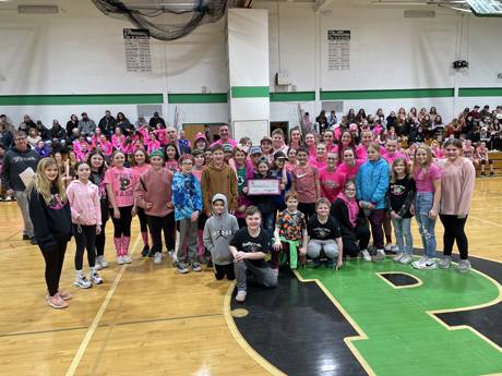
The­­­ Pembroke Jr./Sr. High School Girls’ Basketball Team will host its 12th annual Shooting For A Cure! event versus Oakfield-Alabama on Friday, Feb. 3, 2023 at 7:00 p.m. at the high school gym located at the corner of Routes 5 and 77 (8717 Alleghany Road) in Pembroke, New York. Admission is free. The team asks that attendees make a donation of any amount as they enter the facility, and all donations go to Roswell Park to support research efforts. In addition to donations at the door, all proceeds from raffle tickets, concession sales, and apparel sales go directly to Roswell Park. To date, Shooting For A Cure! has raised over $227,000 and has remains Roswell Park’s largest independent, community-based fundraising event.

The event began over a decade ago when the team approached then head coach Mike Wilson with an idea; they wanted to show their support for Toni Funke, wife of former coach and Pembroke teacher Ron Funke, in her battle against breast cancer by hosting a game in her honor which would bring the community together to raise awareness and funds for cancer research at Roswell Park. This season, the team hopes to add to the more than $227,000 the event has generated and donated since 2011 by continuing this benevolent Pembroke tradition.

Direct online donations are now being accepted in support of this year’s Shooting For A Cure! game at: http://give.roswellpark.org/goto/shooting-for-a-cure-12. In addition, the team is seeking donations from the community in the form of items to include in various raffles.  Food and beverages, provided by local vendors and restaurants, will be for sale during the event.  All of the proceeds will benefit cancer research at Roswell Park Comprehensive Cancer Center.  The 2022-2023 Shooting For A Cure! donors list already contains many businesses and organizations, including 26Shirts, ADPRO Sports, Billy The Kid Automotive, the Buffalo Bills, the Buffalo Sabres, Dry Creek Group, Five Guys, the Genesee County YMCA, Hershey's Ice Cream, Homeslice 33 Pizzeria, Jimbo’s Construction, Knockaround Sunglasses, Linda's Family Diner, M&T Bank, Mighty Taco, New Era, Original Pizza Logs, Oxford Pennant, Pesci's Pizza, Roswell Park Alliance Foundation, Salsarita’s, Salvatore’s, Sincerely Kayla, Terry Hills, The Pink Cow, and Tim Horton's.

There will be several other ways to support the cause this year. Currently, the team has partnered with 26Shirts from Buffalo, a local company that designs and sells apparel items to benefit those in need. To date, 26Shirts has raised $1,694,965 for local families, foundations, and organizations. All proceeds from this apparel sale will directly benefit cancer research at Roswell Park. If you’re interested in limited edition, 12th annual Shooting For A Cure! gear, please visit: https://26shirts.com/collections/shooting-for-a-cure.

In addition to the apparel sale, Can Jam Redemption Center in Corfu has partnered with Shooting For A Cure! From today, up through February 3rd, you can donate your bottle and can return slips in support of cancer research at Roswell Park. When you bring in your returns, just let them know that you’d like to donate your slip to our Shooting For A Cure! mission.

Businesses and organizations wishing to make a donation for this year’s event should contact Mike Wilson, the Shooting For A Cure! coordinator at Pembroke, by calling (716) 949-0523.

Elba Girls defeat Pembroke on the road 63-41 to win two straight

By Howard B. Owens

a76y4200.jpg

Behind another big game for Sydney Reilly, who scored 28 points, Elba picked up its second straight win in Girls Basketball, beating Pembroke 63-41.

Reilly had six rebounds and four assists.

Haile Scouten scored 13 points and six rebounds along with five blocked shots.

Lydia Ross scored nine and had six steals.

Kennedy Augello scored eight points, had five rebounds, and four assists.

Isabel Breeden scored 20 points for Pembroke. Ellie Peterson scored six points.

 “The girls are really starting to buy into our defensive end of the floor, which helps our offense," said Elba's coach, Charlie Pangrazio. "Early in the season, we got a little lackadaisical on that.  These last two games tonight and versus Kendall, we really brought that together, our defense has really taken off."

Elba is now 4-7, and after its fourth-straight loss, Pembroke is 4-9.

Also, in Girls Basketball on Tuesday:

  • Notre Dame beat Kendall, 59-15. Amelia McCulley scored 33 points, 11 rebounds and six steals. Avelin Tomidy scored 10 points, and Emma Sisson scored seven and had 11 steals. The Irish are now 10-1 on the season.
  • Alexander improved to 10-4 with a 36-26 win over Byron-Bergen. For the Trojans, Alyssa Kramer scored 17 points.
  • Oakfield-Alabama beat Batavia, 44-27. O-A is 11-1.  Batavia is 0-12.

In Boys Basketball:

  • Batavia beat Livonia, 64-48. Carter McFollins scored 20 points, Sawyer Siverling, 16, and Mikey McKenzie, 10. Siverling hit four three-point buckets. The Blue Devils are 9-2.
  • Le Roy beat Pavilion, 66-36.  Merritt Holly, Jr. scored 20 points.

To view or purchase photos, click here.

Photos by Steve Ognibene

a76y4193.jpg

a76y4287.jpg

a76y4218.jpg

a76y4249.jpg

a76y4266.jpg

a76y4239.jpg

a76y4306.jpg

Law and Order: Driver from Buffalo accused of fleeing from police

By Howard B. Owens

Name redacted upon request, 41, of Rosemary Avenue, Buffalo, is charged with obstructing governmental administration 2nd, speeding, and failure to obey a police officer. xxx is accused of failing to yield for a patrol vehicle's emergency lights on Jan. 10 at 8:53 p.m. on Bloomingdale Road, Tonawanda Indian Reservation, and then, when he did stop, running from the vehicle. Once apprehended, he was transported to the Genesee County Jail for processing and then released on an appearance ticket.

Antonio Elmer Sosa-Martinez, 33, of West Academy Street, Albion, is charged with DWI, moving from lane unsafely, drinking alcohol or using cannabis in a motor vehicle on a highway, and unlicensed driver. Sosa-Martinez reportedly crashed his work van on Warsaw Road in Le Roy at 8:14 p.m. on Jan. 7. After an investigation by Deputy Mason Schultz and Deputy Jacob Kipler, Sosa-Martinez was placed in custody. He was transported to the Genesee County Jail for processing and released.

John James Gronowski, 45, of Cayuga Circle Road, Cheektowaga, is charged with criminal trespass 3rd. Gronowski was allegedly at Batavia Downs after previously being told he was not allowed on the property. He was issued an appearance ticket and released.

David Charles Pfenninger, Jr., 44, of Fargo Road, Corfu, is charged with DWI, driving with a BAC of .18 or greater, and moving from lane unsafely. Pfenninger was reportedly found in his vehicle stuck in a ditch on Route 77, Pembroke, at 1:10 a.m. Jan. 13 by Deputy James Stack. He was released on an appearance ticket.

Jordan Roger Difilippo, 29, of Pratt Road, Pembroke, is charged with sex offender failing to report change of address/status. Difilippo was arrested on Jan. 12 for allegedly failing to disclose an email address to the Department of Probation. He was released on an appearance ticket.

Paul Crawford, 54, of Old Meadow Lane, Batavia, is charged with criminal possession of a controlled substance 7th and driving on a suspended registration.  Crawford was arrested on Jan. 12 after being located on Old Meadow Lane at 9:02 p.m. He was released on an appearance ticket.

Timothy Ting Hsia, 33, of Sinclair Street, Mckeesport, Pa., is charged with DWI, driving with a BAC of .08 or greater, aggravated unlicensed operation 3rd, unlicensed driver, and failure to use four-way flashers. Hsia was stopped at 6:05 a.m. on Jan. 14 on Genesee Street, Pembroke, by Deputy Ayrton Blankenship.

Matthew J. Zon, 41, of South Byron, is charged with criminal contempt 1st. Zon was arrested on Jan. 12 by State Police in connection with an incident reported at 3:09 p.m. on Oct. 15 in the Town of Byron. According to the statute cited, Zon reportedly has a prior criminal contempt conviction. He was released on his own recognizance. 

Kim M. Sobczak, 60, of Batavia, is charged with petit larceny. Sobczak was arrested by State Police in connection with an incident reported on Jan. 11 at 1 p.m. in the Town of Batavia. She was released on an appearance ticket. No other information released.

Developers say Pembroke location ideally suited for planned $142 million distribution center

By Howard B. Owens

img_4571.jpg

The developers of a planned 100-acre distribution center are confident they've selected a unique and ideal location for such a facility -- halfway between Rochester and Buffalo along a stretch of Thruway with few other appropriately zoned sites.

"I think we all know why this is a great site for this particular use," Buffalo-based attorney Sean Hopkins said to the Genesee County Planning Board on Thursday evening. "I was actually looking at the county IDA (Industrial Development Agency/GCEDC) website. I believe what it says is this is well within a one-day drive for a tractor-trailer (to an area) of 2.8 million people, and we were obviously right on the Thruway. It's an excellent location. If you look in the Rochester market, you look in the Buffalo market -- there is a shortage of this type of use."

The location is on Route 77, across from the Flying-J, close to the 48-A Thruway Interchange.

Horizon Acres Associations of Spring Valley is the lead applicant. Geis Companies, of Ohio, is the developer. Metzger Civil Engineering presented the application for a Site Plan Review to the board.

After the presentation, the board recommended approval with modifications of required permits from the state Department of Transportation, that the applicants receive comments on the application from the Pembroke Fire Department, and that the site complies with 9-1-1 address requirements.

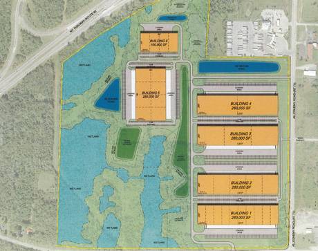
Geis currently has no tenants committed to any of the six buildings planned for the property but at build-out, within an estimated five years, the various warehouses should employ at least 400 people.

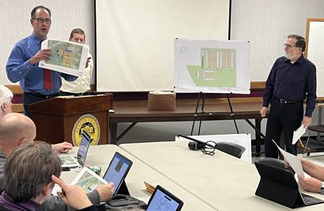
"This would be flex industrial buildings designed to attract potentially different-sized tenants," said Michael Metzger (on right in top photo). "We've had conversations with potential tenants, but nothing that is ready to be committed at this point." 

The developers hope to begin construction this year, at least getting the site graded and ready for construction, if not "going vertical" on at least two of the six buildings.  The six buildings combined will offer 1.5 million square feet of warehouse space and cost more than $142 million to construct.
"I think that documentation demonstrates that, in terms of the build-out of the project, we're hoping that this would occur in approximately five years," said Hopkins (speaking in top photo). "Obviously, it is subject to market demand."

Later he added, "But we do want to have a shovel-ready site. That's our goal, and we think we can accomplish it."

He expressed confidence in Geis Companies. He said the company has a lot of experience with this type of project in Ohio and they have "an excellent track record."

"I think it's really a welcome opportunity to bring them to Western New York, to bring their expertise," Hopkins said. "We think this project is a win-win for all parties involved."

When discussing the renderings of the potential design of the buildings, he said he anticipated the construction of quality, attractive buildings on the site.

"They're gonna have to obviously serve the function that they'll be designed for, but we also want them to look attractive from the outside," Hopkins said.

The site uses 100 acres of a 200-acre parcel, with the remaining space reserved for federally protected wetlands.

"We're not proposing any impact whatsoever to DEC wetlands, and I believe our impact on to federal wetlands is approximately .2 acres, so it's a very small impact," Hopkins said. "We readily expect that we will get that permit from the Army Corps of Engineers."

The wetlands-related documents, prepared as required by the application process and provided to the board, run to dozens of pages.

Horizon Acres Associates has requested from the Genesee Center for Economic Development a sales tax exemption of about $6.2 million, a property tax abatement estimated of approximately $11.9 million, and a mortgage tax exemption estimated at $1.1 million.

The project is projected to generate $7.9 million in PILOT revenues for municipalities during the 10-year PILOT agreement. According to the GCEDC, those payments total about  39.5 times more than anticipated municipal revenue from the property's undeveloped state.

Top photo by Howard Owens. Illustrations below, submitted.

pembrokestorage_02.jpg

storagesitepembroke_01.jpg

GCEDC board asked to consider support for commercial/industrial project off Thruway in Pembroke

By Press Release

Press release:

The Genesee County Economic Development Center will consider a project with the fifth largest proposed capital investment in Genesee County history at its Jan. 12, 2023, meeting. 

Horizon Acres Associates, LLC., based in Rockland County, partnering with Geis Companies, based in Streetsboro, Ohio, is proposing to invest $142 million to build six flex commercial/industrial facilities totaling 1.5 million square feet in the Town of Pembroke. The project would be located on 115 acres immediately off the 48-A interchange on the New York State Thruway and is positioned to support project companies located at the Science & Technology Advanced Manufacturing Park (STAMP) as well as other nearby locations.

“This historic economic development investment in Genesee County, similar to the major investments made by Edwards Vacuum and Plug Power in just the last couple of years, demonstrates our community’s high capacity for private sector growth,” said GCEDC President and CEO Steve Hyde.  “It’s no coincidence that this type of investment is being considered here as a result of continuing growth at STAMP and our central location between Buffalo and Rochester.”

The company plans to start construction in the 4th quarter of 2023 with the goal of having one to two buildings totaling 560,000 square feet operational in late 2024. The facilities will be suitable for a large single tenant, multiple smaller tenants, or suppliers for advanced manufacturing projects. The development is estimated to create up to 400 new jobs at full build-out.

Horizon Acres Associates, LLC is requesting a sales tax exemption estimated at $6.2 million, a property tax abatement estimated at $11.9 million and a mortgage tax exemption estimated at $1.1 million. The project is projected to generate $7.9 million in PILOT revenues to municipalities during the proposed 10-year project agreement, which is estimated at 39.5 times the municipal revenue that would be generated under the property’s current use.

The GCEDC’s economic analysis of the project estimates a $227 million impact, including $218 million in payroll and $9.1 million in revenues to the Town of Pembroke, the Pembroke Central School District and Genesee County.  For every $1 of public benefit, the project is projected to generate $16 in the local economy.

The project ranks only behind Plug Power (2021), Edwards Vacuum (2023), HP Hood (2017), and Project Dairy (2012) for the largest capital investments by commercial/industrial projects in Genesee County history.

If the project application is accepted, a public hearing will be scheduled on the proposed project agreements in the town of Pembroke.

Notre Dame 62-19 vs. Pembroke in 33rd Annual Rotary Tournament

By Howard B. Owens

a76y3248.jpg

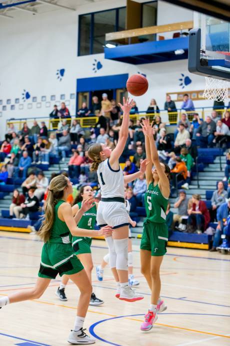
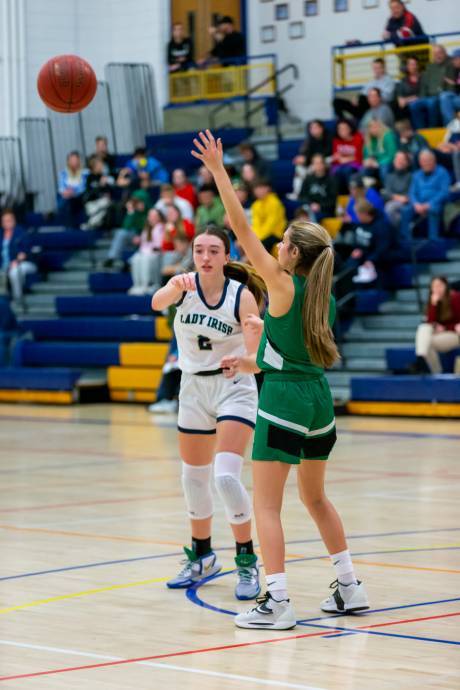
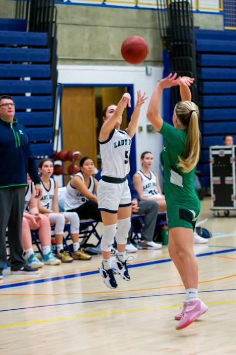
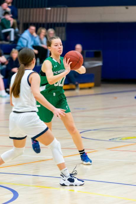
Amelia McCulley scored 31 points to lead Notre Dame to a 62-19 win over Pembroke in a first-round game of the 33rd Annual Batavia Rotary Club Basketball Tournament at GCC on Tuesday.

Emma Sisson scored 14 points for the Irish, and Avelin Tomidy scored eight. Sisson also had ten rebounds and five steals. Tomidy had 11 rebounds and six assists. 

Olvia Breeden scored eight points for the Dragons.

Notre Dame will play in the championship game at 7:45 p.m. on Thursday at GCC.

To view or purchase photos, click here.

Photo by Steve Ognibene

a76y3235.jpg

a76y3241.jpg

a76y3260.jpg

a76y3244.jpg

a76y3253.jpg

County's smallest department kept travelers fed, warm, and safe during Winter Storm Elliott

By Howard B. Owens

indianfallsdept2022.jpg

Genesee County's smallest volunteer fire department shouldered a big burden during the pre-Christmas blizzard that blew through Genesee County a week ago, providing rest, warmth and food to about 60 people stranded in the area by the storm.

The Indian Falls Volunteer Fire Department has 12 members, but only six could muster the storm response because the rest were trapped in their homes by heavy snow.

For Chief Ed Mileham, the department's response began Friday morning, Dec. 23, when the dispatchers informed him that deputies had rescued two people and wanted to bring them to the Indian Falls Fire Hall to provide them shelter.

Sure, Mileham said, he would be to the hall in 20 minutes.

But getting there wasn't that easy. The storm was already blowing through the area and the passage from his home on Indian Falls Road to the fire hall on Route 77 was already covered in snow drifts.  It took close to half an hour for him to make the trip.

At 2 p.m., a couple more people arrived, then a few more, then a few more. 

"After a couple more people arrived, I called Lu (Lu Anne Mileham) and said, 'hey, can you put out a message to anyone available?'" Mileham said.

Dave Olsen said he couldn't get out of his yard, but Mileham spoke with another resident who had a snowplow, and he went and cleared a path for Olsen and his son Max.

With Max Olsen on board, the department could start participating in some rescues. 

"I started to get actual phone calls here at the Fire Hall," Mileham said. "'Hey, we're stuck here. We're stuck there.' Max went out, picked them up and brought them in. By five o'clock, I think we had 12 people here. By six o'clock, I called Lu and I said, 'Hey, can you do some sloppy joes up?' I said. 'I got 12 people down here,' but the time she got done making sloppy joes and I sent Max down to pick them up, and it was seven o'clock, and we had 20 people."

By midnight, the count was up to 40 people, and by Saturday morning, it was 60.

And it was quite a mix of people -- a group of young Asians, a couple from Munich, a couple from Poland, folks from California going to Niagara Falls, an ER doctor returning from work in Rochester to his home in Williamsville.  There were people from New Jersey, Pennsylvania, Ohio, Canada, and Maryland.

"It was a large number of people that were either coming from or going to Canada," Max said. "I think that might have been like a GPS thing. It wasn't the whole crowd by any means, but there was a definite consistency that they were all using their GPS, and it kept closing roads and redirecting them, so like, it seemed they kind of almost got funneled into this area."

The Indian Falls response to this influx of people was handled by Ed Mileham, Lu Anne Mileham, Dave Olsen, Max Olsen, Matt Delre, and Randy Filter.

The leadership came from Mileham, and Dave Olsen gives him all the credit for keeping things in order.

"We got a lot of comments that (the situation) was handled, probably, as best as it possibly could be," Olsen said. "With some of the people, they complimented the chief quite a bit for his professionalism and the way he kept everything in order and had a plan and kept things written down. You know, he had an organization. He thought ahead. He thought about getting the food and things that, Most of us were just thinking about, 'Oh, what's the next fresh hell is that this storm is going to bring?'"

No serious issues
In Oakfield, volunteers were called upon to deal with a couple of hypothermia cases that were very serious. Indian Falls was spared any dire medical cases but there was a woman who arrived at the hall from Oakfield. She has epilepsy and had left home without her medication. It had been more than eight years since she'd had a seizure.  After several hours, she informed Mileham that she was getting a headache, so he arranged for one of the convoys that were sweeping the area to pick up stranded motorists to transport her back to Oakfield.

Then there was the guy who showed up in a kevlar vest packing a sidearm.

It turns out he is private security for a company in Rochester.

"He walked in, and there were like five deputies, and one was Joe Graff (the chief deputy of investigations)," Mileham said. "He comes walking in. He's got his bulletproof vest on. He's got his pistol on. It's like two o'clock in the morning. 'Whoa, wait, who are you? Let's see your permit.' Had no ID. No wallet. Nothing."

He had left his wallet in his car.

The deputies took his vest and gun and secured it, and told him he could pick it up Monday at the Sheriff's Office.

"The guy said, 'Hey, I've got no problem with it. I'll see you Monday or Tuesday.'"

That level of cooperation was apparent throughout the two days folks were stranded at the Indian Falls Fire Hall, Mileham said.  People just got along and cooperated.  

The first night's sleeping arrangements weren't ideal. Since the number of travelers coming through the area was unexpected, Indian Falls wasn't quite prepared to host 60 people.  There were no cots or blankets on hand.

Fortunately, the hall's floor is heated.

"Everybody said that, once they got laid on the floor, they were pretty warm and comfortable," Mileham said.

The Red Cross delivered cots and blankets on Saturday so the second night at the shelter was a bit more comfortable.

Feeding sixty unexpected guests
The hard part was food.

Lu Anne Mileham hadn't exactly prepared to feed 60 travelers, but with the storm coming, she had stocked up in case she needed to feed department members.

"On Wednesday or Thursday, I happened to be at BJs and I thought, you know what, I'll pick up a couple of loaves of bread, some chips, some lunch meat and stuff," Lu Anne said. "I'm thinking if our guys get caught here, at least we'll have that, and we've got water and soda in the fridge, so but at least they'll have something to eat a little bit."

She also had some supplies at home, and with some kids in the hall, a couple of boxes of mac and cheese came in handy.

On Saturday morning, Mileham contacted Crosby's in Corfu and ordered six sheets of breakfast pizza.

Later that day, he ordered pizza from a new pizza shop in Corfu, and by then, he was aware that some of the Indians in the group were vegans, so he had to get some meatless options.  One guy wanted a white sauce pizza, too, so Mileham ordered a pizza with white sauce.

The one difficulty Mileham couldn't solve for one of his department's guests was getting the Buffalo Bills game on the TV.  Spectrum was out of service during the storm.

"He goes, 'really?' I go, 'Hey, I'm with you. If you can get it on your phone, great."

When The Batavian told Tim Yaeger, Genesee County's emergency management coordinator, that we were doing a story about the storm response of the Indian Falls Volunteer Fire Department, he texted back immediately, "Ed and Lu Anne Mileham specifically are truly amazing people.  From working the COVID vaccination site at GCC to covering calls in the West Battalion on a daily basis, we would be lost and in trouble without them."

It turns out, so would have been a bunch of people from throughout North America and Europe on Dec. 23 and 24 when Winter Storm Elliott hit Western New York.

See previously: 'Fast Eddy' hangs up badge after 32 years of police work

Top photo: By Howard Owens, of Max Oslen, Dave Olsen, Lu Anne Mileham, and Ed Mileham.

Photos below, courtesy of Ed Mileham.

img_0422indianfalls.jpg

img_0417indianfalls.jpg

img_0423indianfalls.jpg

Law and Order: Two people accused of attempting to smuggle contraband into jail

By Howard B. Owens

Jose A. Rivera, 36, of Batavia, is charged with criminal contempt 1st, attempted promoting prison contraband 1st, and Ida M. Vanorden, 36, of Swan Street, Batavia, is charged with conspiracy 5th. Rivera and Vandorden are accused of conspiracy along with an unknown male, to introduce contraband into the Genesee County Jail. The contraband was intercepted by corrections officers on Dec. 26. Rivera is accused of violating a stay-away order of protection. Both Rivera and Vanorden were issued appearance tickets.  The investigation is ongoing, and deputies are attempting to identify the third suspect. Any person who may have additional information are requested to contact Deputy Nicholas Charmoun at (585) 345-3000, ext. 3258

Ledeja K. Wright, 32, of Maple Street, Batavia, is charged with torture/injure animal/fail to provide sustenance. Wright is accused of leaving a dog in an apartment after moving out and failing to provide sustenance to the animal. The incident was reported Nov. 30. Wright was arrested Dec. 15. She was arraigned in City Court and released. The dog is at the Animal Shelter. 

Vicki Lynne Manns, 52, of Brookville Road, Alexander, is charged with menacing 2nd, criminal possession of a weapon 4th, assault 3rd, and harassment 2nd.  Manns is accused of throwing a tray at a person, causing an injury. She is also accused of pointing a firearm at the same person. She was issued an appearance ticket.Robert L. Drennen is charged with criminal mischief 3rd. Drennen is accused of causing damage to a residence in the City of Batavia on Dec. 23. He was released on an appearance ticket.

Julie R. Richardson, 31, of Batavia,  is charged with grand larceny 4th, petit larceny, conspiracy 5th and tampering with evidence. Richardson is accused of stealing from a vehicle on South Main Street, Batavia, on Nov. 16. Richardson was arrested after an investigation by Officer Nicole McGinnis.

Andrew A. Crimes, 50, of West Main Street Road,  Batavia, is charged with criminal contempt 1st and aggravated family offense. Crimes is accused of violating an order of protection by contacting the protected party on Dec. 9. He was arraigned in City Court and released.

Deanna L. Yox, 37, of Clifford Street, Buffalo, is charged with petit larceny. Yox is accused of stealing from a business in Batavia in February 2020. She was arrested Dec. 21 following an investigation by officers Felicia Martinez and Wesley Rissinger. Yox was released on an appearance ticket.

Malinda J. Falk, 41, of East Main Street, Batavia, is charged with harassment 2nd and criminal obstruction of breathing/blood circulation. Falk is accused of attacking another individual on Dec. 17 at a location on East Main Street, Batavia. Falk was arraigned in City Court and released on her own recognizance. 

David L. Weaver, 32, of Atlanta, Illinois, is charged with harassment 2nd. Weaver is accused of striking another person during a disturbance on Dec. 10. He was released on an appearance ticket.

Dustin T. Forkell, 31, of Holley, is charged with petit larceny and false impersonation. Forkell is accused of stealing property from a local business on Dec. 11 and fleeing. He was located at another business in the Town of Batavia, at which time he allegedly provided a false name to officers. He was arrested, processed at Batavia PD, and issued an appearance ticket. The incident was investigated by officers Wesly Rissinger and Megan Crossett

An 18-year-old of Washington Avenue, Batavia, is charged with assault 3rd and criminal mischief. An 18-year-old resident is accused of attacking another person on Dec. 14 with an iPad, causing an injury. The youth was arraigned in City Court and released. 

Brittanee J. Hooten, of State Street, in Batavia, was arrested on two bench warrants after having failed to appear on an appearance ticket on prior arrests. Hooten was arraigned on Dec. 14 in City Court and released. 

Karrie A. Morrow, 40, of Summit Street, Batavia, was arrested on several outstanding Bench Warrants. Morrow was arrested on Dec. 14 after she was located during an unrelated incident. The warrants stem from several petit larceny cases at local businesses. Morrow was arraigned in City Court and released under supervision.

Jeffrey M. VanEpps, 45, of Albion, is charged with criminal mischief and attempted assault 3rd. VanEpps was allegedly involved in a disturbance at a business on West Main Street on Dec. 14. He was arraigned in City Court and released.

Jacob A. Richards, 34, of Rochester, is charged with possession of a forged instrument 1st and grand larceny 4th. Richards allegedly passed a forged check at a local bank. He was arraigned in City Court and ordered held on bail.

Terrance L. Falk, 24, of North Street, Batavia, is charged with criminal mischief 4th and assault 3rd. Falk was allegedly involved in a disturbance on an unspecified date in the City of Batavia. After initially fleeing the scene, according to police, he was located and taken into custody without incident. He was arraigned in City Court and released on his own recognizance. 

Byron K. Bell, 53, of Rochester, is charged with criminal possession of stolen property 3rd, aggravated unlicensed operation 3rd and speeding. Bell was stopped on Dec. 11 in the City of Batavia by Officer Josh Girvin and Officer Bryan Moscicki. Bell was allegedly driving a stolen vehicle while on a suspended license. He was arraigned in City Court and jailed.

Harry R. Silliman, 58, of Batavia, is charged with trespass. Silliman was allegedly on property on Maple Street without permission. He was arrested and issued an appearance ticket.

Zakara R. Jackson, age 19, of Trumbull Parkway, Batavia, is charged with bail jumping 2nd and failure to appear. Jackson was arrested on a warrant on Dec. 8 He was arraigned in City Court and released under supervision.

Daquan J. Butler, 26, of Ross Street, Batavia, is charged with petit larceny.  Butler is accused of stealing an iPhone 13 from another person on Ross Street on Dec. 3. He was arraigned in City Court and released.

Raymond Lunday Kelley, of Oak Street, Batavia, is charged with a false written statement. Kelley allegedly provided law enforcement with a false written statement related to an incident reported at Batavia Downs at 11:59 p.m., Dec. 16. He was released on an appearance ticket.

Douglas Wayne Logsdon, 74, of Big Tree Road, Pavilion, is charged with endangering the welfare of a child and harassment 2nd. Logsdon allegedly threw items at a person while a child was present during an incident reported at 5:41 p.m., Dec. 16 at a location on Big Tree Road, Pavilion. Logsdon was arraigned in Town of Pavilion Court and released.

Rachel B. Solomon, 30, of North Lake Road, Pembroke, is charged with criminal contempt 2nd and harassment 2nd. Solomon is accused of violating an order of protection by harassing an individual at 1 p.m. on Dec. 22. She was arraigned in Town of Pembroke Court and ordered held without bail. Solomon is also charged with aggravated criminal contempt, assault 3rd, and endangering the welfare of a child. The charges stem from an incident reported at 2:45 a.m., Jan. 2, at a location on Meadville Road, Tonawanda Indian Reservation. Solomon was jailed pending arraignment.

Joseph Michael Morelli, 54, of Orchard Street, Oakfield, is charged with DWI and driving with a BAC of .08 or greater. Morelli was allegedly found to be intoxicated at 2:02 p.m., Dec. 14, while at the Genesee County Probation Department on Main Street, Batavia, and arrested by Deputy Jonathan Dimming. Morelli was released to a third party on an appearance ticket. 

Adam Joseph Pape, 35, of Morrow Road, Pavilion, is charged with felony DWI, felony driving with a BAC of .08 or greater, aggravated unlicensed operation, driving without an interlock device, and drinking alcohol in a motor vehicle on a public highway. Pape was stopped at 8:11 p.m., Dec. 30, by Deputy Zachary Hoy and released on an appearance ticket.

Nia Hanevin Spring, 23, of Griffin Road, Tonawanda Indian Reservation, is charged with criminal contempt 2nd and grand larceny 4th. Spring was arrested on Dec. 30, processed at the Genesee County Jail, arraigned in Town of Alabama Court, and released under supervision. 

Ronald Charles Inzinna, 54, of Le Roy, is charged with criminal mischief and harassment 2nd. Inzinna is accused of subjecting another person to unwanted physical contact and preventing that person from contacting 9-1-1 during an incident reported at 6 p.m., Dec. 30, at a location on East Main Road, Le Roy.  Inzinna was arraigned in Town of Stafford Court and released on his own recognizance. 

Arthur James Felski, 45, of Tonawanda Indian Reservation, is charged with harassment 2nd. Felski was charged following an investigation into an incident reported at 3:25 p.m., Jan. 1, in Basom. He was arraigned in the Genesee County Centralized Arraignment Court and released on his own recognizance.

Chimney fire reported on Indian Falls Road

By Howard B. Owens

A chimney fire is reported at 1279 Indian Falls Road, Pembroke.

No flames show but there is smoke in the residence.

Pembroke Fire, Indian Falls Fire, and Corfu Fire dispatched.

UPDATE 3:12 p.m.: Crittenden asked to standby in Corfu's hall to standby for anything in Corfu, Pembroke, or Indian Falls.

UPDATE 3:16 p.m.: National Grid requested to the scene to cut power.

UPDATE 3:19 p.m. Tankers from Darien and Alabama requested to the scene.

UPDATE 3:26 p.m.: "It looks like we're getting a knock on the fire."  Crews are pulling exterior walls to check for extension.

UPDATE 3:38 p.m.: Red Cross shelter requested for two adults.

UPDATE 3:49 p.m.: Fire is out. Starting overhaul.

Weary traveler thanks staff at travel center for calm, warmth, and rest during the storm

By Howard B. Owens

20221224_081755.jpg

Amber M. King of Rochester was quite impressed by how well the management of Dennys at the Flying J in Pembroke treated stranded motorist during the blizzard on Friday and Saturday.

"I was stranded there for two days after trying to get back to Rochester," she told The Batavian in an email. "There were more than 150 people sitting inside at any given time from New Hampshire, Nova Scotia, Toronto,  Queens, Pennsylvania and many other locations. They provided us with a place to eat, stay warm, to close our eyes for a bit or use the bathroom.

"The staff at both places busted their butts to help in any way they could, but mostly to keep us safe."

She said many in the group tried to repay the kindness by helping with dishes, clearing tables, taking out trash and keeping the coffee flowing.

"I'm grateful to them all; many of us are," she said.

She sent us the info so the staff could receive a public "thank you." 

"A few of their names are Juanita, Jenni, Johnny from Denny's and Todd at the Flying J, Nikki and all the other crew," she said. "They kept the pumps cleared so we could always get gas to keep cars running so we could sleep. The sidewalks cleared so we could get in and out. They were even pet-friendly so the doggies wouldn't freeze. There were maybe 10 employees running the whole place, and they did a great job."

Submitted photos.

20221224_081738.jpg

20221223_140057.jpg

20221223_152618.jpg

20221223_145703.jpg

Law and Order: Convicted child sex predator accused of possessing control substance in jail

By Howard B. Owens

Melvin Andre Huntley, 41, of Wilkenson Road, Batavia, is charged with promoting prison contraband 1st, promoting prison contraband 2nd, and criminal possession of a controlled substance 7th. Huntley was accused of possessing and bringing a controlled substance into the Genesee County Jail at 7:35 p.m. Nov. 16. He was arraigned in City Court and released back into the custody of the jail. Previously: Child sex predator convicted by jury, faces possible life in prison

Brett M. Holt, 32, of West Center Street, Medina, and Kelly M. Holt, 46, of West Center Street, Medina, are each charged with petit larceny. On Dec. 12 at 5:20 p.m., dispatchers received a report of a theft in progress at Sally Beauty Supply on Veterans Memorial Drive. Patrols eventually located two individuals matching the description of the suspects inside of Kohl's Department Store. The suspects were returned to Sally's, where a witness identified them as the individuals suspected of stealing $400 in products. Both suspects were processed at the Genesee County Jail and released on appearance tickets.

Dustin Travis Forkell, 31, of Hulberton Road, Holley, is charged with falsifying business records, 1st, criminal possession of a controlled substance 7th, and criminal impersonation 2nd. Forkell is accused of possessing narcotics while being arrested on separate offenses in the City of Batavia on Dec. 11 at 6:30 p.m. He is accused of attempting to conceal his true identity while being processed at the Genesee County Jail. Forkell was released on an appearance ticket.

Alyssa Michele Harnish, 34, of Main Street Road, Batavia, is charged with criminal possession of a controlled substance 7th. Harnish was arrested on Dec. 14 as the result of an incident reported on Nov. 16 at 9 p.m. at a location on West Main Street Road, Batavia. She was issued an appearance ticket.

Stephanie Lynn Salcido, 33, of Ellicott Street Road, Batavia, is charged with felony DWI, moving from lane unsafely, uninspected motor vehicle, unregistered motor vehicle, and aggravated unlicensed operation. Salcido was stopped on Dec. 15 at 2:38 a.m. on Lake Street Road, Le Roy, by Sgt. Matthew Clor. She is also accused of driving without a required interlock device. Salcido was issued an appearance ticket.

Kevin Quinn Widzinski, 29, of Hubbard Drive, Chili, is charged with DWI, moving from lane unsafely, and speed not reasonable and prudent. Widzinski was arrested by Deputy Zachary Hoy following the report of a motor vehicle accident on Dec. 15 at 7:24 p.m. on Warsaw Road in Le Roy. Widzinski was released on an appearance ticket.

Micahel Gilbert Hoskins, 50, of Rochester, is charged with DWI, driving with a BAC of .08 or greater, driving an uninspected vehicle, and driving with an open alcohol container. Hoskins was stopped on Dec. 4 at 12:10 a.m. on Seven Springs Road, Stafford, by Deputy Ryan Mullen. He was issued an appearance ticket.

Tatiana Makarevic, 55, of Maple Road, Alabama, is charged with DWI, driving with a BAC of .18 or greater, and moving from lane unsafely. Makarevic was stopped on Dec. 15 at 8:48 p.m. on Alleghany Road, Pembroke, by Deputy Jacob Kipler. Makarevic was processed at the Genesee County Jail and released on an appearance ticket.     

Karrie Ann Morrow, 40, of Alexander Road, Batavia, is charged with petit larceny. Morrow on Dec. 14 in connection with a theft reported at 2 a.m., Oct. 11 on Genesee Street, Pembroke. She was issued an appearance ticket.

Arthur James Brown, 48, of State Street, Batavia, is charged with sex offender failure to register a change of address. Brown is to report a change of address within the required 10 days for a registered sex offender. He was arraigned in City Court and ordered held without bail.

Bryan D. McEwan, 36, of Darien, is charged with criminal mischief 4th and endangering the welfare of a child. McEwan was arrested by State Police in connection with an incident reported at 10:10 p.m. on Dec. 18 at a location in Darien. McEwan was released to a third party. No further information released.

Lady Dragons fall to Attica 56-39

By Howard B. Owens

Pembroke fell to 2-3 on the season with the team's third-straight loss in Girls Basketball on Monday, 56-39 to Attica.

Scoring for Pembroke: 

  • Karli Houseknecht: 16 points, 6 rebounds, 3 assists
  • Olivia Breeden: 16 points
  • Izzy Breeden: 7 points, 4 rebounds, 3 assists.

Veterans honored in day of remembrance and reflection at WNY National Cemetery

By Howard B. Owens

wreathspembroke2022.jpg

The men and women interred at the WNY National Cemetery were honored on Saturday as part of a national effort, Wreaths Across America.

Family members and community members placed a wreath on each headstone in the cemetery.

Wreaths were sold by members of the Veterans Outreach Club at Pembroke Junior-Senior High School, led by teacher Matthew Moscato.

Genesee County's veterans' services officer, Bill Joyce, was the keynote speaker during an opening service that included placing a wreath for each branch of the military by either a veteran or an active member of the Armed Forces, a 21-gun salute and the playing of taps.

Joyce recalled a speaker he had heard previously at another ceremony honoring veterans.  That speaker noted that when we are at a headstone of a dead service member, we tend to look at the birth date and the death date but rarely stop to consider the space between those dates -- the dash.  It is the dash that matters most.

"How did they live their lives? How did they live, in other words, the dash? We know how these individuals interred here at the Western New York National Cemetery lived part of their lives, serving in every military service. They served this great nation honorably," Joyce said. 

Joyce called the service a day of "remembrance and reflection," noting that he was honored as a retired Army veteran to be the day's featured speaker.

Families of service members buried in the cemetery were given several minutes to place wreaths at their loved one's headstones. Then community members were given numbered wreaths to place at the remaining headstones.

They were instructed to salute after placing the wreath if they were an active service member or a veteran, or place their hand over their heart if not, and say the service member's name.

"When we read the names on the headstones today, it symbolizes acknowledging the sacrifices that service members made on behalf of the country," Joyce said.

Photos by Howard Owens.

wreathspembroke2022-2.jpg

Bill Joyce

wreathspembroke2022-3.jpg

Matthew Moscato

wreathspembroke2022-4.jpg

wreathspembroke2022-6.jpg

wreathspembroke2022-7.jpg

wreathspembroke2022-8.jpg

wreathspembroke2022-9.jpg

wreathspembroke2022-10.jpg

wreathspembroke2022-11.jpg

wreathspembroke2022-12.jpg

wreathspembroke2022-13.jpg

318902718_2560918200717844_8799201428792023894_n.jpg

Members of Notre Dame's Varsity Basketball team volunteered to place wreaths. Photo submitted by Susan MacPherson Woodruff

Dragons hand Hornets first loss of the season

By Howard B. Owens

oapembroke2022-34.jpg

Pembroke and Oakfield-Alabama had a shootout on Friday and the Dragons pulled out a big win over the Hornets, the defending Division C2 champions, 65-59.

It was the first loss of the season for the Hornets after opening the year 3-0.

Scoring by quarter:

O-A: 17 15 14 13
Pembroke:  14 14 24 13

Scoring for Pembroke:

  • Cayden Pfalzer, 23 points
  • Tyson Totten, 15 points
  • Chase Guzdek, 15 points


Scoring for O-A:

  • Kyle Porter, 23 points
  • Noah Currier, 8 points
  • Aiden Warner & Brayden Smith, 7 points

​Pembroke is now 2-1.

Photos by Kristin Smith. For more photos, click here.

oapembroke2022-26.jpg

oapembroke2022-27.jpg

oapembroke2022-20.jpg

oapembroke2022-11.jpg

Diesel fuel spill reported it TA Travel Center in Pembroke

By Howard B. Owens

An approximately 25-gallon diesel fuel spill is reported at the TA Travel Center on Allegheny Road in Pembroke.

The initial spill reportedly happened at 9 p.m. Pembroke and Indian Falls fire departments were just dispatched. City Fire's FAST team is also dispatched.

Fancher project in Pembroke gives students introduction to building trades

By Howard B. Owens

pembrokeproject2022.jpg

Taylor McCabe, of McCabe Enterprises, an electrical contractor, was one of four contractors on a job site at Brickhouse Corners in Pembroke to introduce students to the building trades.

Owner and developer Randy Fancher said he and his brother thought their mixed-use development -- retail and apartments -- was a good job site to show young people what a construction site is like and hear about the kind of work available in different facets of construction.

Besides electrical, students -- and their parents and grandparents -- learned about drywall, HVAC, and plumbing.

"We're letting kids know there are opportunities in the building trades," Fancher said.

For more on the development, click here.

Photos by Howard Owens.

pembrokeproject2022-2.jpg

Brian Stevens of DWC Mechanical talks about pipes with a group of students.

pembrokeproject2022-3.jpg

Cindy Merritt tries her hand at putting a screw into drywall.

pembrokeproject2022-4.jpg

Authentically Local