
weather

Photo: A hopeful sign of spring

By Howard B. Owens

Children outside playing under bright blue skies, surely this is a sign of spring?

Ah, alas, a cruel April 1 joke, as the weatherman says there's still some freezing temps in our near future.

But today is nice enough for children from the YMCA's preschool program to practice a little chalk art. Above, Teegan, 5, draws a house.

Travel advisory issued for Genesee County (Lifted)

By Howard B. Owens

The Sheriff's Office has issued a travel advisory for Genesee County:

A travel advisory has been issued for all of Genesee County as of 0540 hrs. There are numerous accidents due to icy road conditions.

UPDATE 6:40 a.m.: Two-hour delays for schools: Batavia City, Attica, Alexander, Elba, Notre Dame.

UPDATE 8:15 a.m.: The travel advisory has been lifted. Also, the Richmond Memorial Library has delayed opening until 11 a.m.

Icy road conditions predicted for this morning

By Howard B. Owens

A winter weather advisory is in effect until 11 a.m.

The National Weather Service in Buffalo warns of a patchy, freezing drizzle with accumulations of a trace of ice.

Temperatures will be in the low 30s throughout the morning.

Expect slick spots on untreated roads.

Snow removal during harsh winter remains a challenge for city

By Howard B. Owens

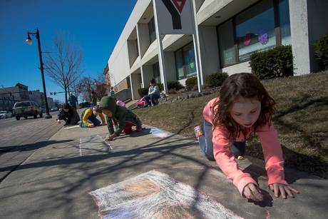
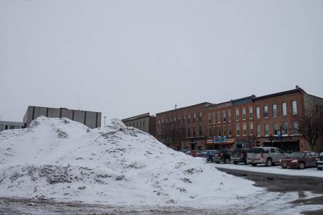
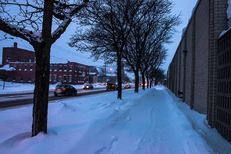
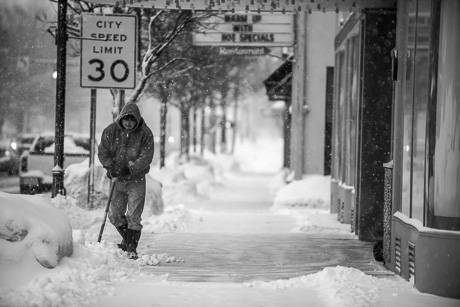
At least one Downtown business owner doesn't think the city is doing enough to address snow removal and he's not convinced the city cares.

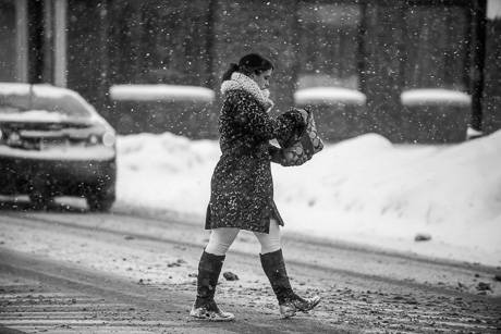
Snow piled up on sidewalks and in parking lots costs bars, restaurants and retail shops money, said Derek Geib, owner of Bourbon & Burger Co. on Jackson Street, and the city loses sales tax revenue.

He thinks the city could be more aggressive about finding a solution.

Geib, along with other business owners, met with city officials earlier this winter and were told city work crews act as quickly as possible to remove snow, but there's only so many workers and so many hours they can work.

That isn't a good enough answer, Geib said.

"Accepting this as just the way it is is not an option," Geib said. "It is directly affecting just about every business Downtown. It needs to be addressed and something needs to be proposed as a solution. Reallocate BID funds, raise taxes, cut something else. Jason (City Manager Jason Molino) needs to sit down and address this. That's my only request. We can't just 'deal with it.' This is 2015. I'm sure someone has some solution somewhere."

Molino said, actually, snow pile-up this winter is something every municipality in the Northeast is dealing with this winter.

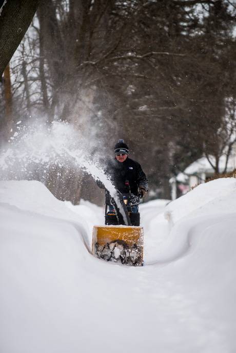
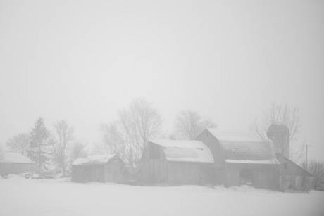
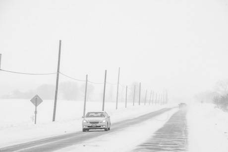
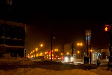
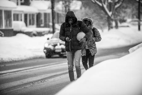
Unrelenting cold, near record snowfall, and storms spread out at a pace that keeps workers tied up and makes it impossible to keep up with the mounds of frozen water.

"This February has absolutely been challenging to say the least when it comes to snow removal," Molino said. "From Buffalo to Boston, everyone is having the same conversation. It's not just us with this problem. It's the circumstances of the type of weather we're having, and now we're about to get hammered with another snow and ice event, which means our guys will be out far into the night and perhaps into the morning, which means they're not going to be removing snow tomorrow."

The "not enough workers" answers isn't a good one, Geib said.

"We shouldn't as a city accept that things are just the way they are," Geib said. "If there aren't enough employees to actually do the task at hand then people should be made aware of that and budgets should be adjusted. If garbage wasn't getting picked up, it would be an issue. Snow removal is no different. There is a solution, but the City Manager has to recognize there is a problem first."

Molino said he does recognize there's an issue, but without unlimited resources, there's only so much the city can do.

"I understand and sympathize with the frustration business owners feel over snow accumulation," Molino said. "When there's manpower available, we remove the snow from the parking lots and then from the sidewalks. We do the best we can with the manpower we have."

This has been an incredibly difficult and challenging winter for the city's DPW and Water Department workers, as it has been for municipal employees throughout New York, he said.

The constant use of snow-removal equipment also puts a strain on city resources because inevitably, equipment breaks down and needs to be repaired, Molino said.

Under the circumstances, he said, he thinks they've done an incredible job.

Batavia has also been plagued by a series of water line breaks. Typically, those are handled by the Water Department, but the night of the River Street break, Water Department employees were already out helping with plowing and salting, and with the break, the city's already overextended DPW workers had to help with that nasty and complicated break.

"They went from plowing roads to jumping into a water-filled hole on the coldest night of the year," Molino said. "We've had a series of water line breaks in very poor weather and some of these have been large, deep digs that make the job very challenging. Throw on top of that, sub-zero weather, that makes the job very challenging."

Winter weather advisory issued for Tuesday

By Howard B. Owens

It's been a bit nasty out today, but at least it's not sub-zero.

There's more winter weather on the way, too.

The National Weather Service in Buffalo has issued a winter weather advisory for noon Tuesday to 1 a.m. Wednesday.

The forecast is for a mix of snow and freezing rain and sleet. 

Snow accumulations of one to two inches and ice of a tenth of an inch.  

Visibilty will be less than a mile at times.

Caution when traveling is advised.

Top Photo: Ray Tortorice walks his Cub Cadet on Trumbull Parkway to clear snow from his walk and his neighbor's walk this afternoon. Bottom photo: a tree in Centennial Park.

Too cold for too long

By Howard B. Owens

Every evening the on-duty fire dispatcher comes on-air at 1800 hours with a time check, temperature and any fire service announcements.

Tonight the dispatcher informed us "current temperature is 91 degrees," but as soon as the words were out of her mouth, she corrected herself.

"Nine degrees."

Wishful thinking, maybe?

Weather advisory warns of snow and freezing drizzle

By Howard B. Owens

A winter weather advisory has been issued for snow and freezing drizzle through 10 a.m. tomorrow.

The National Weather Service anticipates snow through this evening, then areas of freezing drizzle after midnight through Sunday morning.

Look for from two to five inches of snow and then a trace of ice.

Travel conditions could be difficult.

Visibility could drop to less than a mile.

Photos: Taken around noon on Route 33 in Stafford.

Closures and cancellations for Friday, Feb. 20

By Howard B. Owens
  • Oakfield-Alabama: "This is a message from the Oakfield-Alabama Central School District. Due to the anticipated cold temperatures and wind chill students will not have school tomorrow, Friday, February 20th. All faculty and staff are still required to report as Friday will now be a Superintendent’s Conference Day. This unplanned change to the calendar will result in students attending school on Monday, April 27th which was originally planned as a conference day. Please make note of this change on your calendar. Extracurricular activities are not canceled at this time, except for the elementary super hero party. The party will be rescheduled for a later date.  Please stay safe and warm tomorrow!"
  • Elba Central Schools: As a result, tonight's production of CATS has been rescheduled as a matinee for 2 p.m., tomorrow. The 7 p.m. performance tomorrow will go on as scheduled. (Look for photos on The Batavian later today from last night's dress rehearsal.)
  • Alexander Central School
  • Notre Dame High School
  • Pavilion Central School District
  • Pembroke Central School District

Send closures and cancellations to howard@thebatavian.com.

Weather: A warming trend not far off

By Howard B. Owens

If you're the optimistic sort, you might look at the 30-day forecast and choose to believe it. If you believe it, we'll have two days of single-degree temperatures Thursday and Friday, and after a 30-degree weekend, 10 degrees on Monday, and then things start to look up considerably. March 1 should be 30 and never lower the rest of the month heading into spring.

Of course, 30-day forecasts are notoriously unreliable.

But perhaps you're an optimist.

Meanwhile, an inch or two of snow tonight and bone-chilling wind for a couple of days. And then we can hope.

Photo: Ellicott Street behind Save-A-Lot.

Wind chill warning in effect from midnight through midmorning Friday

By Billie Owens

A wind chill warning has been issued by the National Weather Service and it will be in effect from midnight through 10 a.m. Friday in WNY.

Winds will be 10 to 20 mph with wind chill values as low as minus 35 degrees. The wind will make it feel like it's 25 degrees below zero or colder for several hours.

Dangerous cold and threatening wind chills will be possible by Thursday night and this could lead to frostbite and hypothermia if you are outside and not properly dressed.

"Those planning to venture outdoors should use common sense and dress warmly."

Weather: Single-digit cold to hold on today

By Howard B. Owens

It's minus two degrees in Batavia. The good news is, we're going to see a warming trend through the afternoon, all the way up to five degrees.

There are no weather alerts posted at the moment.

The photo is of the spillway on the Tonawanda Creek behind the County Courthouse from about 30 minutes ago.

Photo: A cold Downtown Batavia

By Howard B. Owens

Yes, it's cold, and getting colder.

The overnight low is expected to be two or three degrees below zero with wind chill dropping it down to -24, then in the morning, the temperature will fall even more.

And it will snow. A couple of more inches tonight and another an inch or two tomorrow.

The winter storm warning is effect until 6 p.m., Sunday.

Winter storm warning in effect this weekend - extreme cold, possible wind chill 35 degrees below zero

By Billie Owens

A winter storm warning has been issued by the National Weather Service in Buffalo, in effect from 7 a.m. Saturday until 6 p.m. Sunday. Expect more snow, blowing snow and extreme cold.

Snow accumulations of three to seven inches are anticipated; winds 20 to 30 mph; visibility near zero at times.

The weather service says there will be a dangerous mix of wintry conditions this weekend. Strong winds along with snow will lead to considerable blowing and drifting snow. Travel will become difficult with snow-covered roads. Heavy snow and/or ice will cause hazardous driving conditions. Be prepared to encounter whiteout conditions.

The combination of extremely cold air and strong winds will create dangerously and possibly life-threatening wind chill values -- as low as 35 degrees below zero at times. "Frostbite times will only be on the order of just minutes." Limit your time outside and dress in multiple layers this weekend.

County highway superintendent warns of treacherous conditions tomorrow

By Howard B. Owens

Message from County Highway Superintendent Tim Hens:

The National Weather Service is not catching this yet, but I expect that driving conditions from tomorrow afternoon through Sunday morning will be treacherous. Forecast is for wind gusts up to 37 mph and lake effect snow off and on for and additional 3-5 inches. Most of the County has between 20 and 36 inches of snow on the ground. The snow and wind combined with the high snowbanks is going to create whiteout conditions in open areas. All of this will create blizzard-like conditions.
 
The National Weather Service is covering the dangerous cold and wind chill, but have not yet highlighted the problems with blowing snow. 
 
I am expecting driving conditions to deteriorate rapidly tomorrow afternoon. I suspect there will be plenty of people attempting to travel out for Valentine's Day dinner and other activities. At this point, I recommending extreme caution. Anyone caught in a whiteout or off the road could have serious problems if they are not equipped to handle the extreme wind chills we will be experiencing - -currently projecting -35°F.

Closures and cancellations for Friday, Feb. 13

By Howard B. Owens

Closures and cancellations announced so far for Friday, Feb. 13, due to weather:

  • Batavia City Schools
  • Pavilion Central Schools (not closed: two-hour delay)
  • Notre Dame
  • St. Joe's
  • Bingo tonight at St. Mary's is cancelled

E-mail closures and cancellations to howard@thebatavian.com

Weather Report: Wind chill warning issued for this evening through Friday

By Howard B. Owens

A little bit of snow fell on Batavia overnight and this morning, but that isn't the worst weather news you're going to get today.

It's going to get cold. Very cold.

A wind chill warning is in effect from 6 p.m. until noon Friday.

With winds of 10 to 20 mph, the wind chill value will be 20 to 30 degrees below zero.

The National Weather Service warns of the dangers of frostbite and hypothermia.

Stay warm.

Snow squall coming through area in next hour, could affect driving visibility

By Howard B. Owens

A band of lake effect snow is passing through Western New York and could come into Genesee County, affecting visibility for those on the roadways within the next hour.

There could also be unexpected slick spots on roads.

The Thruway area affected is between exits 48 and 60.

Caution is advised while driving.

Photo: Rime ice on tree on Tracy Avenue

By Howard B. Owens

Dave Twichell shared this photo he took this morning of the spiky ice on a tree on Tracy Avenue, Batavia.

The formation is known as "rime ice," which is formed by the rapid freezing of cold water droplets of fog onto a cold surface.

Reminder: Keep furnace vents clear of snow

By Howard B. Owens

With the snow piling up and more coming, Joe Bradt sends in this photo and a timely reminder: Keep your furnace vents clear of snow.

A plugged intake or vent can lead to furnace malfunction and carbon monoxide poisoning.

The Rome Sentinel has a related story.

Winter storm warning just issued, up to 13 inches of snow predicted starting tomorrow morning

By Billie Owens

A winter storm warning has just been issued by the National Weather Service in Buffalo. (It upgrades yesterday's winter storm watch.)

It's in effect 10 a.m. Sunday through 4 a.m. Tuesday. Heavy snow is expected in Orleans, Genesee and Ontario counties.

Hazards include snow possibly mixed with sleet and freezing rain on Sunday south of the Thruway.

Accumulations of two to three inches of snow Sunday; three to five inches Sunday night; two to four inches Monday; and one to two inches Monday night. Storm total of nine to 13 inches.

Winds 10 to 20 mph. Visibility as low as half miles at times.

Long-lasting accumulated snow will produce difficult travel and hazardous driving conditions, with snow-covered roads and reduced visibility.

Severe weather is expected. Motorists in the warning area should use an alternative route if possible or use extreme caution if travel is unavoidable.

If you lose power and plan to run a generator, be sure it is located outdoors and is properly ventilated. Space heaters should also be properly ventilated and used only if operating properly. Make sure snow does not block exhausts and fresh air intakes for high efficiency furnaces and water heaters.

Authentically Local