
weather

Photos: 30 DOT plow trucks staging in Stafford

By Howard B. Owens

A convoy of 30 DOT plow trucks pulled into Genesee County today, coming down Route 19 to Route 5 in Le Roy and then stopping at the DOT facility on West Main Street Road, Stafford.

The stop is a staging area before heading further west into Erie County.

While the roads have been cleared in Darien, there's still a lot of work to be done in Erie County, and more snow is expected tonight.

UPDATE: A total of 199 trucks are staging in Stafford, coming from all over the state, mostly locations to the east. Drivers are being housed in local hotels while awaiting assignments, primarily in Erie County.

I spent all morning in Darien and will have pictures to post later, but there's something else I need to go cover now.

Snow showers expected overnight

By Howard B. Owens

Weather report from Mark McLean, weatherman for 13WHAM, The Batavian's news partner:

Ultimate Doppler HD shows that the intense lake snow band from Lake Erie is weakening and drifting to the north shore of the lake. This is away from the areas that got buried yesterday. Also note on the wider view that another storm system is headed our way now. This storm will deliver a general light snow in WNY late this afternoon and this evening.

Check out the snow accumulation on the futurecast. Snow amounts will be generally light with this afternoon’s storm system. A coating-2” will be possible by late evening in WNY. Much heavier snow will develop overnight southwest of Rochester once more as lake snow from Lake Erie cranks up again. Several feet of snow will be possible in sustained lake snow areas in Genesee and Wyoming counties tonight and Thursday with a solid 3-6” possible in northern Livingston County as well.

Currently it’s frigid in WNY. Many areas have temperatures in the upper teens or low 20s with single digit wind chills and that noticeable wind out of the south. Local spotters show temperatures in the low 20s at this point. The neighborhood forecast shows the light snow moving in late this afternoon, but the temperature won’t fall. We’ll see the readings stay in the mid-20s throughout the night. On the wider view, the futurecast finally shows this intense lake snow band breaking up early Friday morning southwest of Rochester. Closer to Rochester some lake snow from Lake Ontario will be possible Friday, but this snow will be much less intense than the snow observed in Buffalo yesterday.

The forecast for today shows increasing clouds at 3 p.m. with a temperature near 24 in Rochester. By 7 tonight we expect some snow showers. The temperature will be in the mid-20s. At 10pm the general light snow will taper, most areas will see a coating -2” of snow. Tonight’s low will be in the mid-20s with snow showers and flurries near Rochester. Areas south of the Thruway may find up to 12” of snow by sunrise, especially in Genesee and Wyoming counties.

The 7-day forecast does show some slow improvement by the weekend. Any lake effect snow Friday will taper heading into Saturday. Friday’s high will be near 30 with Saturday’s high near 40. A few rain showers will move in for Sunday and Monday, but the temperature will be dramatically warmer. Sunday’s high will be near 50 with Monday reaching 57. All signs point to another substantially colder air mass moving in for mid-late of next week.

Closures and cancellations for Wednesday, Nov 19

By Howard B. Owens

These are the closing and cancellations we've been notified about so far:

  • Leadership Genesee, We the People session
  • Alexander Central 
  • Batavia City Schools
  • Notre Dame and St. Joe's
  • Pembroke Central Schools
  • Pavilion Central Schools
  • Byron-Bergen Central Schools
  • DAV Transportation pickups From the Batavia VAMC
  • Oakfield-Alabama Central Schools
  • Le Roy Family Medical Care
  • Pembroke Diagnostics at 860 Main St. Road, Corfu
  • Le Roy Diagnostics at 8745 Lake St. Road, Le Roy
  • Tountas Family Care Center at 3 Tountas Ave., Le Roy
  • Dr. Marlin Salmon's office will be closed today at Batavia Pediatric office location, which is Dr. Brad Ecker's office
  • Lucky Ducky Daycare
  • Genesee ARC
  • Elba Central School District
  • GCC, Batavia campus
  • Le Roy Central School District
  • All courts in the county, including County Court and City Court
  • Pembroke Family Medicine, all three locations, Pembroke, Batavia, Alexander
  • Le Roy Federal Credit Union
  • Le Roy Curves
  • Grandma’s Luv’n Care Daycare
  • Chamber of Commerce
  • Classic Optical
  • The City of Batavia Yard Waste Station
  • Mental Health Association
  • FoodLink Mobile Food Pantry, ​Batavia Assembly of God
  • The Cello Fury performance, scheduled for tomorrow evening at GCC, has been postponed until a later date, to be announced soon. Tickets previously purchased will be honored at that performance.
  • Dr. Basra's office
  • Corfu Village Court
  • The Law Offices of Bonarigo & McCutcheon
  • The Genesee County Animal Shelter will be closed for adoption hours between 1 and 3 p.m. and between 7 and 9 p.m. today.
  • CORRECTION to court closings. The announced closure does not effect town and village courts. Unless otherwise noted, town and village courts are open.
  • Genesee Co. 4-H ACES Club Meeting and 4-H Fur and Feather Club Meeting
  • Genesee Co. Master Gardener Training Orientation
  • The following meetings for tomorrow night, Nov. 20th: Genesee Co. 4-H Swine Club Meeting and 4-H Beef Club Meeting
  • United Pentecostal Church, Wednesday evening service.

Send closing and cancellations to howard@thebatavian.com.

REMINDER: E-mail snow pictures to howard@thebatavian.com.

UPDATE 6:40 a.m., Wednesday: People are writing to ask if the travel bans are still in effect. We've received no notification from the Sheriff's Office nor the County otherwise, so, yes. There are bans in effect for Pembroke, Darien, Alexander, Bethany, Pavilion and Le Roy. There are travel advisories in place for the rest of the county. The state of emergency has not been lifted at this time.

UPDATE 8:42 a.m.: Over the scanner, no official letter yet, the travel ban has been lifted for all parts of the county under the ban except Darien. Darien remains under a limited travel ban (secondary roads). No word on the travel advisory of state of emergency (which is just a matter of being eligible for state and federal aid). (Right after posting this, we received the letter.)

UPDATE 2:26 p.m.: The travel ban in Darien has been lifted. There are currently no travel bans in Genesee County.

If things get worse, National Guard may be needed in Genesee County

By Howard B. Owens

County officials have declared a state of emergency.

That will primarily make Genesee County eligible for state and federal assistance, and that may be needed, according to Highway Superintendent Tim Hens.

"Depending on how things go tonight in Darien and Alexander, we may need to call in the National Guard," Hens said.

The guard could bring in heavy equipment to help move snow.

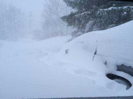
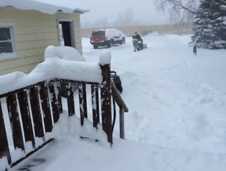
Darien, Alexander and Corfu has been hit by as much as five or six feet of snow, Hens said.

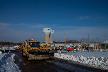
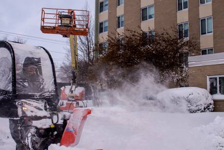
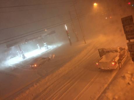
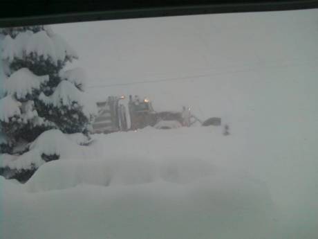
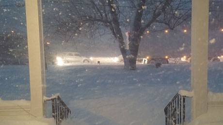
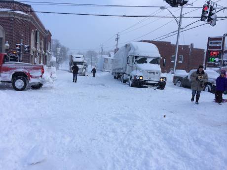
With people venturing out despite the travel bans, it's been difficult to plow roads. There have been extra plow trucks in those parts of the county provided by the county, state and towns and it's still not enough.

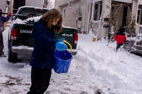
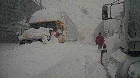
"The amount of snow is just phenomenal," Hens said. "You're talking five, six inches an hour. There are cars and trucks stranded, intersections plugged up. It's literally impossible for the plows to get around. There are roads in Darien that haven't seen a plow yet. That's no exaggeration. I wouldn't doubt it a bit. They're simply not able to keep up."

Members of the county's plow team have been on duty since 8 p.m. last night and most haven't had more than a two-hour break since then.

It's one of the largest storms Hens has ever seen.

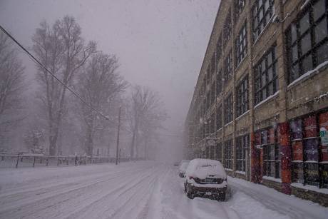
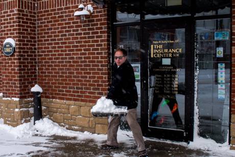
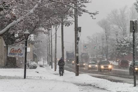
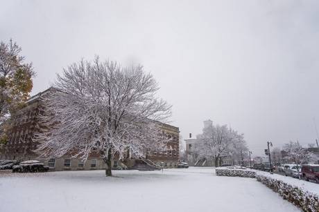
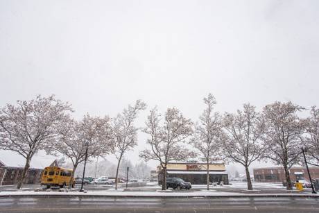
The City of Batavia is approaching the 24-inch mark for 24 hours, which is considered a top 10, 10-year storm. 

The southwest parts of the county are well beyond that for storm totals.

Hens said there is the potential for 70 inches of snow in Darien.

And there's more snow coming tonight, light snow tomorrow and heavy snow predicted for Thursday.

The county may also bring in large snow blower trucks from Livingston and Wyoming counties.

"Those will be a sight to see," Hens said.

The emergency order was signed by County Legislature Chairman Ray Cianfrini. 

"It's a public safety matter," Cianfrini said. "We don't want people on the road who shouldn't be out there."

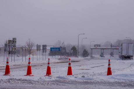
There are travel bans in effect for Darien, Pembroke, Alexander, Bethany and Pavilion, and a travel advisory in effect for the rest of the county.

The bans and state of emergency will remain in effect until further notice.

A lake effect snow warning is in place until Friday.

UPDATE 5:07 p.m.: The Red Cross has announced the opening of a shelter in Alexander, at the Alexander Fireman’s Recreation Hall, 10708 Alexander Road.

UPDATE 5:09 p.m.: There's now a travel ban in Le Roy.

Continued heavy snow predicted today, with another heavy band on Thursday

By Howard B. Owens

Forecast for Genesee County by Mark McLean, weatherman for 13WHAM, official news partner of The Batavian:

Southern portions of Genesee County and northern portions of Wyoming County will likely see snowfall rates between 2 to 4 inches through the remainder of today. This will produce several more feet of snow in areas that have already had several feet of snow. The snow band (as of this writing) has lifted back to near Batavia, but will continue to oscillate over the same areas through the morning commute Wednesday.

A weak storm system will move into WNY on Wednesday and disrupt the lake snow by midday. This general light snow with this next storm system (less than 2 inches) will provide a clean-up break before the next round of very heavy lake snow Wednesday night and Thursday. The Lake Erie snow band on Thursday will produce similar snow rates and intensities with near zero visibility at times, snow rates over 2 inches an hour and treacherous to impossible driving conditions in portions of Genesee, Wyoming, and possibly western Monroe/Livingston counties.

All told, this will likely be a top 10 lake snow event for Lake Erie with many areas seeing more than 4 feet of snow by the end of the week.

UPDATE 3 p.m.: Added a couple of photos taken a little while ago on Harvester Avenue showing the heavy snow and low visibility conditions currently in the city.

Lots of snow so far, more to come for some parts of the county

By Howard B. Owens

Much of Genesee County remains under a travel ban (Darien, Pembroke, Alexander, Bethany, Pavilion) and the rest of the area is under a travel advisory.

The weather service is calling for more lake effect snow, with up to four inches an hour hitting the western and southern parts of the county.

Here's some photos from around Batavia this morning.

Top: Heidi Urban cleans her driveway on North Street.

A Batavia Housing Authority employee blows snow outside 400 Towers.

Skyler Fronczak, 11, helped her family on Ross Street with snow clearing by spreading salt this morning.

Steve Hawley was keeping his walk clear this morning in front of his insurance office on Main Street.

The entrance to the Thruway in Batavia was closed.

A DOT plow truck downtown.

St. Mary's in the snow.

County employee succumbs to heart attack after operating snow blower at Sheriff's Office

By Howard B. Owens

In what county officials are classifying as a weather-related death, a county employee had a heart attack this morning while operating a snowblower in the back parking lot of the Sheriff's Office on Park Road.

A call for a man down came in a little before 7 a.m. this morning. CPR was administered at the scene, but 56-year-old Jack Boyce was pronounced dead later at UMMC.

Boyce worked in the facilities division of the county highway department for one year. Both a brother and a sister are longtime county employees.

Via The Batavian's news partner, WBTA.

Heavy snow overnight, some closures announced, travel advisory issued, plus weather/road updates

By Howard B. Owens

Heavy snow hit parts of the county overnight. There were weather alerts during the early morning hours calling for bands of lake effect snow capable of dropping up to four inches of snow per hour.

Portions of Route 33 and Route 77 are closed.

The Sheriffs' Office has issued a travel advisory. The western part of the county, west of Batavia, has been particularly hard hit. The office is advising against any unnecessary travel this morning.

Here's a list of closures so far:

  • Batavia City Schools
  • Oakfield-Alabama Central School District, including all after school activities
  • Byron-Bergen Central School District
  • Elba Central School District
  • BOCES Batavia
  • Notre Dame and St. Joe's
  • Pembroke Central School District
  • All courts in Genesee County, including County Court and City Court, are closed. Jurors are advised to stay home.
  • Town of Pembroke
  • Batavia Town Hall
  • The Law Offices of Bonarigo & McCutcheon
  • UMMC medical offices on Summit and at Med-Tech
  • Desa Frias DDS
  • Pembroke Diagnostics, located at 860 Main Street Road, Corfu
  • Le Roy Central Schools
  • Pembroke Family Medicine
  • City of Batavia Yard Waste Station
  • Town of Darien
  • Genesee Urgent Care
  • En Garde Batavia, classes cancelled
  • OPEN! -- Dr. Michael Merrill, Medical Office at 229 Summit St., Batavia
  • Independent Living of Genesee Region, at noon
  • Mental Health Association
  • GCASA closed until 3 p.m.
  • NOTE: Regarding closure of medical offices in the Summit Street area, best to call ahead. Some are open, some aren't.
  • Pediatric Associates of Batavia
  • LeRoy Urgent Care is CLOSED today.
  • LeRoy Diagnostics is open until 4 pm.
  • Batavia Urgent Care at the Jerome Center is OPEN
  • The Geneseee County Animal Shelter is closed today, for both the public and volunteers.
  • The Genesee Valley Educational Partnership BSI Conference is cancelled for tomorrow, rescheduled to Dec.15.  Same time, same place. 
  • Batavia Tailors & Cleaners is closing at 3 p.m.
  • The town of Batavia Planning Board Meeting and Public Hearing scheduled for tonight - Tuesday, November 18th at 7:30 p.m. has been cancelled due to weather conditions.    The Public Hearing regarding an application for a Special Use Permit by 5069 East Main LLC will be held on Tuesday, December 2, 2014 at 7:30 p.m.  which is the next regularly scheduled Planning Board Meeting.  Kathleen Jasinski, Chairman, Town of Batavia Planning Board
  • Tountas Family Care
  • Richmond Memorial Library will be closing at 5 p.m.
  • Classic Optical - Closing at 2pm.
  • Sweet Pea's Cupcakery & Cafe - Closing at 2 p.m.
  • Mane Attraction Salon & Spa - Closing at 2 p.m.
  • Wendy's his canceling is "frozen" event. The restaurant will close early, probably about 8 p.m.
  • Planning and Development Committee meeting cancelled
  • Tonawanda Valley Federal Credit Union closed at 3 p.m.
  • Next Level Fitness
  • City Slickers
  • Showtime Theater
  • Olivers

Send closures to howard@thebatavian.com. You can send weather photos to the same address.

UPDATE: The Thruway is shut down west of Henrietta. 

UPDATE 7 a.m.: The National Weather Service says continued heavy snowfall in the western half of the county will continue throughout the morning commute, with snowfall of up to 4 inches per hour in the most intense bands. Thunder and lightning are possible.

UPDATE 7:07 a.m.: Even though the Thruway is closed, people are still trying to get to it. Traffic is tied up on Oak Street.

UPDATE 7:12 a.m.: Top photo submitted by Ashleigh Dominiak showing Route 33 and Route 77 in Corfu at 4:45 a.m.

UPDATE 7:44 a.m.: Law enforcement is looking for information from dispatchers on whether the box stores can make parking lots available for stranded trucks. A plow opeator: "Traffic is just killing us right now. ... We can't get anywheres." There's too many cars on the road.

UPDATE 8:47 a.m.: One highway worker to another, there's a car buried on Colby Road. "Yeah, there's a couple of them. They're everywhere." We're hearing numerous reports of cars stranded on various roads.  

.UPDATE 9:07 a.m.: Travel bans issued for the towns of Pembroke and Darien. The Sheriff's Office is asking all drivers to stay out of those areas until conditions improve.

UPDATE 9:15 a.m.: Town of Batavia, all available manpower to fire stations.

UPDATE 10:30 a.m.: Pembroke, Indian Falls, and Corfu fire departments are told to shut down southbound Route 77.  Also, the travel ban now applies to Alexander, Bethany and Pavilion.

UPDATE 11:21 a.m.: Route 5 westbound at Route 77 is closed to all traffic.

UPDATES 11:36 a.m.: Bethany and Pavilion fire departments are asked to shut down all westbound traffic on Route 20, at the request of Alexander.

UPDATE 11:55 a.m.: A reader called about Route 5 being closed at Wortendyke.  He said the roadway appeared to be clear.  We e-mailed Sheriff Gary Maha about it and here is his response: 

I just talked to Dispatch.  They are now diverting westbound traffic north on RT 63 instead of letting them get as far as Wortendyke.  The problem is not on RT 5 but at Brickhouse Corners.  That area can not handle any more traffic until the mess is cleared up.  There is still a travel ban in effect for the Towns of Pembroke, Darien, Alexander, Bethany and Pavilion.  Highway crews are out working hard to clear these roads of stranded vehicles and plowing them and the travel ban will be lifted once this is completed. We don't need more traffic in these areas getting stuck and making matters worse.

Additional reader photos below.

Corfu

Corfu

Corfu

Corfu

A reader's car buried in Darien.

Bethany, about 8 a.m.

Stafford

Two photos from Ken Laurer, Corfu.

Heavier than expected snow once again heading for Genesee County

By Howard B. Owens

Earlier this evening, a heavier than expected band of lake effect snow hit Genesee County, particularly the southern portions of the county.

The National Weather Service just issued another alert of a band heading toward Batavia that is capable of dropping snow at a rate of 1 or 2 inches per hour.

The band may be accompanied by lightning and thunder.

Travel safety is advised.

Weather causing problems for trucks traveling through Darien

By Howard B. Owens

Tractor-trailers are finding it's tough going on Route 20 and on Route 77, Darien.

Several trucks are blocking Route 20 between Bowen Road and Darien Alexander Townline Road.

There are also trucks backed up on Route 77.

Darien Fire Police are requested to Route 20 to help with traffic control.

Salt trucks and plows are requested to both locations.

UPDATE 11:29 p.m.: Route 20 being reopened.

Photos: Mid-November snowfall in Batavia

By Howard B. Owens

There's been steady snowfall in Batavia all morning. Wet snow. Just an inch or two.

There remains a lake effect snow warning in place for the region. The forecast for Genesee County is for five or six inches of snow through Wednesday. Portions of Erie County may be harder hit with up to two feet of snow.

Top photo: Ellicott Street

Centennial Park

Centennial Park

Ellicott Street from Court Street

County Building #1

Main Street

UPDATED: First lake effect snow expected some time after Monday evening

By Howard B. Owens

The county's first lake effect snow of the season is predicted to hit between Monday evening and Wednesday morning.

Only one or two inches of snow accumulation are expected in the most persistent areas, but with wind, visibility could be down to a quarter mile at times.

Blowing and driving snow could make travel difficult.

Forecasters say there is some uncertainty at this time as to the timing and placement of heavy lake effect snow.

There is a storm watch in effect.

UPDATE 4:44 p.m.: The forecast has been upgraded to a lake effect snow warning, in effect from 5 p.m. Monday through 1 p.m. Wedneday. The weather service says to expect light to moderate snow tonight, followed by very heavy lake effect snow. Accumulations could total up to 6 inches. Winds, southwest 20 to 30 mph with gusts to 45 mph, will result in near blizzard conditions at times. Visibility will be near zero at times later Monday and the morning commute is expected to be slippery and slow. Some roads may become nearly impassable.

A lot of cold, but not a lot of snow, predicted for Genesee County over the next week

By Howard B. Owens

We're at the start of a seven to 10 day blast of Arctic weather, according to various forecasts.

The forecast for Genesee County so far doesn't include much snow, but it's sounding a lot like January for the next week rather than mid-November.

There's a chance of snow showers tomorrow, especially in the morning, but there've been no weather alerts for Genesee County, unlike Wyoming County, which is under a lake effect snow advisory.

High temperatures are going to be in the mid to high 30s and dip into the low 20s if not teens at night.

Weather outlook: Potential for strong, gusty winds and heavy rainfall late tonight

By Billie Owens

Press release:

The National Weather Service in Buffalo has issued a Special Weather Statement saying there's the potential for strong, gusty winds and heavy rainfall tonight.

A strong cold front will push across the Western New York and Finer Lakes Retions very late tonight through early Thursday morning.

Occasional showers and possible thunderstorms will occur well ahead of and along the approaching boundary.

Winds will increase out of the southwest to 20 to 30 mph later this evening, well ahead of the front.

Stronger winds just a few thousand feet off the deck will overspread the area late this evening through the overnight as well.

Stronger convective elements such as a heavy shower or thunderstorms may be able to transport some of these stronger winds down to the surface, which would result in at least a chance of some localized strong to borderline severe wind gusts.

The best time frame for this to occur appears to be during the very late evening into the overnight hours. In addition, high moisture content will pose the threat of locally heavy rainfall with any stronger cells.

Photo: Sun over DeWitt

By Howard B. Owens

A reader sent in this photo Friday (and I've not had time to post it until now) of the sun over the lake at DeWitt Recreational Area when it was 89 degrees locally.  

Rotary learns about how the National Weather Service in Buffalo works

By Howard B. Owens

Jason Franklin, head meteorologist with the National Weather Service in Buffalo, spoke today at the Batavia Rotary Club meeting. He shared information about the technology the NWS uses to help it measure weather and forecast what might be coming.  

Asked how the Weather Channel gets its forecast compared to the NWS, Franklin said, "We work in partnership with them, provide a lot of information to them, like other media, and they provide us information. We work together because our primary mission is to make sure you're safe. To make sure that the companies are getting the information that they need in order for them to do the best that they can. We're all in this together."

Power outage, flooding reported in Le Roy

By Howard B. Owens

There is apparently a power outage in Le Roy. We have no information at the moment regarding the extent of the outage.

There's also flooding on Route 5 by the Le Roy Country Club.

A Le Roy fire chief has requested fire police to the intersection of routes 5 and 19.

UPDATE 9:32 a.m.: Power is out for 2,300 National Grid customers centered around Le Roy. The outage area stretches from Route 19 to Bergen.

Also, the Thruway is being closed because of flooding between Le Roy and Henrietta. Le Roy has been told to expect extra traffic coming through the village.

UPDATE 9:43 a.m.: Stafford recreation is cancelled today due to weather.

UPDATE 10:27 a.m.: The power outage has been reduced to 645 customers in the Village of Le Roy. National Grid estimates power will be restored by 12:45 p.m.

Flash flood warning in effect until 3:15 a.m.

By Howard B. Owens

Thunderstorms tonight have already produced an inch to an inch-and-a-half of rain in some areas, according to the National Weather Service, and the slow moving storm may produce heavy rain for the next few hours.

Another inch to two inches of rainfall is possible.

This could create excessive runoff and lead to flooding of roadways, farmlands and along creeks.

Caution is advised while traveling, especially at night, and people in areas susceptible to flooding should move to higher ground, the Weather Service advises.

Hazardous weather outlook in effect

By Billie Owens

A hazardous weather outlook is in effect. The National Weather Service in Buffalo reports thunderstorms over the region today and throughout the evening will have the potential to produce heavy rain, with up to two inches possible. This would likely lead to localized poor drainage, flooding, and fast, significant rises to smaller tributaries.

The outlook for Monday through Saturday indicates the probability is low for widespread hazardous weather.

Photo: Pot of Gold at the End of the Rainbow

By Howard B. Owens

After the Tigers Under 6 soccer game this evening, members of the team posed for a picture with a rainbow behind them. Shannon Whitcombe, who took the picture, titled it, "Pot of Gold at the End of the Rainbow."

Submitted by Jeff Whitcombe.

Authentically Local