
weather

Winter storm watch in effect starting Sunday

By Billie Owens

A winter storm watch will be in effect from Sunday afternoon through late Monday night, according to the latest weather dispatch from the National Weather Service in Buffalo. Heavy snowfall is expected with accumulations of seven inches or more.

Winds will blow from the north at 10 to 20 mph. Visibility will be as low as a quarter of a mile at times. The storm will result in snow-covered roads and poor visibility that will make travel difficult.

Photos: A cold, nasty winter morning

By Howard B. Owens

It was just nasty out this morning, with brisk winds, falling snow, blowing snow, a temperature in the mid-teens that felt much colder.

But Batavia residents still went about their business.

Weather advisory issued for coming snowstorm

By Howard B. Owens

Get those snow shovels and snow blowers ready because the National Weather Service is predicting there is going to be more snow covering walkways in the morning.

A weather advisory has been issued for 10 p.m. through 4 a.m., Thursday.

There will be an inch or two tonight, an inch to three tomorrow, and storm totals of four to eight.

Photo: Oakfield water tower on a winter day

By Howard B. Owens

This morning, the new Oakfield water tower stood out against the gray, winter sky.

The snowstorm has passed, but a couple of flurries this evening are possible.

It's cold, though, and only going to get colder.

There is a wind chill advisory in effect from 7 p.m. through 10 a.m.

Winds will average 10 mph, creating wind-chill values of 15 to 20 degrees below zero.

There is a greater risk of frostbite and hypothermia, so appropriate dress and caution is advised.

Closing, cancellations and delays for Monday, Feb. 2.

By Howard B. Owens

Closing, cancellations and delays for Monday, Feb. 2.

  • Batavia City Schools
  • Oakfield-Alabama, with this message: "Please note that we had already used all of our snow days for the 2014-15 school year. This closing means that February 18th will no longer be a day off, but a day of attendance for all students, faculty and staff. Please note this change on your calendar and stay safe and warm today."
  • Love Bugs Preschool in Le Roy
  • Pembroke Family Medicine
  • Maya Yoga Studio
  • GCASA in Batavia and Albion, until 4 p.m. (UPDATE: Groups for Monday night cancelled.)
  • Alexander Central School
  • Attica Central School
  • Byron-Bergen Central School
  • Elba Central School
  • GCC delayed (check school's Web site)
  • BOCES
  • Le Roy Central School
  • Notre Dame
  • Pavilion Central School
  • Pembroke Central School
  • St. Joe's
  • The Batavia Youth Center will be closed today due to the inclement weather.
    The center will reopen tomorrow at 2:30-8 p.m. for youth 10-18 years of age.
    Any questions please call 345-6420
  • All Monday classes at Blue Pearl Yoga
  • Byron Town Court's 5 p.m. session is cancelled.

E-mail closing and cancellations to howard@thebatavian.com

Winter storm warning in effect for Sunday and Monday

By Howard B. Owens

The previous winter storm watch is now a winter storm warning.

The National Weather Service is forecasting an inch or two of snow in the morning, another four to six inches Sunday night, two to four inches Monday, with storm totals of seven to 12 inches.

The most intense period of snow is predicted for Sunday night into Monday morning. 

Winds could be 15 to 20 mph, causing areas of blowing and drifting snow. 

Visibility could be down to a quarter of a mile at times. 

Hazardous travel conditions are expected.

CORRECTION: We initially transposed the words. The watch became a warning. 

Winter storm watch issued for Sunday through Monday afternoons

By Howard B. Owens

Up to seven inches of snow is possible tomorrow afternoon through Monday, according to the National Weather Service.

A winter storm watch has been issued from Sunday afternoon through Monday afternoon.

Blowing snow is possible. Travel could be difficult.

Forecast confidence is medium.

Cold and a bit of snow in the forecast

By Howard B. Owens

Weather forecast from Mark McLean, 13WHAM, our news partner:

On Ultimate Doppler HD we don’t see any widespread precipitation now, but a few flurries are showing up, especially west of Rochester and I wouldn’t be surprised if some light patchy freezing drizzle is mixing in as well. Right now we officially have gray skies with the temperature in the upper 20s near Rochester. Across WNY the temperature is in the upper 20s or lower 30s now and will likely stay in this range through midnight.

The hour by hour forecast shows the temperature falling sharply after midnight with a quick burst of snow likely. We expect the temperature will be in the upper teens by morning. Lake snow showers will continue for the morning. On the neighborhood forecast notice that the temperature doesn’t go up from there. We see the temperature staying in the mid to upper teens all afternoon with a few sunny breaks late in the afternoon.

On the futurecast we have several storm systems we’re watching for WNY. The first will impact the region Monday afternoon and evening. Light snow is likely with several inches of accumulation possible, especially south of Rochester. The snow futurecast shows the expected snow amounts nicely. Behind the system Monday, arctic air will continue to cross Lake Ontario creating additional lake snow showers Tuesday.

The weather forecast this evening will stay overcast with a few flurries and patches of freezing drizzle at 7 and 10 p.m. The temperature will hover in the upper 20s or low 30s during this time. arctic cold front will cross WNY overnight and drop the temperature into the upper teens by 8 a.m. A few lake effect snow showers will be possible in the morning.

The 7-day forecast shows Arctic chill sticking around for most of this week. Monday looks bitter cold with the morning starting in the single numbers. We expect light snow Monday afternoon with several inches of accumulation possible. Tuesday will also be frigid. A few passing snow showers are expected with the high once again in the upper teens. Wednesday will still be cold, but not as harsh. With a few sunny breaks the temperature will move into the mid-20s. Another area-wide snow will arrive Thursday with a high in the low 30s. Friday will turn blustery and colder again with lake snow showers, the early day high in the mid-20s. Saturday will be frigid with mostly cloudy skies and a high near 18.

Weather advisory for light snow and freezing drizzle in effect until 11 tonight

By Billie Owens

A winter weather advisory for snow and freezing drizzle is in effect until 11 p.m. for most of Western New York. The National Weather Service in Buffalo.

The weather outlook is hazardous and the mix of freezing drizzle and light snow will create a light coating of ice, procuding slippery spots on untreated roads as well as sidewalks and parking lots.

"A surface that appears just wet may in fact be icy," says the advisory.

Photos: Batavia after the storm

By Howard B. Owens

Joel Emerson delivering mail through the snow and bitter cold on Redfield Parkway.

Joe Caruso cleaning his driveway on North Spruce.

Also on North Spruce.

Craig Thurman on State Street.

Joseph Verssagi on Union while his neighbor Buck Oltman works with his own blower in the background.

The sun was out, the storm was gone, but snow was still blowing on Main Street.

Sheriff issues travel advisory for Genesee County

By Howard B. Owens

Press release:

The Genesee County Sheriff has issued a travel advisory for all of Genesee County effective immediately and continuing until further notice. While travel in the county is not banned at this time, unnecessary travel is discouraged. Heavy, blowing and drifting snow is making roads slippery and limiting visibility. Several motor-vehicle accidents have been reported with numerous vehicles going off the road.

UPDATE: The travel advisory was lifted at 9:30 a.m.

Closings and cancellations for Friday, Jan. 9

By Howard B. Owens

Closing and cancellations reported to us:

  • "This is a message from the Oakfield-Alabama Central School District.  School will be closed today, Friday January 9th due to the weather. This closing includes all after-school and evening activities. Please note that this is our last built-in snow day of the school year. Our plan for makeup days will be distributed next week to allow you to adjust your calendars. Please stay warm and safe this weekend."
  • Alexander Central School
  • Attica Central School
  • BOCES, Batavia campus
  • Pavilion
  • Pembroke
  • Pembroke Family Medicine delayed opening until 10:30 a.m.
  • Independent Living of Genesee Region is closed today.
  • Notre Dame
  • Lamb Family Medicine (Now Open)
  • Bingo at St. Mary's
  • Delayed opening for County Court and City Court
  • Delayed opening to 10 a.m. for Dr. Basra
  • The Women's Care Center in Batavia at 33 Chandler Ave.

E-mail closings and cancellations to howard@thebatavian.com

Heavy lake effect snow expected in western Genesee County before 7 a.m.

By Howard B. Owens

In a special weather statement, the National Weather Service reports a heavy lake effect snow band is moving toward the western portion of Genesee County and could drop snow at a rate of three inches per hour as far east as Batavia.

Visibility will be near zero with winds gusting to 40 mph.

"Travel will be extremely difficult or even impossible due to a combination of snowfall and strong winds," warns the weather service.

UPDATE 6:17 p.m.: A medic with Mercy EMS informs dispatchers that conditions are so bad, "we won't be doing any transports to Buffalo until further notice."

Thruway through WNY closing to all traffic at midnight

By Howard B. Owens

From the Thruway Authority:

Parts of the New York State Thruway in Western New York will be closed due to extreme winter weather conditions. The mainline Thruway, I-90, between Exit 46 (Henrietta) and Exit 61 (Shortman Road), as well as the Niagara Section, I-190, between I-90 and Exit 16 (I-290), will be closed to tractor-trailers at 9 tonight. Starting at midnight, these same sections will be closed to all traffic. Vehicles traveling westbound on I-90 will be detoured off the roadway at Exit 46 (Henrietta) and all eastbound traffic will be detoured off at Exit 61 (Shortman Road). All vehicles traveling south on I-190 will be detoured off at Exit 16 (I-290).

Lake effect snow warning issued for tonight

By Howard B. Owens

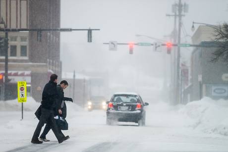
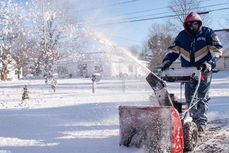
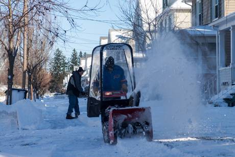
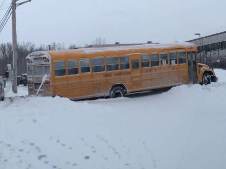
From six to 10 inches of lake effect snow are possible overnight with winds blowing up to 45 mph, according to the National Weather Service.

A lake effect snow warning has been issued. 

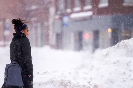
Snow could fall at three inches an hour.

The warning is in effect from 10 p.m. to 10 a.m.

Visibility will be near zero at times.

The weather service warns travel may become nearly impossible.

UPDATE 4:15 p.m.: Here's a weather report from our news partner, 13WHAM:

Tonight expect the gusty winds to continue with sub-zero wind chills. The actual low temperature will be near 14, but will feel much colder. Late this evening an area wide snowfall will make its way toward WNY. Snow will redevelop and bring a fresh coating of 2-3” for Rochester. South and west, through Genesee and Wyoming counties, another 3-5” are likely. For this reason, we have a lake effect snow warning in place west of Rochester for Friday.

The Friday morning commute could be a challenge as a quick burst of snow will fall producing an inch or more of accumulation. With the brutally cold temperatures and blustery conditions it’s no surprise that lake snow will continue also. Genesee and Wyoming counties will see another 3-6” of accumulation. Outside of any lake effect bands, some breaks of sunshine will be possible. 

Bitter cold temperatures and sub-zero wind chills will persist Friday night. Another lake effect band will move through the area and although the exact placement of this snow band is still to be determined, any area that stays within persistent lake snow could see 6-10” of additional accumulation.

Saturday morning will start out with some sunny breaks. Although the sun may be shining, conditions will still be blustery with ice-cold temperatures near 18. By afternoon 3-6” of new snowfall will accumulate south and west of Rochester, bringing snow totals between 2 and 3 feet. Continue to check back for further updates on the snowfall and upcoming storm system from the 13WHAM Weather Authority.

Photo: Biking on Jackson in the cold and snow

By Howard B. Owens

It was 14 degrees and lake effect snow was falling, but Thomas Gilbert, who was riding home on Jackson Street, still said, "this is great weather for a bike ride."

There is a lake effect snow advisory in effect until 4 a.m. and a wind chill advisory in effect until 10 a.m.

Forecasters are calling for four to eight inches of snow with winds from the west at 15 to 25 mph.

Lake effect snow advisory in place until Wednesday morning, plus wind chill possible of 20 below

By Billie Owens

A lake effect snow advisory is in effect from 4 this afternoon until 10 a.m. Wednesday, according to the latest weather update from the National Weather Service office in Buffalo. Snow accumulations are expected to be four to seven inches in the heaviest bands, which will include far southern Genesee County.

Also, a wind chill advisory remains in effect 10 a.m. Wednesday until 10 a.m. Thursday. Winds are predicted of 15 to 25 mph with wind chill values as low as 20-degrees below zero.

The combination of snow and blowing snow will greatly reduce visibility and result in snow-covered roadways, which can create hazardous driving conditions.

Bitterly cold wind chills will result in dangerous conditions for exposed skin. Avoid prolonged exposure to cold to prevent frostbite and hypothermia. If you will be outdoors use common sense and dress warmly.

Freezing rain today, high wind tomorrow

By Howard B. Owens

There is a freezing rain advisory in effect until 7 p.m. this evening.

Patches of ice should be expected on roadways and walking paths. Caution is advised, especially on bridges and overpasses.  

"Walking and driving could be therefore be difficult, but not impossible," advises the National Weather Service.

There is a high wind warning in effect from 7 a.m. to 7 p.m., Sunday. 

Winds from the southwest of 30 to 40 mph with gusts up to 65 mph are expected.

Scattered power outages are possible. Travel will be difficult for high-profile vehicles.

Authentically Local