
weather

No flooding in Genesee County so far, but rain and wind coming

By Howard B. Owens

A flood warning remains in effect, particularly for southern Genesee County, but so far, there are no flood reports. Above, the Tonawanda Creek at the spillway behind the courthouse at 11 a.m.

There's a high-wind warning for 1 p.m. through 4 a.m.

Thundershowers are possible this afternoon from 2 to 4 p.m.

It's currently a pleasant 64 degrees in Batavia. The record high for this date is 70 degrees (1979). Tomorrow's high will be 37 degrees with a low of 28 and some snow.

Weather notes for Sunday evening

By Howard B. Owens

At Tops, they might be singing "Yes! We Have No Bananas," and no asparagus and no pink grapefruit and no celery -- the produce section is running low on just about everything.

But help is on the way, according to managers. The fresh produce truck is in route, making other deliveries along the way. There's just no ETA.

Blame heavy snow, of course.

Speaking of running low on supplies, Janelle Larsen and Laura Kauppi, both of Batavia, and, Timothy Zorn, of Rochester, spent the day volunteering in the Buffalo area delivering food and other supplies to people who have been trapped in their homes by heavy snow.

Laura writes:

The efforts of the National Guard and police are concentrated on snow removal. Many people are stuck in their house with little or no food or supplies. We purchased water, milk, soup, bread, cereal, granola bars, crackers and peanut butter, Pop Tarts, (infant) formula, soy formula, diapers, cat food, dog food and baby wipes. We also had medicine, but we were thankful no one needed it.

Most people we helped were disabled or had very small children at home. Many roads are still closed, and lots of people are stuck with no food in travel bans. We drove to the edge of the bans, and then we had to walk, even as much as a mile to get to homes. These were people not receiving help anywhere else, and were very grateful.

We were surprised at how honest people were. One women told us she only wanted cat food and one milk (carton), and she wanted us to "keep the rest for people who needed it more." A young dad took Pop Tarts, saying "I just want something for my kids."

Another women took only milk, but told us about a single dad snowed in next door. He was grateful for some cereal, milk and bread. At a trailer park, we made up bags with two soups, one milk, a cereal, bread and several granola bars. We dropped them on the porch of every snowed-in house. Another mom was incredibly grateful for soy formula, diapers, milk and cereal. She was in the driving ban and with two babies was unable to walk the .5 mile to reach the nearest open store. Another women took wipes, diapers and cereal for the seven children she was caring for.

There is a Facebook group, WNY Storm Help 2014, where people have been posting needs for themselves or neighbors. It didn't take much time or money for us to make a difference, and I hope we have inspired others to do so, either to help with this storm, the inevitable flooding or the next storm.

We also received this storm-related e-mail fromReginaKoehler:

My husband is a truck driver and was stranded on the highway during the snowstorm. There were people from Alexander who got him and his truck to a safe warm place, a fire station, where he remained for three days. There were several people there who had also been rescued. The Red Cross brought in food and cots. I just want to say on behalf of my family and myself a GREAT BIG THANK YOU to the Town of Alexander for saving my husband and my son's dad, and my grandchildren's grandpa. It will be a happy Thanksgiving for us. It could have gone very bad had he been stuck out there and run out of fuel. Bless you all and have a GREAT holiday season....

UPDATE 5:25 p.m.: I almost forgot about this picture below. I stopped by the Tonawanda about 4:30 to see if the creek was rising.

High wind watch upgraded to warning

By Billie Owens

A high wind watch issued by the National Weather Service has been upgraded to a high storm warning, in effect from 1 p.m. Monday to 4 a.m. Tuesday.

Winds in Genesee County are forecast to be 25 to 35 mph with gusts up to 60 mph. This could bring down some trees and power lines, resulting in scattered power outages.

Due to melting snow, unfrozen and saturated ground will make it easier for some trees to topple, especially shallow-rooted pines.

These winds wil also make travel difficult for high-profile vehicles. Outdoor holiday decorations could be damaged as well as other outdoor items such as trash cans and they could be blown away.

Power outages could cause additional concern for those whose basements tend to flood because sump pumps won't work without electricity.

Weather notes for Saturday afternoon

By Howard B. Owens

There is a high wind watch in place for Monday morning through Monday night. Winds from the southwest of 25 to 35 mph expected with gusts up to 60 mph. Possible impacts include trees down and power lines down. Travel could be difficult for high profile vehicles. Holiday decorations and loose outdoor items, such as trash cans, could be blown away. Scattered power outages are possible.

A flood watch, the result of melting snow, remains in effect from Sunday afternoon through Wednesday morning.

UPDATE 5 p.m.: The flood watch has been upgraded to a flood warning through 4:15 p.m., Monday.

A high of 60 degrees is predicted for Monday. A high of 37 degrees with snow is predicted for Tuesday.

From UMMC: "The blood drive scheduled for Monday, November 24th has been cancelled by the Red Cross. Their mobile unit requires repairs and the necessary parts are undeliverable from Buffalo due to the recent storm."  The blood drive will be rescheduled to a date in January.

Tim Adams sent in these three photos of pumps and hoses loaded and ready for transport to Lackawanna to assist with anticipated flooding clean-up. The equipment is from Godwin Pumps (Xylem). Making the trip from Batavia are Steve Wenzka, Steve Carmichael, Todd Palmer, Dan Judd, Herb Schroeder and Adams.

The Batavian's news partner 13WHAM has a story about anticipated flooding in Genesee County.

Weather notes for Friday evening

By Howard B. Owens

Top photo, members of the Oakfield Fire Department assist the Alexander Fire Department in clearing snow from the rec hall in Alexander (photo submitted by Jeff Christensen).

Six special rescue trucks from the New York City Fire Department, part of a special task force, were at the Home Depot in Batavia today on their way to Buffalo. The trucks were specifically designed and built for high-water rescues following Hurricane Sandy. The trucks were sent to WNY in anticipation of flooding Monday with warmer weather, rain and snow melt. The vehicles can carry up to 16 people each through high water. (Photos submitted by Steve Hynes Fisher)

Some coverage from The Batavian's news partner, 13WHAM:

The Thruway Authority announced the I-90 has reopened.

Press release:

Motorists should be aware of the following restrictions:

  • Thruway (I-90) between Exit 50A (Cleveland Drive) and Exit 61 (Ripley – Pennsylvania state line) will be limited to essential travel only, including travel needed to exit the region, deliver necessary supplies, and remove snow. In this section, all exits are open wherever localities have lifted travel bans.

The following exits remain closed to traffic exiting from the Thruway, although traffic is permitted to enter at these locations:

  • Exit 56 (Blasdell -- Orchard Park -- Mile Strip Road -- NY Route 179)
  • Exit 57 (Hamburg -- East Aurora -- NY Route 75)
  • Exit 57A (Eden --  Angola)
  • Exit 58 (Silver Creek -- Irving -- NY Routes 5, 20 & 438)
  • I-190 (Niagara Thruway) is open, but there is no access to Exit 1 (South Ogden) through Exit 5 (Hamburg – Louisiana).

The Town of Darien office is closed until 9 a.m., Monday.

Photo -- Steve Ferry digging out the Bartlett residence in Darien:

John Brown's car in Alexander this morning:

City leaf pickup may be rescheduled

By Howard B. Owens

If all had gone according to plan, today would be the last day of leaf pickup in the city, but the recent snow storms have made leaf clean up impossible.

Many residents probably still had leaves on some trees when the first storm hit.

City Manager Jason Molino said if warmer weather and snow melt permits, the city may reschedule a period of leaf pickup around the city, but officials won't be able to make that determination, at the earliest, until after this weekend.

Flood watch statement for the City

By Howard B. Owens

Press release:

The National Weather Service has issued a Flood Watch for the City of Batavia and Genesee County from Sunday afternoon through Wednesday morning, Nov. 23-26.

Two significant lake effect snow events this week have brought deep snowpack across the area. This snowpack stores a large quantity of water, and a warming trend begins early this weekend. By Saturday afternoon, air temperatures will remain above freezing through Tuesday night. Daytime highs will rise to near 50 F degrees on Sunday and near 60 F degrees on Monday.

At first the snowpack is expected to absorb much of the water from the snow melt. However as the snowpack ripens, and with the addition of a half inch of rainfall expected Sunday night and Monday, the potential for flooding will rapidly increase.

Recommended precautions/preparedness actions for Batavia residents:

• Monitor forecasts for the latest alerts;
• Make sure sump pumps are turned on and are functioning;
• For those living in low-lying areas or near areas prone to flooding, move the items in your basement up off the floor;
• Don't drive in standing water or flooded streets;
• Do not drive beyond barricades that indicate a street is closed;
• Please help the City keep the storm drains free from debris. Many leaves were in the streets awaiting pick up prior to the snow storm. As the snow melts, these leaves will move toward storm drains and block drainage capability. THIS WILL CAUSE STREET FLOODING. City workers will be out clearing drains throughout the melting period, and the CITY IS ASKING ALL RESIDENTS TO rake leaves and debris away from the storm drains throughout the melting period. Please help neighbors who are out of town or unable to perform this task;
• In an emergency, call 9-1-1.

Storm safety message from National Grid

By Howard B. Owens

Press release:

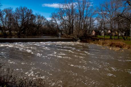
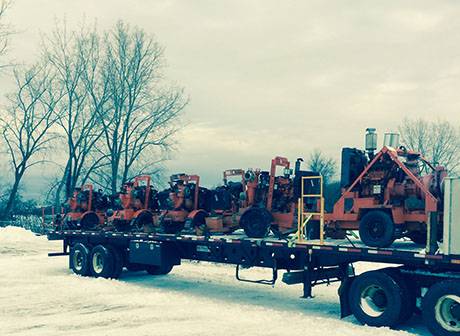
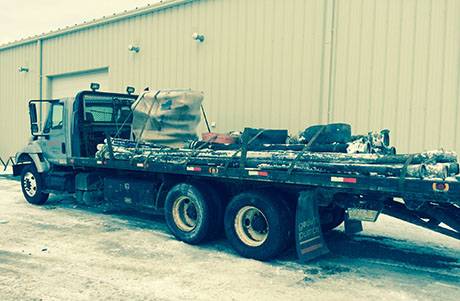
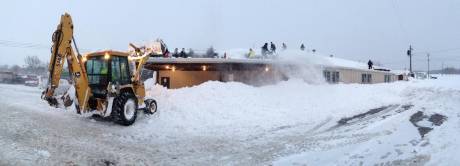
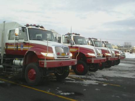
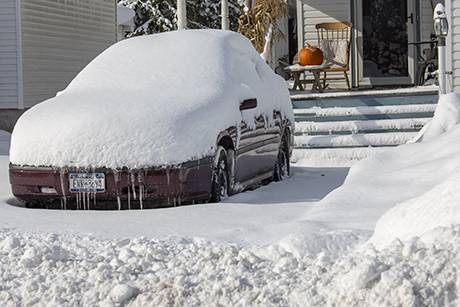
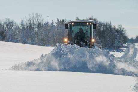
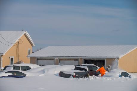
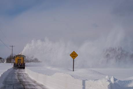
As frigid temperatures, ice and snow begin to thaw, the potential for localized flooding increases. National Grid crews, as always, are ready to respond to any damage that may result from flooding, and the company urges customers to be extremely cautious when dealing with any electricity service that may be at risk.

“Safety of the public and our employees is always our first priority,” said Ken Daly, National Grid’ New York president.  “National Grid is experienced in managing flood events and has a plan in place to assess damage and restore service as quickly as possible should flooding pose a threat. We are ready, and we urge our customers to be ready as well.”

The company offers the following safety tips for customers in any sort of flooding situation that might impact electricity or gas service.

Stay out of flooded basements or standing water. Energized wiring, outlets and appliances below the water line may pose a hazard.

To have electricity service restored once flood waters have receded, contact an electrician to check your home or business to make sure that it is safe to have service energized.

If your main fuse box or circuit breaker box has been under water, or if National Grid was directed to shut off your service due to safety-related concerns, you must have the box inspected by a certified electrical inspector before service can be restored.

If your appliances have been in contact with water, please contact a qualified contractor to make sure those appliances are safe to operate.

If you use a generator to supply power during an outage, be sure to only operate it outdoors. Before operating generators, be sure to disconnect from National Grid’s system by shutting off the main breaker located in the electric service panel. Failure to do this could jeopardize the safety of crews working to restore power.

If you have lost power, turn off any appliances that were on when the power went off, but leave one light on so you will know when power is restored.

Power problems can sometimes interrupt public water supply systems or disable well pumps, so it’s an especially good idea to keep a supply of bottled drinking water handy, as well as some canned food.

National Grid contact information for emergencies is:
To report electric outages or downed wires: 1-800-867-5222
General questions about safety and service: 1-800-642-4272
Call before you dig: dial 811 or 1-800-962-7962

National Grid also offers the following tips for customers to minimize inconvenience and maximize safety in the event that power interruptions occur.'

Never touch downed power lines, and always assume that any fallen lines are live electric wires. If you see one, report it immediately to National Grid or your local emergency response organization.

If you use a generator to supply power during an outage, be sure to only operate it outdoors. Before operating generators, be sure to disconnect from National
Grid’s system by shutting off the main breaker located in the electric service panel.

Failure to do this could jeopardize crew safety.

If you lose power, turn off any appliances that were on when the power went off, but leave one light on so you will know when power is restored.

Power problems can sometimes interrupt public water supply systems or disable well pumps, so it’s an especially good idea to keep a supply of bottled drinking water handy, as well as some canned food.

People who depend on electricity powered life-support equipment, such as a respirator, should let National Grid know. To register as a life support customer, call the company’s Customer Service Center at 1-800-642-4272.

National Grid customers who experience outages should call National Grid’s outage line at 1-800-867-5222 immediately to expedite restoration.

Check on elderly family members, neighbors and others who may need assistance during an outage period.

Flooding safety message from the Office of Emergency Management

By Howard B. Owens

Press release:

Following two significant snow events this week, the National Weather Service is predicting a warming trend over the weekend and into early next week that will result in major water runoff as the snowpack melts.

FLOODING

Flooding can be expected in flood-prone areas. Based on rising temperatures the resulting water run off can be expected to be between four to six inches. Basement flooding will likely occur including some areas that have not previously experienced such flooding. It is recommended that you consider moving items stored in basements to higher levels to prevent water damage.

Be alert for water in underpasses that can collect as storm sewers reach capacity. Do not drive through any standing water on roadways as vehicles may become stalled in high water, leaving the operator and passengers stranded. Also be careful if you must walk through flooded areas. As little as six inches of moving water can result in a fall.

COLLAPSE DANGER

Heavy snow pack on building roofs presents the danger of roof collapse. If you hear strange noises such as creaks and groans in your home, it is recommended that you leave the building for a safe location and notify 9-1-1. Do not enter property you suspect may be in danger of collapse. Property owners should be vigilant of the snow load and if practical, efforts should be made to remove excessive snow from building roofs to reduce the weight.

STORM-RELATED HEALTH ISSUES

Throughout this snow and flooding event, it is important to not overexert. The snowpack is heavy with accumulated water and difficult to remove even with power equipment such as a snow blower. Older people particularly should consider a snow removal contractor to clean driveways and assist with removing snow from heavily loaded roofs.

Check exhausts from furnaces, hot water tanks and other fuel burning appliances to be sure they are clear of snow or other blockage. When blocked, carbon monoxide fumes can back up into dwellings resulting in the danger of carbon monoxide poisoning. Remember carbon monoxide is a colorless and odorless gas. 

If you exhibit symptoms of carbon monoxide poisoning such as headache, dizziness, nausea, flu-like symptoms or fatigue, impaired judgment, chest pains or confusion, dial 9-1-1 immediately for assistance.

Travel advisory lifted

By Howard B. Owens

Press release:

Effective immediately, the Genesee County Sheriff’s Office is lifting the Travel Advisory for the towns of Darien, Alexander, Bethany and Pavilion.

At this time, there are no travel advisories or travel bans in Genesee County.

National Weather Service warns of flooding Monday

By Howard B. Owens

From the National Weather Service:

...FLOODING POSSIBLE EARLY NEXT WEEK... TWO SIGNIFICANT LAKE EFFECT SNOW EVENTS THIS WEEK HAVE BROUGHT A VERY DEEP SNOWPACK ACROSS PORTIONS OF WESTERN NEW YORK. THIS SNOWPACK NOW STORES A LARGE QUANTITY OF WATER. AFTER THE LAKE EFFECT SNOW ENDS...A WARMING TREND IS EXPECTED TO START EARLY THIS WEEKEND. BY SATURDAY AFTERNOON AIR TEMPERATURES WILL REMAIN ABOVE FREEZING THROUGH TUESDAY NIGHT. DAYTIME HIGHS WILL RISE TO NEAR 50 F DEGREES ON SUNDAY...AND NEAR 60 F DEGREES ON MONDAY. IN ADDITION TO THE WARMING AIR TEMPERATURES...A SOUTHERLY BREEZE AND RISING DEW POINTS WILL MAKE FOR A MORE EFFICIENT MELTING OF THE SNOWPACK.

AT FIRST THE SNOWPACK WILL ABSORB MUCH OF THE WATER FROM THE SNOW MELT. HOWEVER AS THE SNOWPACK RIPENS...AND WITH THE ADDITION OF A HALF INCH OR SO OF RAINFALL SUNDAY NIGHT AND MONDAY...THE POTENTIAL FOR FLOODING WILL RAPIDLY INCREASE.

PEOPLE LIVING IN AREAS PRONE TO FLOODING...AND WHERE SIGNIFICANT AMOUNTS OF SNOW FELL SHOULD TAKE TIME IN ADVANCE OF THE WARMING TO PREPARE FOR THE POTENTIAL FOR SIGNIFICANT FLOODING EARLY NEXT WEEK. IN ADDITION TO CREEKS AND SMALL STREAMS FLOODING THEIR BANKS...WIDESPREAD FLOODING IS POSSIBLE ACROSS TOWNS WHERE SEVERAL FEET OF SNOW FELL.

...FLOOD WATCH IN EFFECT FROM SUNDAY AFTERNOON THROUGH WEDNESDAY MORNING...

THE NATIONAL WEATHER SERVICE IN BUFFALO HAS ISSUED A

* FLOOD WATCH FOR A PORTION OF WESTERN NEW YORK...INCLUDING THE FOLLOWING COUNTIES...GENESEE...NORTHERN ERIE...SOUTHERN ERIE AND WYOMING. THIS ESPECIALLY INCLUDES THE BUFFALO METRO AREA.

* FROM SUNDAY AFTERNOON THROUGH WEDNESDAY MORNING.

* SNOW MELT FROM THE RECENT SIGNIFICANT LAKE EFFECT SNOW EVENTS COMBINED WITH RAINFALL EARLY NEXT WEEK WILL BRING THE POTENTIAL FOR FLOODING.

* SMALLER STREAMS AND CREEKS WILL BE PRONE TO FLOODING FROM SNOW MELT. THIS WILL INCLUDE THE CREEKS THAT FLOW THROUGH THE BUFFALO METRO AREA. TOWNS THAT RECEIVED SIGNIFICANT AMOUNTS OF SNOW WILL ALSO HAVE POTENTIAL FOR URBAN FLOODING FROM THE SNOW MELT.

PRECAUTIONARY/PREPAREDNESS ACTIONS...

A FLOOD WATCH MEANS THERE IS A POTENTIAL FOR FLOODING BASED ON CURRENT FORECASTS. YOU SHOULD MONITOR LATER FORECASTS AND BE ALERT FOR POSSIBLE FLOOD WARNINGS. THOSE LIVING IN AREAS PRONE TO FLOODING SHOULD BE PREPARED TO TAKE ACTION SHOULD FLOODING DEVELOP. STAY TUNED TO WEATHER RADIO OR OTHER RADIO AND TV STATIONS FOR FURTHER DETAILS OR UPDATES.

Readers share weather photos and even a new song lyric

By Howard B. Owens

Bernie Thompson and Steve Ognibene face off in a Southside snow blower battle. (Submitted by Steve Ognibene)

Below are some pictures from Le Roy from Rob Radley.

Finally, with perhaps too much time on his hands while snowed in, Bob Trombley rewrote the lyrics to Simon and Garfunkel's "America."

Let us be Eskimos, we'll build our igloos together/ I've got some hand warmers here in my bag.

So we bought pack of rock salt and tops store made pies and walked off to look for Batavia. "Snovember" I said, as we snowboarded along the way in Oakfield, Corfu seems like a dream to me now.

It took me 4 days to clear off my windshield "I've come to look for Batavia."

Laughing in our igloos, playing games with the muckdogs, she said the man in the snow suit was a good guy.

I said "be careful, his snow plow is really buried."

"Toss me a shovel, I think there's one on my front step." We broke the last one an hour ago."

So I looked at the scenery, she read her magazine; and the snow fell over an open field. "Kathy, they're lost" I said as the news trucks were live streaming. "Facebook and Twitter are hashtagging silly snow names and I don't know why."

Counting the cars on the New York State Thruway, they've all come to look for Batavia, all come to look for Batavia, all come to look for Batavia.

Travel advisory issued for southern half of county

By Howard B. Owens

A travel advisory has been issued for Darien, Alexander, Bethany and Pavilion.

The Sheriff's Office advises against unnecessary travel in those areas of the county due to poor driving conditions

There is heavy snow, poor visibility and poor driving conditions.

Also, Route 63 into Pavilion is closed.

Wyoming County is also being hit hard by snow. Trucks are off the road in a couple of locations. The plows haven't been able to keep up in the Village of Attica.  

So, if you were thinking of traveling south, think again.

UPDATE 5:33 p.m.: Route 19 southbound is closed in Le Roy at Robbins Road. Routes 19, 63 and 20 are described as "a parking lot" with cars and trucks unable to move.

UPDATE: Both Route 63 and Route 19 have reopened. The travel advisory is still in effect, however.

Contrary to some news reports, there are no travel bans in Genesee County

By Howard B. Owens

Press release from the Sheriff's Office:

Some news agencies are still reporting travel bans/advisories in Genesee County. At this time there are NO travel bans or advisories in Genesee County.

The previous bans in the Town of Pembroke, Village of Corfu and the towns of Darien, Alexander, Bethany, Pavilion and Le Roy have all been lifted as per the previous releases from the Sheriff.

Closures and cancellations for Thursday, Nov. 20

By Howard B. Owens

What we've received so far:

  • Darien Town Court
  • State offices in Genesee County
  • Pembroke Central School District
  • Oakfield-Alabama Central Schools
  • Batavia City Schools
  • Alexander Central School
  • GCC, Batavia campus
  • Byron-Bergen Central Schools
  • Elba Central School District
  • Notre Dame and St. Joe's
  • Grandma’s Luv’n Care Daycare
  • Genesee Christian Academy
  • Le Roy Central Schools
  • Pavilion Central Schools
  • Alexander Central Schools
  • Pembroke Family Medicene, all three locations, will open at noon today
  • Love Bugs Preschool
  • Batavia Pediatrics will open at noon
  • Continental School of Beauty
  • Women's Care Center is opening at 1 p.m.
  • The Cello Fury concert at GCC will be rescheduled
  • Optique
  • Genesee Association of Municipalities meeting in Oakfield is cancelled
  • Genesee County courts are OPEN today. Jurors should report.
  • City of Batavia Yard Waste Station, closed through the weekend
  • Batavia Assembly of God Church
  • Choir practice at First Presbyterian, Batavia
  • Zoning Board of Appeals
  • Tonight's EMS class is cancelled, but the Mutual Aid Advisory board will meet as scheduled at the Fire Training Center.

E-mail closures and cancellations to howard@thebatavian.com. Ideally before 8 a.m.

E-mail weather pictures to howard@thebatavian.com

Weather service offers reminders for snow safety

By Howard B. Owens

Snow safety advice from the National Weather Service:

Moving all this snow can be dangerous. Here are some precautions.

Do not overexert yourself...shoveling or even walking in the heavy snow is extremely taxing. Take plenty of breaks to avoid overexerting yourself.

Overstressed roofs can collapse. Snow removal off structures is a dangerous activity that should only be done by qualified individuals following safety protocols to minimize risks. If at any time there is a concern that snow loads may cause a collapse...evacuate the building. Signs of overstressed roofs may include sagging tiles or boards. Popping, cracking or creaking sounds also signal significant danger.

Travel safety -- many roads are still in extremely poor condition or are impassible. Heed local, regional and other emergency travel bans. Take the time now and place a winter safety kit in your car. Items include but are not limited to: a fully charged cell phone, blankets, flashlight, knife, non-perishable food, clothing, and a shovel.

Clear snow from high efficiency furnace pipes, snow covering furnace pipes can lead to carbon monoxide build up in your home. Ensure carbon monoxide detectors have fresh batteries and are working properly.

Generator safety -- if you are relying on a generator for power make sure the generator is located away from the house and not in an enclosed space. Running a generator indoors can lead to a build of harmful gases in your home.

Space heater safety -- space heaters should also be properly ventilated and used only if they are operating properly.

More heavy snow coming tonight and during morning commute

By Howard B. Owens

From the National Weather Service:

The next round of lake effect snow...complete with thundersnow at times...will move across the Niagara River and into Niagara County and Orleans County between 9 and 10 p.m. This band will then quickly move south into northern Erie County and Genesee County. Conditions will rapidly deteriorate with this band. Snow rates are forecast to be around 1 to 2 inches per hour...although the band will not linger very long in the lakeshore counties. The band will then cross the north towns before midnight and settle roughly over the same area that was hit hard earlier this week. This band will intensify toward daybreak with snow rates again expected to approach 3 inches per hour or higher during the morning commute. Please heed all existing driving bans and if you must 
travel, carry a survival kit.

Reader snow photos from yesterday and today

By Howard B. Owens

Two photos above from Danyell Selapack.

Jimmy Sheflin says Brix loves the snow.

Corfu

Trucks at Tops last night. Submitted by Greg Rada.

Submitted by Nate Fix. His dad's place (Bernie Fix) in Corfu.

Photos: Dealing with heavy snow in Darien

By Howard B. Owens

Here are some shots of how things looked in Darien this morning after the town received several feet of snow over the previous 24 hours.

Crews and trucks were brought in from Wyoming and Livingston counties to assist the town, county and state drivers and equipment.

And residents were finding any way they could just to clear a path from their front door to the street, such as the Klug family on Sumner Road (top photo). They are, from back, Frank, Jessica, Dawn and Val.

Frank said he just wanted to clear a walking path in case of an emergency. He wasn't even worrying about getting the driveway clear for the four cars buried in the snow.

On Route 20, Austin Heberlein, standing, was lending a hand to his father Mark and brother Zach (neither are pictured) as they tried to extricate his mother's car out of a snow bank.

A state DOT snow blower on Route 20 in Alexander. There were even bigger snow blower trucks brought in, but we didn't get to see one of those in action (in the slide show is a picture of one, however).

The view northbound on Harlow Road.

Close to two hours after the top photo was taken, this plow was finally reaching the south end of Harlow Road.

Digging out on Fargo Road.

It wasn't all work in Darien this morning. Micheal and Tucker Pfenninger had great fun playing on the giant mound of snow Dad made in the process of clearing the driveway of their Fargo Road home.

A Livingston County snow blower on Bell Road.

Residents blowing snow at a home at Sumner Road and Route 77.

A resident tries to build a path from his home to the street on Sumner Road. When I came back nearly an hour later, he hadn't made much more progress.

Taken on Route 98, Alexander. There additional scenic shots in the slide show.

To purchase prints, click here.

Here's some video from today from The Batavian's news partner, 13WHAM

Oops, I can't embed video and embed a slide show in the same post. Click here to view the 13WHAM video.

Authentically Local