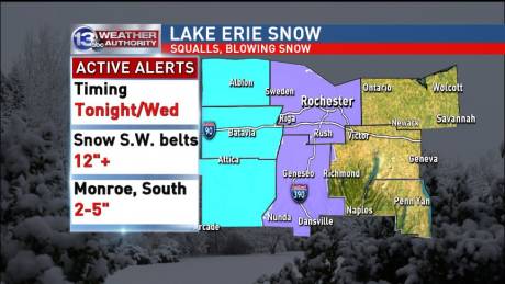
The National Weather Service has revised its snowfall projections for the anticipated winter storm hitting Western New York this afternoon and expected to linger in the area until Thursday morning.
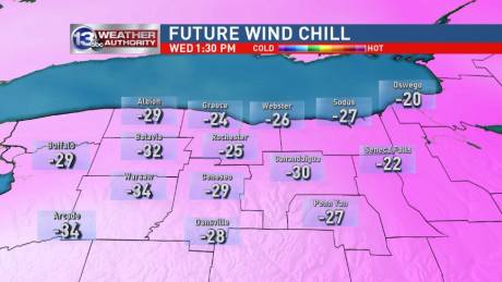
The weather service is calling for 8 to 15 inches of snow in some areas and winds as high as 40 mph with wind chills dropping to 30 below.
A winter storm warning is in effect.
The forecasters at 13WHAM are predicting 6 to 10 inches of snow for Genesee County with Batavia's wind chill dipping to 36 degrees below zero.
The highest levels of snowfall in the county are expected to be west of Batavia.
The winter storm warning is in effect until 7 a.m., Thursday, with a wind chill warning in effect from 6 a.m. tomorrow through 6 p.m., Thursday.
The weather service cautions that travel during the worst of the storm could be impossible and that during the wind chill period frostbite is possible to exposed skin in less than 30 minutes.
Pets should be kept indoors to reduce their exposure to weather conditions.