
weather

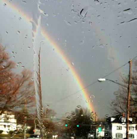
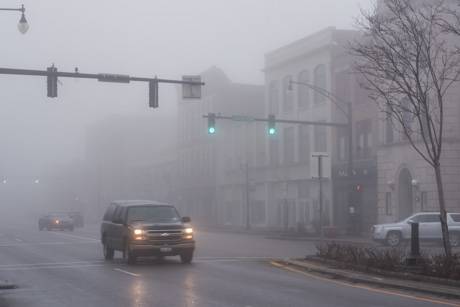
Reader photos: Storm damage, March 8, 2017

By Howard B. Owens

downpolesmoking.jpg

These are photos I received from readers via email. I went through them in the order received and since I received so many, there were a few duplicates of the same scene shown in the same way, so I left those out. If you submitted a photo, sorry I didn't use yours. This is just from email. I'll start working on those that were texted to me next and post those in a separate post.

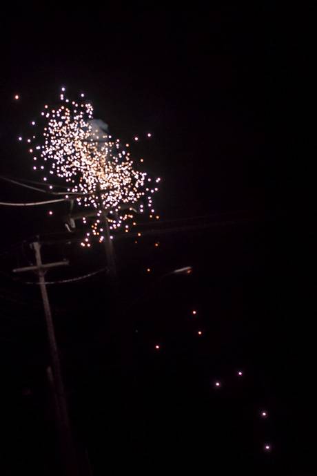
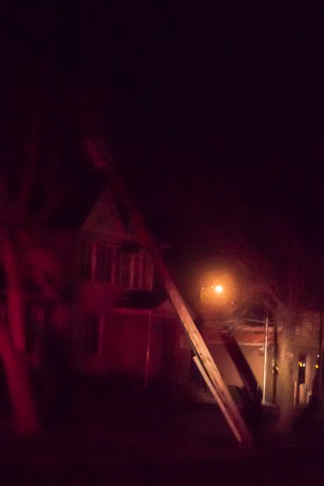
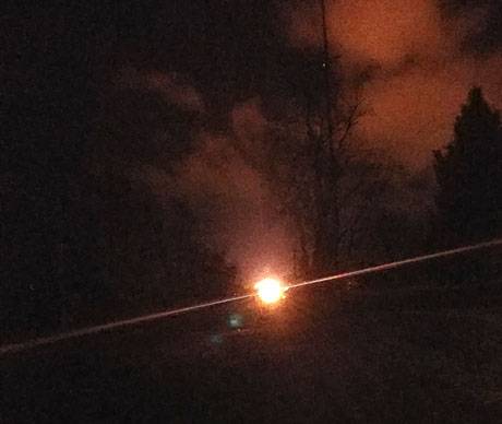
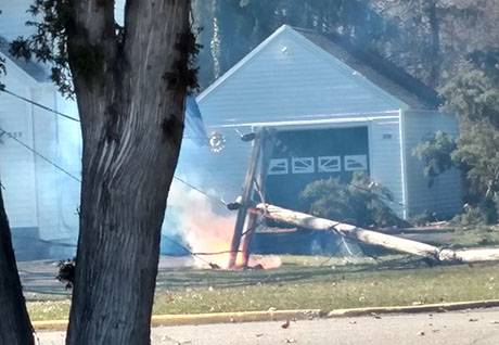
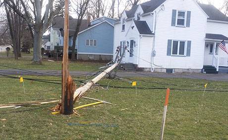
Top: From Tricia DiFilippo, a downed utility pole on State Street, smoldering.

windmarch82017_01.jpg

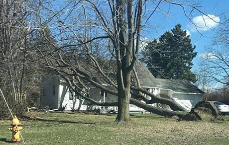
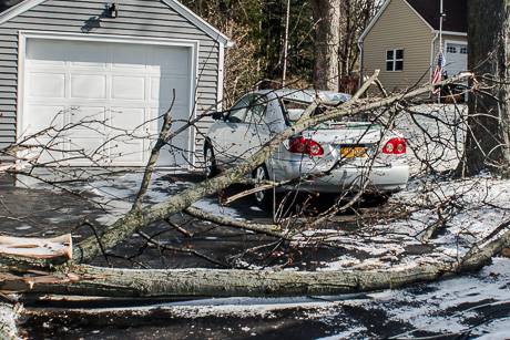
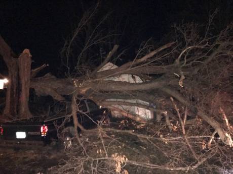
A downed tree on Lewiston Road, Batavia, sent in by Rachel Wommack.

windmarch2017_02.png

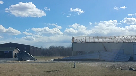
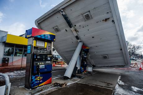
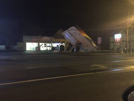
A building on Route 33 that lost its roof, sent in by Ashley Smith.

windmarch2017_03.jpg

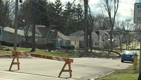
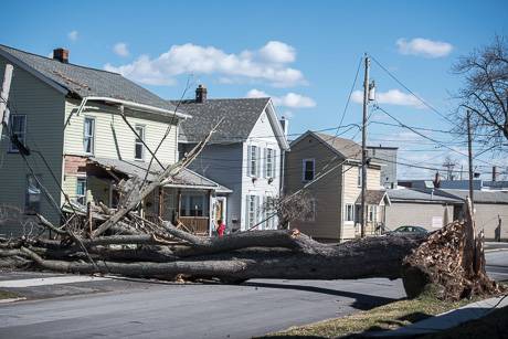
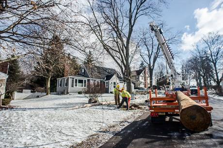
Reader submitted photo of trees down on Prospect Street.

windmarch2017_04.jpg

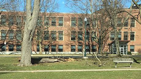
Reader submitted photo of a tree down at the Blind School.

windmarch2017_05.jpg

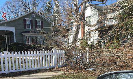
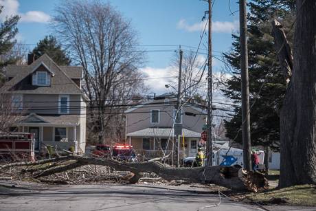
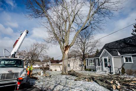
Reader submitted photo of a damaged tree on State Street.

windmarch2017_06.jpg

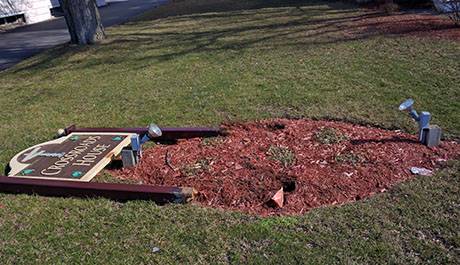
The sign for the Crossroads House knocked down, photo submitted by Joseph Richmond.

windmarch2017_07.jpg

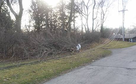
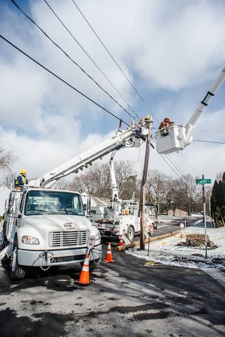
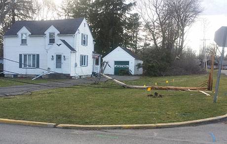
This and the next two photos submitted by Sharon Herdtner of power lines down on State Street near the Batavia Nursing Home.

windmarch2017_08.jpg

windmarch2017_10.jpg

windmarch2017_11.jpg

A reader submitted photo of a tree down on Harvester.

windmarch2017_12.jpg

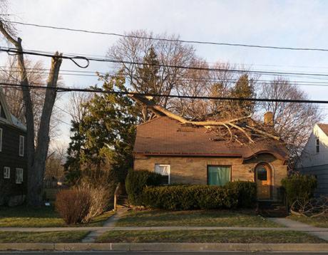
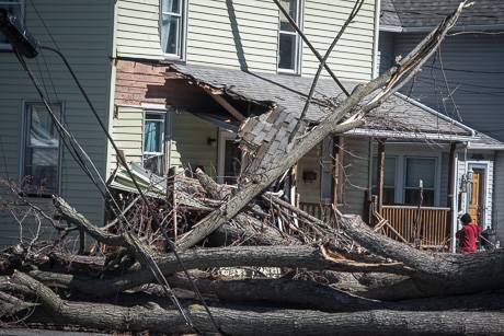
Submitted by Joseph Richmond, a tree down on the roof of the former dentist office on Washington Avenue, Batavia.

windmarch2017_13.png

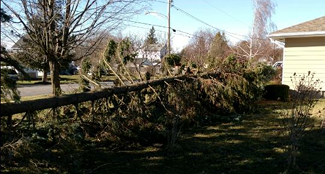
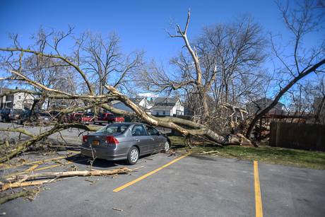
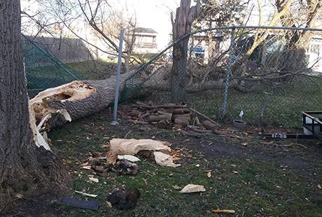
Photo submitted by Patrick Patmos of pine tree down on Osterhout Avenue, Batavia.

windmarch2017_14.jpg

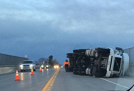
Truck on its side on the Route 98 bridge over the Thruway, submitted by a reader.

Photos: Storm damage

By Howard B. Owens

weatherdamage1march82017.jpg

These are photos I took of some of the trees down in the city earlier today.

We've received several photos from readers. I'll post those as soon as I can. Keep them coming to howard@thebatavian.com or text (585) 260-6970.

I also have photos to post yet from the fire this morning, but I'm going to need to relocate to a place with electrical power (batteries running low) to get all those uploaded.

Top photo: Morton Avenue.

UPDATE 4:39 p.m.: There's a report of unknown type flames in area of 728 Judge Road, Alabama. Also, Julia Ferrini reports for us on Wyoming County Free Press that winds there have been clocked at 102 mph.

UPDATE 4:51 p.m.: It sounds like the Judge Road flames come from a garbage fire which the fire department will be putting out. There was also a car into a building at Leisure Timers; no injuries and Alabama fire is clearling that scene.

weatherdamage1march82017-2.jpg

This photo and the one below, Central Avenue.

weatherdamage1march82017-3.jpg

weatherdamage1march82017-4.jpg

These two, in the Tully's restaurant parking lot.

weatherdamage1march82017-5.jpg

Sheriff's Office issues travel advisory

By Howard B. Owens

The Genesee County Sheriff's Office has issued a travel advisory.  

Press release:

A travel advisory has been issued for all of Genesee County due to extremely high winds. Motorists are cautioned that falling trees, downed high tension wires/poles and wind-driven debris have been reported throughout the County.

Peak winds have already been measured at 67 miles per hour at Genesee Community College and the National Weather Service has estimated that these winds will continue until at least 6 or 7 p.m. this evening. Power outages have been reported and are likely to continue and larger vehicles such as trucks and delivery-type vans could be especially affected. This advisory will be updated as conditions warrant.

Sheriff Sheron reminds motorists that dark traffic signals that are not working are to be treated as a four-way stop. 

ALSO: We haven't been able to keep up with the notifications on cancellations. It seems all school districts have canceled events. Section V canceled activities, including the Elba consolidation game in Victor. (It will be played at a location to be determined tomorrow.) Richmond Memorial Library is closing. GCC is closed. UMMC has closed several clinics and programs.

High winds hitting Genesee County and first damage reported

By Howard B. Owens

High winds have just hit Genesee County -- there is a high wind warning in effect throughout the day -- and the first report of poles and wires down comes from Alabama.

Wires and poles are down on Lewiston Road and Knowlesville Road with arcing and sparking.

UPDATE 9:37 a.m.: Lines down on Vine Street, Batavia.

Wind warning issued for Wednesday

By Howard B. Owens

High winds are expected to hit the area tomorrow so the National Weather Service has issued a wind warning starting at 9 a.m. and lasting through 10 p.m.

Winds of 25 to 35 mph expected with gusts of 60 mph.

Strong winds can lead to downed trees, property damage and scattered power outages. Travel for high-profile vehicles could be difficult.

Photos: Storm damage clean up in Batavia

By Howard B. Owens

stormphotosmarch22017.jpg

Crews this morning got busy dealing with some of last night's storm damage.

Above, city workers on Jackson Street cleaning up a downed pine tree.

Below, daylight photos of the gas station canopy on West Main Street that blew over last night. Workers there say they won't be able to begin cleanup work until insurance adjusters have finished their work, which may not be today.

Bottom photos, crews on Genesee Street (just west of the NYS Blind School) dealing with snapped utility poles and downed power lines after a large limb on a tree snapped off last night, also damaging a parked car.

Thousands of National Grid customers lost power for at least part of the night last night and currently, National Grid is still dealing with 21 power outages in the county affecting hundreds of customers. There are seven small outages in the city.

stormphotosmarch22017-2.jpg

stormphotosmarch22017-3.jpg

stormphotosmarch22017-4.jpg

stormphotosmarch22017-5.jpg

stormphotosmarch22017-6.jpg

stormphotosmarch22017-7.jpg

Photo: Double rainbow in Batavia

By Howard B. Owens

20170301_170140.jpg

Sharon Herdtner submitted this photo of a double rainbow that she took from Richmond Avenue that seems to stretch from the Blind School over North Avenue to Northside Deli.

Thousands of people without power in Batavia and parts of the county

By Howard B. Owens

weatherdamage1mach12017.jpg

This is a power line arcing on Washington Avenue at Ellicott Avenue this evening.  

There are a total of 14 power outages in the City of Batavia, affecting 4,371 National Grid customers. 

The largest outage by geography starts in the city just west of Clinton Street at Main Street and spreads in a triangle shape from there to Nilesville Road in Stafford, as far north as the Thruway and south to East Bethany.

There are 2,093 customers effected by that outage (that number is included in the 14 outages mentioned above). The power went out for this outage at 7:49 p.m. and there is not yet an estimate when power will be restored.

There are also outages in Darien, Indian Falls, Le Roy, Pavilion and South Byron.

Below, a picture of a broken pole on Ellicott Avenue.

weatherdamage1mach12017-2.jpg

UPDATE: A reader submitted photo of a downed tree on Richley Road, Darien.

b2a8d944-3394-4023-8671-6e4c5b65bdf0.jpg

UPDATE: Ashley Smith submitted this photo of arcing near the Arrow Mart in Batavia.

0301172047.jpg

High winds blow over structure at gas station on Main Street in Batavia

By Billie Owens

A reader submitted this photo of the Sunoco gas station on Main Street in Batavia. The wind toppled the gas tank island's roof, breaking the metal pillar which holds it up at the base. The station was closed at the time and no injuries were reported.

High winds are wreaking havoc countywide and numerous power lines and tree limbs are reportedly down, keeping first responders and maintenance crews busy.

Photo: Rainbow in Oakfield

By Howard B. Owens

img_5004oakfieldrainbow.png

Jason Smith caught a bit of this rainbow of Oakfield-Alabama Central School while driving home from work this afternoon.

Wind advisory issued for Wednesday night

By Howard B. Owens

Winds of 20 to 35 mph with gusts of 50 mph are expected starting about 6 p.m., Wednesday, and lasting until 4 a.m., Thursday.

Wind advisory issued for Saturday

By Howard B. Owens

Winds of 20 to 30 mph are expected to blow through Genesee County on Saturday.

A wind advisory has been issued from 10 a.m. to 10 p.m.

Gusts up to 50 mph are possible.

The National Weather Service warns that winds of this speed could result in downed tree limbs and isolated power outages. Travel in high profile vehicles could be difficult.

Winter weather advisory issued for Sunday

By Howard B. Owens

Freezing rain, snow and wind are in the forecast for Sunday from 4 a.m. to 7 a.m., Monday.

Snow accumulation could range from four to seven inches.

Winds will be from the northwest at 15 to 25 mph with gusts up to 35 mph.

Blowing and drifting snow on top of icy conditions are expected.

Visibility could be as low as a half mile at times.

Freezing rain advisory for tonight and tomorrow morning

By Howard B. Owens

The National Weather Service is predicting freezing rain starting at 11 p.m. with an advisory in effect through noon Sunday.

An accumulation of a 10th of an inch is possible.

Lows will be in the lower 30s overnight and upper 30s Sunday afternoon.

Driving and walking conditions could be hazardous.

Freezing rain advisory in place until 1 p.m.

By Howard B. Owens

A freezing rain advisory has been issued by the National Weather Service for Genesee County and is effect until 1 p.m.

An accumulation of ice on roadways and sidewalks of only a few hundredths of an inch will make for slippery conditions and caution is advised.

Lake effect snow warning in place now through early Sunday

By Howard B. Owens

weathermapjan282016.png

A lake effect snow warning has been issued for the region starting now until 4 a.m.

The previous winter storm advisory has been lifted.

Up to two inches of snow are expected to hit the area between now and this evening, with five to nine inches falling tonight.

Winds will be from 10 to 20 mph with gusts up to 35 mph.

Visibility could drop to a quarter mile at times in some places.

Potential for lake effect snow on Saturday downgraded

By Howard B. Owens

The National Weather Service is now saying to expect slightly less snow over the course of Saturday into Sunday morning.

A previous winter weather watch has been downgraded to an advisory.

From two to four inches possible Saturday, three to five inches Saturday night, with a storm total of five to nine inches.

Winds will be 10 to 20 mph with gusts up to 30 mph from the southwest.

Blowing and driving snow could make travel difficult at times in some locations.

Up to 10 inches lake effect snow possible Saturday

By Howard B. Owens

A lake effect snow watch has been issued for the region from Saturday morning through late Saturday night.

From five to 10 inches of snow accumulation are possible.

Winds are expected from 15 to 25 mph from the west with gusts up to 35 mph.

Travel could be difficult at times.

The forecast confidence is medium. "There remains some uncertainty as to how far north the heaviest snow will advance," the weather service states.

Winter weather advisory issued for late this afternoon into tomorrow

By Howard B. Owens

Up to six inches of snow could be headed our way starting late this afternoon, and with winds of five to 15 mph, the National Weather Service has issued a winter weather advisory for Genesee County.

It takes effect at 4 p.m. and runs through 10 a.m. tomorrow.

Rain will change to snow in the late afternoon and from three to six inches of accumulation is expected.

The temperature will drop to around 30 degrees.

The weather service warns that snow will result in slick travel conditions. The worst conditions are expected tonight into Tuesday morning.

Photo: Fogged in Downtown Batavia

By Howard B. Owens

downtownfogjan222017.jpg

We have heavy fog throughout the county today and it's continuing this evening and into tomorrow morning.

There's a winter storm watch in place for Monroe County from Monday night into Tuesday, but so far it looks like this storm will miss Genesee County.

Authentically Local