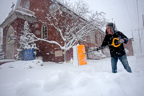
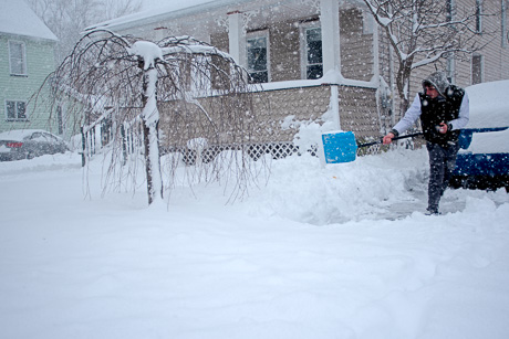
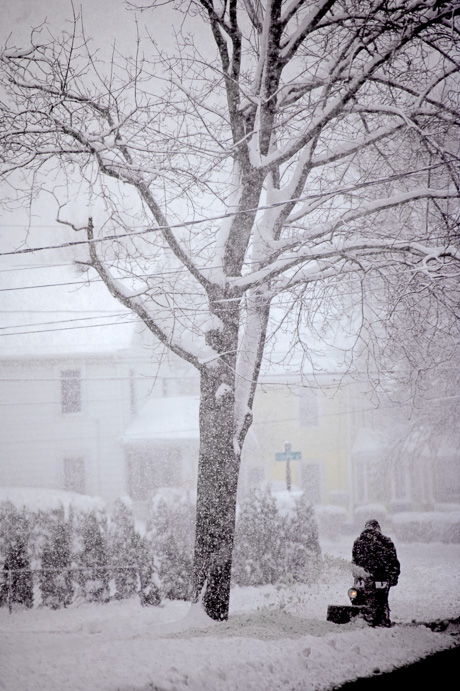
weather

Photo: Storm clouds over Indian Falls

By Howard B. Owens

img_2056.jpg

Joanne Meiser submitted the photo of storm clouds rolling in near McAlpine Road in Indian Falls.

There is a strong thunderstorm alert for parts of Genesee County through 8:30 p.m.

Winds could exceed 35 mph and there may be pea-sized hail.

Areas affected could be Batavia, Darien Lakes State Park, Le Roy, Pembroke, Pavilion, Byron, Oakfield, Stafford, Alabama, Corfu, Elba, and Alexander.

Photo: Sunrise in Bergen

By Howard B. Owens

sunrisebergenmay122022.jpg

Brandan Smith submitted this photo of this morning's sunrise in Bergen by his uncle Dan Maher.

Photo: Storm cloud over Batavia

By Howard B. Owens

stormcloudap252022.jpg
+

Steve Tufts submitted this photo of a massive cloud rumbling through Batavia during the thunderstorm that passed through the city at about 7 p.m.

Tufts said, "Good thing there was no rotation in that wall cloud -- it was heading straight for the Cornell Cooperative Extension!"

Utility poles down, power out in the Sandpit Road area of Alexander

By Howard B. Owens

About 95 National Grid customers are without power in the area north of Route 20 and east of Route 98 in Alexander after two utility poles came down during the wind storm that passed through the area.

Alexander fire responded to the report of powerlines down at about 6:50 p.m. in the area of Railroad Avenue and Sandpit Road.

The fire department has since cleared the scene, reporting to dispatchers that village crews have erected barriers to block traffic to those roads and that National Grid is on scene saying it will take hours to complete repairs.

National Grid reports that it expects three complete repairs at about 9:30 p.m.

Photos: This morning's colorful sky

By Howard B. Owens

20220330_065146.jpg

This morning's sky was stunning, and Frank Capuano, Batavia (top photo), and Jodi Carmichael, Alabama, shared these two photos.

img_5730morning_sun.jpg

Photo: Rainbow in Pembroke

By Howard B. Owens

20220319_162448.jpg

Photo submitted by Jim Reinhardt. A rainbow this afternoon, visible over the pond in his backyard in Pembroke.

Man walking in Woods in Bergen during windstorm dies after being struck by falling tree

By Howard B. Owens

still_bergen_3.jpg

A 61-year-old man walking in the woods off Sackett Road in Bergen during yesterday's windstorm was killed when a tree fell and struck him in the head.

Dispatchers received a report of an unresponsive male pinned under a tree at 5:58 p.m.

The victim is identified as Steven K. Reber.

Lifesaving measures were attempted at the scene by family and emergency personnel but Reber was pronounced dead at the scene.

Foul play is not suspected.

Photo by Alecia Kaus/Video News Service.

High winds knocking down trees, power lines, throughout county

By Howard B. Owens

20220306_124022.jpg

Dispatchers and first responders are dealing with multiple calls throughout the county related to wind damage, including this big branch down on Clinton Street in the City of Batavia.

There are multiple power outages reported in Genesee County, including 816 National Grid customers without power in Stafford/Byron/Bergen. The outage is centered in Byron.

There is an outage affecting 143 customers in the northern part of the Town of Elba and into Barre. There are 109 customers without power north of North Byron Road just west of Byron Holley Road.

There is an outage for 76 customers and another for 69 customers in Alexander north of Route 20.

West of Darien Center is an outage affecting 235 customers and just north of that location, one affecting 130 customers. 

Between Basom and Oakfield, 208 customers are without power. there are smaller outages northwest of Alabama.

National Grid has extra crews on duty to help handle the workload.

High winds are expected to continue until 7 p.m.

Photo submitted by Arielle McVay

Tonawanda Creek: Nine-feet high and about to crest

By Howard B. Owens
Video Sponsor
.pane-node-body img {background: none !important; border: 0 !important; margin: 0 !important; padding: unset !important; padding-left: 1px !important } broadstreet.zone(69076)

The National Weather Service is forecasting that by late tomorrow afternoon, the Tonawanda Creek could crest at 10 feet.

Measurements are taken behind the County Courthouse.

Currently, Law Street is closed with minor flooding near Walnut Street in the City of Batavia. Stegman Road in Pembroke is also closed.

Kibbee Park is flooded to the brim.  There is minor flooding on South Jackson.

Send your flood photos from anywhere in Genesee County to: howard@thebatavian.com

CORRECTION: This story previously used measurements and forecasts for the wrong stream gauge on the Tonawanda.  It's been corrected to reflect the correct stream gauge.

tonawandacreekfeb182022.jpg

img_0663tonawanda.jpg

Kibbe Park

img_0661tonawanda.jpg

Law Street near Walnut.

img_0656tonawanda.jpg

Behind the County Courthouse

img_0666tonawanda.jpg

South Jackson.

Flooding disrupts power, heat for The Grand Rehab in Batavia

By Howard B. Owens

img_0645grandrehflood.jpg

Residents of The Grand Rehabilitation and Nursing at Batavia, 257 State Street, are without heat and power tonight due to water infiltration into the basement of the facility.

Interim Chief Dan Herberger said crews have yet to determine the source of the water but it's possible that it is more than weather-related flooding.

"The fact that there is chlorine (in the water) tells us it may be city water, drinking water," Herberger said.

At about 11 p.m., a DPW crew shut off water to the facility.  That will help emergency responders determine whether the source of the water with chlorine is from a break in a line going into the facility or from a nearby water main.

"We're trying to rule out a water main break somewhere," Herberger said.

Firefighters from both the City of Batavia and Town of Batavia are on the scene running pumps in the basement to try and get ahead of the ongoing infiltration. 

Herberger said the water got into electrical chase ways and the heating system.  He said it will take an electrical inspection and HVAC contractors to determine when it is safe to turn on those systems again.

State Health Department officials are on scene to assist the facility in implementing its emergency response plan.

Herberger said for now the residents are warm.

"We're hoping not to evacuate," Herberger said. "That's the last resort."

UPDATE 1:33 a.m.: National Fuel requested back to the scene to turn the gas back on and get the heat back on.

img_0648grandrehflood.jpg

img_0652grandrehflood.jpg

Minor flooding expected for Tonawanda Creek

By Howard B. Owens

Heavy rains are expected to hit Genesee County this afternoon and the rain along with snowmelt could cause minor flooding in the Tonawanda Creek, according to the National Weather Service

There is a flood warning in effect.

Water flows in creeks and rivers are likely to increase quickly and reach critical levels, according to the weather service.

There is also a winter weather advisory in effect from 7 p.m. to 9 a.m.  The forecast is for mixed precipitation and snow as temperatures fall tonight.  The snow accumulation could be from 2 to 4 inches along with ice accumulation. Winds could gust as high as 45 mph.  The weather service warns travel may be difficult.

UPDATE via Accuweather:

accuweatherfreezeup2022.jpg

The weather will change in dramatic fashion with a rapid freeze-up anticipated across portions of Midwest and interior Northeast due to a multifaceted storm that will continue to push across the country from Thursday night into Friday, AccuWeather meteorologists warn.

Temperatures have already plummeted from springlike levels on Wednesday into the 20s across parts of the central United States as a snowstorm created slippery travel conditions.

"We are turning the clock back to January in the central United States on Thursday and Thursday night and will do the same in the Northeast on Friday," AccuWeather Chief On-Air Meteorologist Bernie Rayno said.

After surging to levels more typical of April in many areas, temperatures are forecast to plummet to 10-20 degrees or more below average for mid-February from west to east across the Plains, Midwest and Northeast into Friday.

As temperatures plunge from west to east, areas of standing water, slush and moisture will freeze unless treated with significant ice-melting compounds. On top of that, many crews may not be able to successfully pre-treat roads as rain will quickly wash away chemicals used to melt snow and ice.


Flood watch issued for Wednesday through Friday

By Howard B. Owens

floodriskfeb2022.jpg

A flood watch is in effect for Genesee County from Wednesday evening through Friday evening.

Potential flooding may be caused by snowmelt and torrential rainfall. 

The National Weather Service stated: "Excessive runoff may result in flooding of rivers, creeks, streams, and other low-lying and flood-prone locations. The greatest threat for flooding will be in ice jam-prone areas ... . Creeks and streams may rise out of their banks. Flooding may occur in poor drainage and urban areas."

Image provided by Accuweather.

Closings and Cancellations for Friday, Feb. 4, 2022

By Howard B. Owens

These closings and cancellations have been announced for Friday, Feb 4, 2022:

  • Batavia City Schools
  • Elba Central Schools
  • Byron-Bergen Central Schools
  • BOCES Batavia Campus
  • Oakfield Central Schools
  • John Kennedy Intermediate School's Polar Plunge has been rescheduled to Feb. 11 at 3:30 p.m.
  • GCC's Batavia campus is closed.
  • Richmond Memorial Library is closed.
  • The Byron-Bergen Public Library is closed.

Send closings and cancellations to news@thebatavian.com.

Winter storm watch issued for Wednesday through Friday

By Howard B. Owens

Up to nine inches of snow are possible from a storm headed to the area that could hit sometime Wednesday evening through Friday afternoon.

A winter storm watch is in effect for all of western and north-central New York.

"Travel could be very difficult to impossible," advises the National Weather Service. "The hazardous conditions could impact the morning or evening
commutes."

Weather service warns of deteriorating road conditions this evening

By Press Release

Press release:

Light snow across western New York will increase in intensity for a few hours into the early evening. Snow will accumulate quicker on area roadways. With the sun setting and temperatures dropping, earlier wet roads will re-freeze if not well treated. The combination of accumulating snow and re-freezing roads will cause driving conditions to deteriorate through the evening commute.

The increased snowfall rate will also cause reduced visibilities to a quarter-mile at times. If traveling, allow extra time to reach your destination and allow extra space between you and the vehicle in front of you.

Crews continue working to remove nearly two feet of snow that fell in city

By Howard B. Owens

snowdaymlk2022-5.jpg

Press release:

Due to the volume of snow that fell in the last 24 hours, approximately two feet, the cleanup process will take time to complete for City staff and for residents alike.  While this was not the worst snow event that the community has seen, it was certainly significant. 

“I would like to take the time to remind residents and business owners that we will continue to make our best efforts to clear the City streets and remove snow from City owned parking lots.  These are the primary target areas that our Public Works staff focuses on, and then sidewalk clearing as time allows,” said Rachael J. Tabelski, City Manager, City of Batavia.

“In terms of students who walk to school, there are many sidewalks that have been cleaned and snow removed, however, there still remains some sidewalks that are not passable.   This presents a hazard that could force students to have to walk in the street. I ask that parents and guardians take this under advisement if they have children that walk, and we urge drivers to be more alert and understand the difficult conditions in the City at this time,” said Jason Smith, Superintendent, Batavia City School District.

”If pedestrians are forced to walk in the streets due to sidewalks being unpassable, pedestrians should walk facing traffic and wear bright colored and reflective clothing. Pedestrians should also be sure to cross at intersections using crosswalks whenever they are visible.” said Shawn Heubusch, Police Chief, City of Batavia, “Drivers should always be more cautious after snow events and keep an eye out for pedestrians in the streets.”

Snow operations by the City of Batavia have run continuously from 10 p.m. on Sunday, January 16th until 8 AM Tuesday, January 25th with the primary objective of fighting the snow to allow for safe vehicular traffic.  Now that the snow event is over, snow removal will begin. 

“For the most part, the snowfall was uniformed within the City. The City ran a full plow run, 14 pieces of equipment and personal, for over 36 hours during the snow event.  The long duration events are the most taxing on staff and equipment,” said Ray Tourt, Superintendent Bureau of Maintenance.

The city has fielded a few complaints regarding clearing sidewalks in the last 24 hours.  The Batavia Municipal Code (BMC) Chapter 159-8 explains that property owners have the responsibility to clear snow and ice from sidewalks, however as staffing allows, the City will remove snow from sidewalks.  The cleanup process will take time for City staff and for residents alike. 

Photo: By Howard Owens. A city plow clearing the parking lot on at Center Street and School Street yesterday morning.

Photos: Batavia gets busy digging out from overnight snow

By Howard B. Owens

snowdaymlk2022a.jpg

While much of Batavia was busy this morning digging out from more than a foot of snow that fell overnight, Grayson, 3, and Deliah, 5, found it was a good time to play outside their home on Hart Street.

snowdaymlk2022-2.jpg

Jackson Street

snowdaymlk2022-3.jpg

Morton Avenue

snowdaymlk2022-4.jpg

Center Street

snowdaymlk2022-5.jpg

Center Street parking lot

snowdaymlk2022-6.jpg

Summit Street

snowdaymlk2022-7.jpg

City Hall

snowdaymlk2022-8.jpg

State Street

snowdaymlk2022-9.jpg

State Street

Authentically Local