
weather

National Grid preparing crews for strong winds and thunderstorms

By Billie Owens

Press release from National Grid:

Weather forecasts are calling for strong winds and thunderstorms across large portions of New York this afternoon and into the evening. While National Grid is preparing its crews and storm response plans, we also urge customers to be safe and ready.

The company offers the following tips to help customers be prepared and stay safe:

Electricity & Generator Safety

  • National Grid customers should call 1-800-867-5222 to report a power outage, or to report any downed wires.

  • Customers are urged to stay away from all downed wires, and anything those wires might be touching like tree limbs or fencing.

  • Generators used to supply power during an outage must be operated outdoors. Before operating a generator, be sure to disconnect from National Grid’s system by shutting off themain breaker, located in the electric service panel. Failure to do this could endanger restoration crews, first responders and your neighbors.

  • Customers who depend on electrically powered life support equipment, such as a respirator, should register as a life support customer by calling National Grid at 1-800-642-4272. (In a medical emergency, always dial 9-1-1.)

  • Keep a number of working flashlights and an extra supply of batteries in your home. Also, make sure to keep mobile devices charged.

  • Please drive carefully and use caution when driving near any repair crews working to restore power.

  • Be sure to check on elderly family members, neighbors and others who may need assistance during an outage.

National Grid also advises staying tuned to local media for important announcements from emergency officials about possible evacuations or other emergency procedures. In most areas, information on storm shelter locations is available by calling 2-1-1.

Stay Connected

National Grid offers several ways to stay informed and safe – before, during and after a storm:

  • We can send personalized alerts by text, e-mail or phone call when an outage is detected ata customer’s address, restoration estimates are available, or weather warnings have beenissued. To enroll, customers can call National Grid or text REG to 64743.

  • For real-time power outage information, online outage reporting, and in-depth storm safety information, visit the Outage Central section of www.nationalgridus.com. Customers who create an online profile on our website can also sign up for email alerts.

  • To receive text message alerts and updates from National Grid, text the word STORM to NGRID (64743).

  • Online and text alert services can be started and stopped at the customer’s request.

  • Visit our website: www.nationalgridus.com

Heat advisory issued for Western New York

By Howard B. Owens

The National Weather Service has issued a heat advisory for this morning through early evening with a heat index into the upper 90s.

The combination of high temperatures and high humidity will combine to create a situation in which heat-releated illnesses are possible, the weather service warns.

The weather service advises: drink plenty of fluids; stay in air-conditioned rooms; avoid extended time in the sun; and check on relatives and neighbors.

Severe thunderstorm watch in effect until 2 p.m.

By Howard B. Owens

A severe thunderstorm watch is in effect for most of Western New York, including Genesee County, until 2 p.m.

Strong winds that could cause damage are expected with this storm.

The National Weather Service encourages people to be prepared to seek shelter if a thunderstorm approaches.

Winds of 45 mph are possible.

Hazardous weather outlook for Genesee County, with slippery, icy roads

By Billie Owens

Hazardous weather outlook for Genesee County was issued at 2:42 p.m. by the National Weather Service in Buffalo.

Wyoming, Livingston, Ontario, Cattaraugus and Allegany counties are also included in the outlook, which is in effect from midnight tonight through 10 a.m. Friday, April 5.

Freezing rain is expected, with ice accumulation up to a 10th of an inch.

Plan on slippery road conditions. The hazardous conditions could impact the morning commute.

Periods of snow, sleet or freezing rain will result in slippery roads and limited visibilities. Slow down and use caution while driving.

A winter weather advisory is in effect Friday through Wednesday.

High wind warning issued for Sunday in Genesee County, gusts up to 60 mph expected

By Billie Owens

A high wind warning will be in effect in Genesee County on Sunday, March 10, from 11 a.m. to 11 p.m., according to the National Weather Service in Buffalo.

Winds are expected from the southwest at 20 to 30 mph with gusts up to 60 mph.

High winds of 58 mph or greater will make driving difficult and could result in property damage, including downed trees and power lines. Scattered power outages are expected. Homeowners should secure loose objects.

Winter weather advisory in effect until 10 p.m., expect snow, slippery roads and limited visibility

By Billie Owens

A winter weather advisory is in effect until 10 o'clock tonight.

The National Weather Service office in Buffalo says snow accumulations of 4 to 8 inches are expected. The heaviest snow will fall mid-afternoon through early evening.

Plan on snow-covered and slippery road conditions, making travel difficult. Hazardous conditions will significantly impact the evening commute.

Visibility will be limited. Slow down and use caution while driving.

Dangerous winds, flash freeze in tonight's forecast

By Billie Owens
From the National Weather Service in Buffalo:
 
Dangerous winds and flash freeze are forecast for late this afternoon and evening in Genesee County.
 
Very strong and damaging winds will continue late this afternoon and early this evening from the Lake Erie shore northeastward across the Niagara Frontier and Genesee Valley, including the Buffalo and Rochester areas. Peak wind gusts will reach 75 mph at times. 

Winds of this magnitude will result in extensive damage to trees and power lines, widespread power outages, and property damage to roofs and siding.
 
Buildings which are under construction and older deteriorating buildings may experience significant damage or even collapse. 

This is a particularly dangerous situation!
 
If you must travel be prepared for extensive damage and downed power lines. Always assume power lines are live. Falling trees and power lines will create a very dangerous environment to be outside in, including in vehicles. Seek shelter in a substantial building until the strongest of the winds begin to subside. 

In addition to the very strong winds, temperatures will also fall below freezing as we progress through the late afternoon and early evening hours. This will result in the rapid freezing up of water on untreated roadways, leading to areas of ice that could make travel hazardous, particularly on bridges and overpasses.
 
If you must travel, be sure to slow down and exercise caution.

Bricks fall from ledge at City Centre

By Billie Owens

A reader sent this photo of wind-caused damage at City Centre. Some bricks fell from the top ledge and a light fixture's glass got broken. The business is located at 46 City Centre.

National Grid Outage Map: 1,018 customers in Genesee County without power

By Billie Owens

According to the National Grid Outage Map, which they update every 15 minutes, there are currently 1,018 Genesee County customers without power. They are still assessing damages.

A total of 26,948 customers are served here by the utility company.

To view the interactive map, click here.

UPDATE 4:03 p.m.: Checked the map and nothing has changed since we first posted it at 3:24 p.m.

UPDATE 5:16 p.m.: There's been an uptick in the number of Genesee County customers without power. National Grid reports 1,066 customers without power, up from 1,018 almost two hours ago.

Weather-related calls starting at 2:30 p.m.

By Billie Owens

Unknown wires are down in the roadway at Colby Road and Genesee Street. Corfu Fire Department is responding.

******

A tree is down on wires, which are smoking, at 2679 Galloway Road, Batavia. East Pembroke Fire Department is responding. National Grid has been informed.

*****

UPDATE 2:38 p.m.: A broken tree branch is pulling wires from a house at 3104 Dodgeson Road, Alexander. Lines are in the roadway. The location is between Beaver and Seward roads. Alexander Fire Department is called.

UPDATE 2:42 p.m.: City of Batavia Fire Department is called for a tree and wires down at 66 Franklin St. between Davis Avenue and the dead end.

UPDATE 2:56 p.m.: A tree and wires are down, completely blocking the roadway, at 7116 Tripp Road, Byron. Byron and South Byron fire departments are called. National Grid crews are no longer on scene (after responding earlier when seven poles toppled into a field).

UPDATE 2:58 p.m.: A tree and wires are down at 2623 Brown Road, Corfu. The location is between Wilkinson Road and Ridge Road. East Pembroke Fire Department is responding.

UPDATE 3:02 p.m.: A tree and wires are down at 3650 Batavia Oakfield Townline Road. Town of Batavia Fire Department is called to respond.

UPDATE 3:07 p.m.: A fire alarm is sounding at city Public Works Department, 147 Walnut St. A power failure has occurred and the "supervisory alarm" has been tripped. City Fire Department is responding.

UPDATE 3:15 p.m.: A tree is down in the roadway at 2879 Batavia Oakfield Townline Road. Town of Batavia Fire Department is called.

UPDATE 3:52 p.m.:  A tractor-trailer has tipped over on Bank Street Road at Cockram Road. Byron and South Byron fire departments are called to respond along with Mercy medics.

UPDATE 3:53 p.m.: A tree is down and wires are on fire at 10498 W. Bethany Road. Alexander Fire Department is responding.

UPDATE 3:57 p.m.: A tree and primary wires and secondary wires are down at 3073 Pearl Street Road, Batavia. East Pembroke Fire Department is called. The location is between Upton and Wortendyke roads.

UPDATE 4:08 p.m.: Wires are down on a house and arcing at 8885 Keeney Road in Le Roy. The home is being evacuated. Le Roy Fire Department is responding. The location is between West Main Street and Quinlan Road.

UPDATE 4:11 p.m.: A celler pump detail is requested at a house at 7509 Mechanic St. in Byron. The power is out there. Byron and South Byron fire departments are called.

UPDATE 4:53 p.m.: Power lines are down in the road and in water on Powers Road, Batavia. East Pembroke Fire Department is called.

UPDATE 4:58 p.m.: Town of Batavia Fire Department is called to 3658 Batavia Elba Townline Road for wires down in the roadway.

UPDATE 5:56 p.m.: A tree and wires are down at 8151 Kelsey Road, Batavia. East Pembroke is called to respond.

UPDATE 5:58 p.m.: A tree is down across the front steps of a residence at 7041 N. Pearl Street Road, Oakfield. Oakfield Fire Department is responding.

UPDATE 6:07 p.m.: East Pembroke command requests mutual aid from Town of Batavia fire to shut down traffic at Kelsey and Galloway roads because of multiple trees and wires down in the roadway.

Utility crews ready for deployment in several staging areas in Batavia

By Billie Owens

A reader sent us photos just taken in Batavia showing the apparent readiness of utility crews staged by businesses, ready to deploy as needed due to the  high wind warning in effect today and tomorrow.

In addition to these staging areas photographed in Batavia, there are about a dozen vehicles in the KMart parking lot and 15 or so in the lot at BJs Warehouse Plaza; and there may be other staging areas in Batavia as well.

"Seems like a high degree of readiness," a reader commented.

Above, at the Quality Inn & Suites.

Staging area by Target and Quality Inn & Suites.

More utility vehicles in Batavia Towne Center parking lot.

Tree, pole and wires down on Akron Road, Pembroke

By Billie Owens

An officer reports a tree, utility pole and wires are down across the roadway on Akron Road, just east of Wyman Road. Pembroke and Indian Falls fire departments are responding.

Seven poles topple onto field on Tripp Road, Byron

By Billie Owens

Seven utility poles, possibly with power lines attached, are down in a field on Tripp Road near Townline Road in Byron. Byron and South Byron fire departments are called to investigate.

UPDATE 1:27 p.m.: National Grid crews are called to the scene.

Cuomo says New York is ready for 'extremely strong winds', Thruway Authority bans empty big rigs

By Billie Owens

From the New York Thruway Authority:

TRAVELER ADVISORY: Empty tractor-trailers and empty tandems (three-axled vehicles) are banned on the NYS Thruway in Western and Central New York beginning at 10 a.m. Sunday (Feb. 24) due to high wind warnings and high wind watches.

All empty tractor-trailers and empty tandems will be prohibited from traveling on the NYS Thruway (I-90) between exit 31 (Utica) and exit 61 (Ripley - PA Line), as well as the Niagara Thruway (I-190).

Additionally, the Thruway Authority encourages motorists to download its mobile app, which is available to download for free on iPhone and Android devices. The app provides motorists direct access to real-time traffic and navigation assistance while on the go.

Motorists can also sign up for TRANSalert e-mails, which provide the latest traffic conditions along the Thruway by following this link: www.thruway.ny.gov/tas/index.shtml.

For real-time updates, motorists can follow @ThruwayTraffic on Twitter or by visiting www.thruway.ny.gov to see an interactive map showing traffic conditions for the Thruway and other New York State roadways.

For updated forecasts, motorists should check with the National Weather Service.

And from the Governor's Office:

Governor Andrew M. Cuomo today urged New Yorkers to prepare for a new weather system this weekend that will bring extremely strong winds that could result in property damage and power outages. Winds are expected to gust at or above 45 mph much of Sunday night and Monday over the vast majority of the state, with gusts approaching 75 mph at times in Western New York and western portions of the North Country.

Strong winds will continue across much of the state on Monday, with gusts continuing to range between 45 to 55 mph. In advance of this weather system, the Governor has directed multiple state agencies to pre-deploy response equipment throughout the state and ensure that utility companies are prepared to respond as well.

New Yorkers should pay close attention to their local weather reports throughout the weekend, as well as take the steps necessary to ensure their families are protected in the event of a power outage. 

Additionally, Governor Cuomo has directed the Department of Transportation and the Thruway Authority to ban empty tractor-trailers and empty tandems from portions of the New York State Thruway and some interstate highways in the Western New York, Central New York and Finger Lakes Regions due to high wind warnings and high wind watches. The ban will take effect beginning at 10 a.m. Sunday, Feb. 24.

"New York is preparing to endure yet another extreme weather event that could bring strong winds resulting in significant power outages," Governor Cuomo said. "I want to make it abundantly clear that utilities are expected to be prepared with response plans to deal with emergencies and quickly restore power to residents following any storm-related outages.

"We expect that utilities will be working aggressively and around-the-clock to fully restore power to all New Yorkers affected by this storm. The state is monitoring the situation closely and is prepared to assist localities quickly as needed."

Empty tractor-trailers and tandems will be banned from the following interstate highways:

DOT Highways:

  • I-390 from Dansville to Route 104
  • I-490 from I-90 exit 45 to I-90 exit 47
  • I-590 (full extent)
  • Route 104 at the Bay Bridge
  • I-190 from Grand Island to Lewiston / Queenston
  • I-290 from I-190 to I-90
  • NY 5 from I-190 to NY 179 (with a full truck ban on the elevated section of the Skyway)
  • US 219 from I-90 to Peters Road
  • NY 400 from NY 16 to I-90
  • I-990 from I-290 to NY 263

Thruway Highways:

  • I-90 between exit 31 (Utica) and exit 61 (Ripley to PA line)
  • Niagara Thruway (I-190)

The system will begin moving into the state on Saturday and bring some snow and rain with it. By Sunday, all regions will be experiencing rain, and a cold front will enter the state bringing strong winds with it.

Currently, Western New York and the counties along Lakes Erie and Ontario are forecasted to experience the strongest of the damaging winds. Gusts will increase across Western New York beginning Sunday morning, before spreading throughout the Finger Lakes, Central New York and North Country Regions as the day progresses.

Wind gusts will rapidly increase up to 75 mph across Chautauqua county, the northern Niagara Frontier, Rochester and in Jefferson County behind the front. Strong winds over Lake Erie and Lake Ontario will also likely drive an increase in water level along the shoreline, as well as create significant blowing snow with reduced visibilities Sunday night and Monday morning.

Current forecasts are projecting that maximum wind gusts will reach 45 mph in New York City and on Long Island; 50 mph in the Mid-Hudson, Capital, Mohawk Valley, Central New York and Southern Tier Regions; 70 mph across the North Country; and 75 mph in the Western New York and Finger Lakes regions.

The National Weather Service has already posted high wind watches and warnings for the majority of the state. Additionally, lakeshore flood watches will be in effect Sunday into Monday for the counties east of lakes Erie and Ontario as the powerful winds will create significant wave action. For a complete listing of weather watches, warnings, advisories and latest forecasts, visit the National Weather Service website.

Motorists are reminded that State Law mandates that if an intersection is "blacked out" and the traffic signal is not operational, the intersection is automatically a "four-way" stop. In the event of closed or blocked roadways due to flooding, downed power lines or debris, motorists are advised to exercise caution and obey all traffic signs or barricades in place, regardless of whether a roadway looks clear.

Agency Preparations

Division of Homeland Security and Emergency Services

The Division of Homeland Security and Emergency Services will activate the State Emergency Operations Center to enhanced monitoring mode on Sunday morning to closely track the weather system and its impacts. The Division is also coordinating with state agencies and local governments to ensure resources from the State's ten regional stockpiles are available for deployment throughout the storm.

Currently, the stockpiles are prepared to respond to requests for assistance with assets from its stockpiles, including:

  • More than 725 generators
  • More than 1,250 pumps
  • More than 2 million sandbags
  • 19 sandbaggers
  • More than 6,700 feet of Aquadam

Department of Public Service

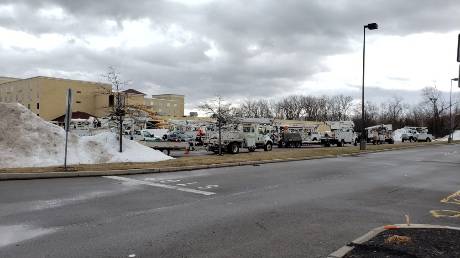
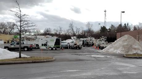
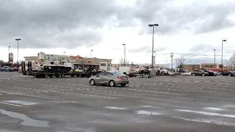
The Department of Public Service is in contact with utility senior executives to ensure that the utilities are prepared for inclement weather, and it will be closely monitoring utility storm-preparation efforts to ensure that utilities stand ready to minimize outages and expedite outage restorations. Electric and gas utilities, as well as telecommunication service providers, such as Verizon, are prepared to bring on additional personnel to minimize service disruptions, if they occur.

New York's utilities have more than 6,000 workers available for restoration efforts, plus more than 1,000 external line and tree crews brought on for this event, to be deployed in areas most impacted. The utilities are on alert and are closely watching as the storm develops and will deploy restoration crews where needed.

Department staff will continue to monitor the utilities' efforts during the storm event. Utilities will continue to secure added resources in anticipation of prolonged outages due to sustained winds which may delay restoration efforts.

Utilities are prepared to respond 24 hours a day to power disruptions and are mandated to implement their emergency response plans, when needed, which includes contacting customers on life-support equipment and other critical customers. New Yorkers should prepare for outages that may last several days.

In light of the potential significant inclement weather, the Department has expanded its Call Center Helpline hours beginning Sunday, Feb. 24, from 9 a.m. until 5 p.m., to assist consumers in storm response and restoration efforts. The Department's Call Center Helpline can be reached by calling (800) 342-3377.

Department staff will monitor and report on storm impacts and utility restoration activities throughout the event and will be present in the field, as needed.

Department staff will continue to monitor the utilities' efforts during the restoration period. The utilities are prepared to respond to power disruptions throughout the event. 

New York Power Authority

The New York Power Authority (NYPA) is preparing its facilities and operations for the forecasted weather. In Niagara, NYPA is staging equipment to prepare for any necessary ice boom repairs and for any needed ice breaking activity. In addition, NYPA has taken the necessary actions for continued safe operations to support grid reliability. NYPA transmission crews are ready to respond to events that may impact the transmission system. NYPA also is in communication with municipal utility partners and investor-owned utilities to coordinate on potential mutual aid response to outages, if needed. NYPA will continue to communicate with utility and emergency management partners and will continue to monitor weather forecasts.

Department of Transportation

The Department of Transportation has more than 3,900 supervisors and operators statewide that are prepared to respond to this weekend's event. The Department currently has 79 chippers, 52 traffic signal trucks, 15 tree crew bucket trucks and 45 loaders with grapple statewide.

In addition, to support response activities in critical areas, 15 wood chippers, four traffic signal trucks, and eight traffic signal technicians will be deployed and distributed as follows:

Central NY:

  • Receiving one traffic signal truck and two traffic signal technicians from the Mid-Hudson Region.

Finger Lakes:

  • Receiving one traffic signal Truck and two traffic signal technicians the Capital District

Western NY:

  • Receiving four chippers from the Capital Region
  • Receiving three chippers from the Mohawk Valley
  • Receiving four chippers from the Mid-Hudson Region
  • Receiving four chippers from the Southern Tier
  • Receiving one traffic signal truck and two traffic signal technicians from the Southern Tier
  • Receiving one traffic signal truck and two traffic signal technicians from the Mohawk Valley and Capital Region

Chippers are currently on route to their destinations, while traffic signal crews will deploy to affected areas tomorrow in advance of the wind event.

Thruway Authority

The Thruway Authority staff are prepared to respond to any wind related issues with 667 operators and supervisors across the state, small to medium sized excavators, plow/dump trucks, large loaders, and a number of portable VMS boards, portable light towers, smaller generators, smaller pumps and equipment hauling trailers, as well as signage and other traffic control devices available for any detours or closures. Variable Message Signs, Highway Advisory Radio and social media are utilized to alert motorists of weather conditions on the Thruway.

The Thruway Authority encourages motorists to download its mobile app which is available to download for free on iPhone and Androiddevices. The app provides motorists direct access to real-time traffic and navigation assistance while on the go. Motorists can also sign up for TRANSalert e-mails which provide the latest traffic conditions along the Thruway by following this link: www.thruway.ny.gov/tas/index.shtml. For real-time updates, motorists can follow @ThruwayTraffic on Twitter or by visiting www.thruway.ny.gov to see an interactive map showing traffic conditions for the Thruway and other New York State roadways.

New York State Police

State Police will be ready to deploy additional Troopers to affected areas as needed, and all Commercial Vehicle Enforcement Unit and Traffic Incident Management patrols will be actively engaged for the duration of the weather event. All four-wheel-drive vehicles are in service and all specialty vehicles, including snowmobiles, Utility Task Vehicles, and boats are staged and ready for use.

Department of Environmental Conservation

Department of Environmental Conservation Police Officers, Forest Rangers, Emergency Management staff, and regional staff are on alert and monitoring the developing situation. Twenty-one saw crew teams are strategically located in key regions of the state and ready to assist with any tree clearing and response needs. In addition, all available assets, including snowmobiles and utility vehicles, are ready to assist with any emergency response.

For a complete list of weather terms and preparation ideas before during and after a power outages, visit the Division of Homeland Security and Emergency Services website at http://www.dhses.ny.gov/oem/safety-info/outage/.

City PD reminds residents to stay safe during high wind event Sunday and Monday

By Howard B. Owens

Press release:

The National Weather Service – Buffalo has issued a high wind warning in effect from 7 a.m., Sunday, to 10 a.m., Monday, for Niagara, Orleans, Monroe, Jefferson, Erie, Genesee and Chautauqua counties. Winds will be out of the west between 35-45 mph and perceived gusts up to 75 mph.

Strong winds will bring down trees, power lines and may result in power outages in the area for many days. Shallow-rooted pine trees, in particular, may be vulnerable. Property damage is also possible, especially to roofs and siding. Traveling in high profile vehicles will be very difficult at times, and empty tractor-trailers may be in danger of being blown off the road.

Winds over 58 mph will make driving difficult and could result in property damage, including downed trees and power lines. Scattered power outages are expected. Homeowners should secure loose objects.

The City of Batavia, including the Batavia Police Department, City of Batavia Fire Department and the Department of Public Works would like to remind everyone: In the event of an extended power outage, it may disrupt the community and the economy -- disrupt communications, water and transportation.

  • If phone lines are down, use social media to texting to let others know you are OK.
  • Close retail businesses, grocery stores, gas stations, ATMs, banks, and other services.
  • Cause food spoilage and water contamination. If you have a water supply (such as a well-water pump system) that could be affected by a power outage, fill your bathtub and spare containers with water. The water in the bathtub should be used for sanitation purposes only. You can pour a bucket of this water directly into the toilet bowl to flush it.
  • Prevent the use of medical devices.

During a power outage please remember to:

  • Keep freezers and refrigerators closed. (A full freezer will keep the temperature for about 48 hours if kept closed. Monitor temperatures with a thermometer.)
  • Maintain food supplies that do not require refrigeration.
  • Only use generators outdoors and away from windows. (Avoid carbon monoxide poisoning.)
  • Generators, camp stoves, or charcoal grills should always be used outdoors and at least 20 feet away from windows. Never use a gas stovetop or oven to heat your home.
  • Be sure to have a flashlight with spare batteries on hand. Do not use candles or any other source with an open flame for lighting.
  • Bring inside loose, lightweight objects such as lawn furniture, potted plants, garbage cans, garden tools, and toys.
  • Anchor objects that would be unsafe outside, such as gas grills or propane tanks.
  • Disconnect appliances and electronics to avoid damage from electrical surges.
  • Have alternate plans to refrigerating medicines or using power-dependent medical devices. Check with your pharmacist for guidance on proper storage.
  • Let the fire department know that you are dependent on life-support devices.
  • If safe, go to an alternate location for heat or cooling.
  • Check on neighbors. Older adults and young children are especially vulnerable to extreme temperatures.
  • Stay away from downed utility wires. Always assume downed power lines are live.
  • If a traffic light is out, treat the intersection as a four-way stop.
  • Fully charge your cellphone, laptop and other electronic devices.
  • Keep your car’s gas tank full. Pumps at gas stations may not work during a power outage.
  • Follow instructions from public safety officials.
  • Call 9-1-1 to report emergencies including:
    • Downed power lines
    • If you are dependent on equipment that requires electricity and you need medical assistance.
  • DO NOT CALL 9-1-1 to report an outage or to ask about power restoration.
  • Continue to pay attention to local weather forecasts and bulletins issued by the National Weather Service on local radio stations.

The Batavia Police Department can be reached at 585-345-6350; the confidential tip line at 585-345-6370.

Strong, potentially damaging winds, expected Sunday

By Howard B. Owens

Wind gusts up to 75 mph are expected in a storm that will pass through the area Sunday, according to the National Weather Service.

The NWS has issued a high-wind warning for 7 a.m. Sunday though 10 a.m. Monday.

Steady winds of 35 to 45 mph from the west are expected.

Strong wind gusts could bring down trees and power lines and widespread power outages are possible. Power may be out in some areas for several days.

Shallow rooted pine trees may be particularly vulnerable.

Property damage is also possible, especially to roofs and siding.

Travel by high profile vehicles will be very difficult and empty tractor trailers may be in danger of blowing off roadways.

Homehowners should secure loose objects.

Winter weather advisory issued for Wednesday afternoon and evening

By Howard B. Owens

A winter weather advisory has been issued for Wednesday, from 1 to 10 p.m.

The National Weather Service says residents should expect snow, sleet and freezing rain. 

Less than an inch of snow is expected but with sleet and freezing rain, driving conditions could be hazardous.

Authentically Local