
weather

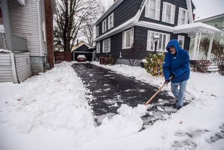
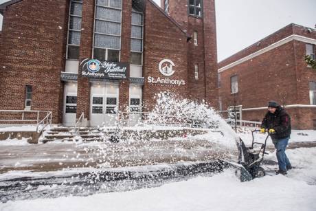
Winter storm warning prompts closures

By Billie Owens

The National Weather Service has issued a Winter Storm Warning for Saturday (Jan. 19) and Sunday (Jan. 20). Due to the projected forecast, the Batavia City School District is canceling all activities and building uses on Saturday, Jan. 19 and Sunday, Jan. 20.   

Please note that when campus is closed, there will be limited maintenance of District roads, parking lots and sidewalks. Please avoid using campus during the closure. Take Care of BCSD!

Christopher J. Dailey
Superintendent of Schools
Batavia City School District
 
*********
 
The Batavia City School District is closing its facilities and has cancelled programs for Saturday and Sunday in anticipation of severe weather, so the Richmond Memorial Library will close on Saturday, too. 
 
We're closed every Sunday, and Monday for the Dr. King holiday, so we'll reopen on Tuesday, Jan. 22, weather permitting.
 
Thank you,
Bob Conrad
Director

Winter storm warning issued for Saturday through Sunday

By Howard B. Owens

The National Weather Service has upgraded the outlook for the expected winter storm this weekend to a warning with the possibility, starting at 1 p.m., Saturday, that the storm will bring up to 14 inches of snow to the region.

Winds could gust to 35 mph and temperatures are expected to be low and cold.

The warning is in effect until 6 p.m., Sunday.

Travel is expected to be very difficult, potentially impossible, according to the weather service. Areas of blowing snow could reduce visibility.

Wind chills could make it feel like 15 below zero and frostbite on exposed skin could occur in as little as 30 minutes.

Weather service anticipates winter storm Saturday through Monday

By Howard B. Owens

Expect snow to start falling Saturday morning, according to the National Weather Service, snowfall becoming heavier that night and becoming lake-effect snow by Sunday night.

At this time, accumulations of only seven inches are expected but it will be accompanied by gusting winds and cold, arctic air.

Blowing and driving snow could make travel difficult and wind chills could drop to well below zero.

This storm is expected to hit all of Western New York.

Drivers should plan on slippery roads and low visibility.

Weather advisory issued for freezing drizzle, potential slick roads and walks

By Howard B. Owens

A winter weather advisory is in effect until 10 p.m. for freezing drizzle, which could create a glaze of ice accumulation on roadways and walkways.

The weather service warns of potentially hazardous conditions, especially on untreated roads, particularly during the evening commute.

Bitterly cold winds expected to sweep through the area tonight

By Howard B. Owens

Cold temperatures and cold winds will make for even colder feelings tonight and tomorrow morning, according to the National Weather Service in Buffalo.

The wind chill is expected to drop below zero throughout most of Western New York, with values as low as 25 below zero east of Lake Ontario.

Frostbite and hypothermia can occur if precautions are not taken. Make sure to dress properly if spending time outdoors during the cold period.

Hazardous weather outlook issued, expect up to 8 inches of snow

By Billie Owens

A hazardous weather outlook is in effect this afternoon and tonight, according to the National Weather Service in Buffalo.

A winter weather advisory is in effect until 1 p.m. Thursday.

Lake effect snow is expected. Total snow accumulations of 4 to 8 inches expected in the most persistent lake snows.

Winds gusting as high as 45 mph also producing areas of blowing snow. This includes Niagara, Orleans, Northern Erie and Genesee counties.

Greatest snow accumulation will be south of Route 104, across Northeastern Erie and Genesee County.

Expect slippery driving conditions. Areas of blowing snow could significantly reduce visibility. The hazardous conditions could impact the morning or evening commute.

Lake effect snow will fall in relatively narrow bands. If traveling, be prepared for rapidly changing road conditions and visibilities.

National Grid planning extra crews during anticipated windstorm

By Howard B. Owens

Press release:

With strong winds in the forecast for large portions of Upstate New York, National Grid is increasing its overnight staffing and will have line crews report for duty earlier than normal tomorrow morning. The company is prepared for the upcoming weather and provides the following safety tips so customers can be prepared as well.

Electricity & Generator Safety

  • If a power outage occurs, customers can notify National Grid online to expedite restoration.
  • Never touch downed power lines; always assume they are carrying live electricity.
  • Downed lines should be immediately reported to National Grid at 1-800-867-5222 or to your local emergency response organization.
  • Generators used to supply power during an outage, must be operated outdoors to prevent the buildup of deadly carbon monoxide. Before operating a generator, be sure to disconnect from National Grid’s system by shutting off the main breaker, located in the electric service panel. Failure to do this could endanger our crews and your neighbors.
  • Customers who depend on electrically powered life-support equipment, such as a respirator, should register as a life-support customer by calling National Grid at 1-800-642- 4272. (In a medical emergency, always dial 9-1-1.)
  • Keep a number of working flashlights and an extra supply of batteries in your home and be sure to charge all electronic devices.
  • Please drive carefully and use caution when driving near any crews working to restore power.
  • Be sure to check on elderly family members, neighbors and others who may need assistance during an outage.

Gusts up to 65 mph expected tomorrow night

By Howard B. Owens

A high-wind watch has been issued for Monday evening through Tuesday morning with winds of 25 to 35 mph and gusts up to 65 mph expected.

Winds of 58 mph can cause property damage, the National Weather Service warns.

Homeowners are encouraged to secure personal property.

Strong winds may also bring down trees and power lines, leading to power outages. 

Travel in high-profile vehicles will be difficult.

Video and Photos: Christmas Eve snow in Batavia

By Howard B. Owens

It looks like we're having a White Christmas after all.

christmasevesnow2018.jpg

Stephen Hall blowing snow on Ross Street.  

christmasevesnow2018-2.jpg

Jonathan Hoca and Quintin, 5, building a snowman on Ross Street.

img_7270.jpg

Jennifer Desautels submitted this photo of Teigan Desautels, 5, with a snowman.

Warning issued for snow squalls passing through the area

By Howard B. Owens

Snow squalls are expected to pass through the area this afternoon and early evening, according to the National Weather Service.

This could create areas of low visibility, and potential whiteout conditions, at times with brief periods of localized heavy snow and slick, snow-covered roads.

A cold front is crossing the region this afternoon, into early evening, resulting in lake effect snow from both Lake Erie and Lake Ontario that will move inland. This will affect the evening commute, particularly between about 4 to 6 p.m.

Photo: December Rainbow

By Howard B. Owens

img_6126rainbow.jpg

Lyndsay Baker captured a shot of a rainbow this morning.

Photos: Mid-November snowstorm in Batavia

By Howard B. Owens

weathernov162018.jpg

It wasn't a lot of snow that fell overnight but it was wet and heavy and that made it hard to shovel, said Bob Pappalardo, above, who was clearing a driveway on Summit Street this morning.

Paul Lamendala, below, said the snow wasn't much easier to clear with a snow blower on the sidewalks outside of City Church/St. Anthony's on Liberty Street.

The snow is tapering off through early afternoon and Saturday and Sunday are expected to be partly cloudy.

weathernov162018-2.jpg

weathernov162018-3.jpg

Winter weather advisory in effect from 4 p.m. until 7 a.m.

By Billie Owens

A winter weather advisory is in effect from 4 p.m. this afternoon (Nov. 15) until 7 a.m. Friday, Nov. 16, according to the National Weather Service office in Buffalo.

Snow is expected. Total snow accumulations of 3 to 6 inches expected across Orleans, Monroe and Genesee counties.

The snow may mix with sleet this afternoon and evening. The snow may mix with freezing rain this afternoon and evening across portions of Northern Erie and Genesee counties with less than a 10th of an inch of ice accumulation.

Plan on snow-covered and slippery roads. Periods of snow, sleet or freezing rain will result in slippery roads and limited visibilities. Slow down and use caution while driving.

Winter weather advisory in effect until 1 p.m. Saturday

By Billie Owens

A winter weather advisory, issued by the National Weather Service office in Buffalo, is in effect from 3 a.m. to 1 p.m. Saturday, Nov. 10.

Lake effect snow is expected. Total snow accumulations of three to five inches are expected in the most persistant lake effect snow areas. Lake effect snowfall will occur in relatively narrow bands.

Wind gusting up to 45 mph is also expected.

Northern Genesee County is specifically cited.

Plan on slippery road conditions.

If traveling be prepared for rapidly changing road conditions and visibilities.

Wind advisory issued for Tuesday and Wednesday

By Howard B. Owens

Winds of 20 to 30 mph with gusts up to 50 mph are expected tomorrow prompting the National Weather Service to issue a wind advisory.

The advisory runs from 7 a.m. Tuesday to 4 p.m. Wednesday.

Rain is also possible on Tuesday.

The winds could result in some downed tree limbs and isolated power outages. Driving high-profile vehicles will be more difficult.

Flood watch issued for Thursday and Friday

By Howard B. Owens

With rainfall anticipated of 1.5 to 2 inches anticipated, and the ground already saturated, the National Weather Service has issued a flood watch for Genesee County starting Thursday afternoon and continuing through Friday afternoon.

The NWS stated:

Excessive runoff from heavy rainfall may result in minor flooding of poor drainage areas and small creeks from late Thursday afternoon through early Friday morning. Minor flooding is also possible on some of the larger creeks and rivers on Friday, including the upper Genesee River, upper Allegheny River, and Buffalo area creeks.

Photos: Batavia's morning sky

By Howard B. Owens

img_6158sunrise.jpg

The sky lit up this morning and readers sent us pictures.

Melanie Case submitted the rainbow over Bank Street in the top photo.

img_1405sunrise.jpg

Submitted by Guy Clark.

20181004_070256sunrise.jpg

Submitted by Frank Capuano.

Hazardous weather outlook issued for Genesee County

By Billie Owens

A hazardous weather outlook was issued this afternoon by the National Weather Service office in Buffalo.

It is for portions of Western New York, including Genesee County, through Tuesday.

This afternoon and tonight the probability of widespread hazardous weather is low. Gusty southwest winds will develop Friday ahead of a strong cold front. Winds may gust to over 50 mph northeast of Lake Erie, including much of the Niagara Frontier to near Rochester.

Scattered thunderstorms will then develop from mid-afternoon through mid-evening Friday along and ahead of the advancing strong cold front. There is a slight risk that some of these storms may contain damaging winds.

Severe thunderstorm warning issued for Northern Genesee County until 4:15 p.m.

By Billie Owens

A severe thunderstorm warning has been issued for Northern Genesee County.

At 3:12 p.m. the National Weather Service office in Buffalo issued the warning, saying the severe thunderstorm was located near Middleport, or seven miles west of Medina, moving east at 35 mph.

It is in effect until 4:15 p.m.

Expect up to 60 mph winds and up to three-quarters of an inch of hail; damage to roofs, siding, and trees. Locations impacted include Byron and Oakfield.

For your protection move to an interior room on the lowest floor of a building. Damaging winds and continuous cloud-to-ground lightning is occurring with this storm. Move indoors immediately. Lightning is one of nature`s leading killers. Remember, if you can hear thunder, you are close enough to be struck by lightning.

Authentically Local